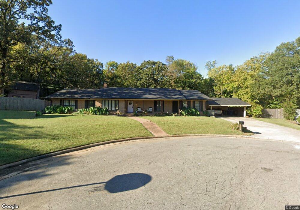
2500 Fresno Place Fort Smith, AR 72901
Estimated Value: $320,000 - $468,000
4
Beds
4
Baths
3,399
Sq Ft
$110/Sq Ft
Est. Value
About This Home
This home is located at 2500 Fresno Place, Fort Smith, AR 72901 and is currently estimated at $375,372, approximately $110 per square foot. 2500 Fresno Place is a home located in Sebastian County with nearby schools including Fairview Elementary School, Ramsey Junior High School, and Southside High School.
Ownership History
Date
Name
Owned For
Owner Type
Purchase Details
Closed on
Jun 19, 2020
Sold by
Stuart Sydney Loyce and Scott Davis Stuart
Bought by
Bottoms Jonathan
Current Estimated Value
Home Financials for this Owner
Home Financials are based on the most recent Mortgage that was taken out on this home.
Original Mortgage
$173,794
Outstanding Balance
$154,055
Interest Rate
3.2%
Mortgage Type
FHA
Estimated Equity
$221,317
Purchase Details
Closed on
Mar 22, 1999
Bought by
Stuart Scott D and Stuart Loyce W
Create a Home Valuation Report for This Property
The Home Valuation Report is an in-depth analysis detailing your home's value as well as a comparison with similar homes in the area
Home Values in the Area
Average Home Value in this Area
Purchase History
| Date | Buyer | Sale Price | Title Company |
|---|---|---|---|
| Bottoms Jonathan | $177,000 | Guaranty Abstract & Title Co | |
| Stuart Scott D | $175,000 | -- |
Source: Public Records
Mortgage History
| Date | Status | Borrower | Loan Amount |
|---|---|---|---|
| Open | Bottoms Jonathan | $173,794 |
Source: Public Records
Tax History Compared to Growth
Tax History
| Year | Tax Paid | Tax Assessment Tax Assessment Total Assessment is a certain percentage of the fair market value that is determined by local assessors to be the total taxable value of land and additions on the property. | Land | Improvement |
|---|---|---|---|---|
| 2024 | $2,639 | $50,260 | $11,200 | $39,060 |
| 2023 | $2,493 | $50,260 | $11,200 | $39,060 |
| 2022 | $2,543 | $50,260 | $11,200 | $39,060 |
| 2021 | $2,918 | $50,260 | $11,200 | $39,060 |
| 2020 | $1,474 | $50,260 | $11,200 | $39,060 |
| 2019 | $1,474 | $43,690 | $11,200 | $32,490 |
| 2018 | $1,499 | $43,690 | $11,200 | $32,490 |
| 2017 | $1,322 | $43,690 | $11,200 | $32,490 |
| 2016 | $1,672 | $43,690 | $11,200 | $32,490 |
| 2015 | $1,322 | $43,690 | $11,200 | $32,490 |
| 2014 | $1,322 | $31,845 | $11,200 | $20,645 |
Source: Public Records
Map
Nearby Homes
- 2400 Houston St
- 2414 Independence St
- 2420 Independence St
- 2601 Dallas St
- 2929 Gary St Unit 14
- 2925 Gary St Unit 12
- 3405 S 29th Cir
- 11 Carthage Cir
- 3000 Independence St
- 3917 S 27th Cir
- 5222 S 31st St
- 12 Carthage Cir
- 2112 Carthage Dr
- 2715 Dallas St
- 2906 S Carthage St
- 3415 S 32nd St
- 70 Haven Dr
- 4209 Old Jenny Lind Rd
- 3205 Independence St
- 2916 Cliff Dr
- 2512 Fresno Place
- 2501 Fresno Place
- 2501 Houston St
- 2427 Houston St
- 2507 Fresno Place
- 2507 Houston St
- 2518 Fresno Place
- 2513 Fresno Place
- 2415 Houston St
- 2519 Fresno Place
- 2515 Houston St
- 2600 Fresno Place
- 2501 Gary St
- 2501 Gary St
- 2660 Enid Place
- 2430 Houston St
- 2411 Houston St
- 2500 Houston St
- 2601 Houston St
- 2508 Houston St