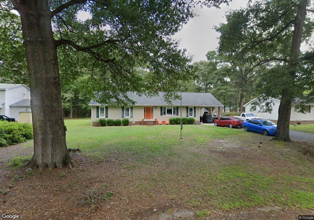
2500 Mattaponi Ave West Point, VA 23181
Estimated Value: $278,000 - $335,000
3
Beds
2
Baths
1,630
Sq Ft
$189/Sq Ft
Est. Value
About This Home
This home is located at 2500 Mattaponi Ave, West Point, VA 23181 and is currently estimated at $307,585, approximately $188 per square foot. 2500 Mattaponi Ave is a home located in King William County with nearby schools including West Point Elementary School, West Point Middle School, and West Point High School.
Ownership History
Date
Name
Owned For
Owner Type
Purchase Details
Closed on
Aug 23, 2022
Sold by
Hixenbaugh Timothy W and Hixenbaugh Whitney L
Bought by
Smith Robin Carol
Current Estimated Value
Home Financials for this Owner
Home Financials are based on the most recent Mortgage that was taken out on this home.
Original Mortgage
$260,200
Outstanding Balance
$248,824
Interest Rate
5.54%
Mortgage Type
FHA
Estimated Equity
$58,762
Create a Home Valuation Report for This Property
The Home Valuation Report is an in-depth analysis detailing your home's value as well as a comparison with similar homes in the area
Home Values in the Area
Average Home Value in this Area
Purchase History
| Date | Buyer | Sale Price | Title Company |
|---|---|---|---|
| Smith Robin Carol | $265,000 | First Virginia Title |
Source: Public Records
Mortgage History
| Date | Status | Borrower | Loan Amount |
|---|---|---|---|
| Open | Smith Robin Carol | $260,200 |
Source: Public Records
Tax History Compared to Growth
Tax History
| Year | Tax Paid | Tax Assessment Tax Assessment Total Assessment is a certain percentage of the fair market value that is determined by local assessors to be the total taxable value of land and additions on the property. | Land | Improvement |
|---|---|---|---|---|
| 2025 | $762 | $249,800 | $28,000 | $221,800 |
| 2024 | $674 | $249,800 | $28,000 | $221,800 |
| 2023 | $674 | $249,800 | $28,000 | $221,800 |
| 2022 | $507 | $135,200 | $28,000 | $107,200 |
| 2021 | $514 | $135,200 | $28,000 | $107,200 |
| 2020 | $514 | $176,700 | $27,000 | $149,700 |
| 2019 | $514 | $134,300 | $28,000 | $106,300 |
| 2018 | $527 | $135,200 | $28,000 | $107,200 |
| 2017 | $548 | $135,200 | $28,000 | $107,200 |
| 2016 | $554 | $135,200 | $28,000 | $107,200 |
| 2015 | $581 | $239,500 | $28,000 | $211,500 |
| 2014 | $678 | $0 | $0 | $0 |
Source: Public Records
Map
Nearby Homes
- 2660 N Oak Ln
- 605 Rivergate Terrace
- 330 Pointers Dr
- 342 Ogden St
- 332 Ogden St
- 322 Ogden St
- 314 Ogden St
- 311 Pointers Dr
- 321 Pointers Dr
- Lot 23 Glen St
- 000 Glen St
- .21ac Glen St
- 00 Glen St
- 230 Glen St
- 4204 Mattaponi Ave
- 3050 King William Ave
- .21ac King William Ave
- Lot 24 King William Ave
- Lot 25 King William Ave
- 3557 Odi St
- 2480 Mattaponi Ave
- 2455 Chelsea Rd
- 2470 Chelsea Rd
- 2460 Mattaponi Ave
- 2490 Mattaponi Ave
- 2560 Mattaponi Ave
- 2560 Mattaponi Ave
- 2510 Mattaponi Ave
- 2450 Chelsea Rd
- 2490 Chelsea Rd
- 2490 Chelsea Rd
- 2450 Chelsea Rd
- 2470 Mattaponi Ave
- 2555 Mattaponi Ave
- 880 Westwood Ct
- 2510 Chelsea Rd
- 910 Thompson Ave
- 2430 Chelsea Rd
- 2430 Mattaponi Ave
- 850 Westwood Ct