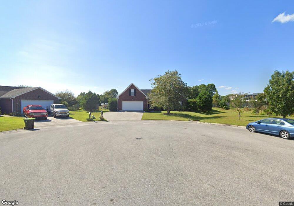
2501 Blockade Ct Wilmington, NC 28411
Estimated Value: $484,000 - $573,080
4
Beds
3
Baths
2,456
Sq Ft
$212/Sq Ft
Est. Value
About This Home
This home is located at 2501 Blockade Ct, Wilmington, NC 28411 and is currently estimated at $519,520, approximately $211 per square foot. 2501 Blockade Ct is a home located in New Hanover County with nearby schools including Murrayville Elementary School, Emma B. Trask Middle School, and Emsley A. Laney High School.
Ownership History
Date
Name
Owned For
Owner Type
Purchase Details
Closed on
Aug 3, 2007
Sold by
Landry Edward D and Landry Denise C
Bought by
Shaw David L and Shaw Melissa L
Current Estimated Value
Home Financials for this Owner
Home Financials are based on the most recent Mortgage that was taken out on this home.
Original Mortgage
$228,000
Outstanding Balance
$143,989
Interest Rate
6.7%
Mortgage Type
Purchase Money Mortgage
Estimated Equity
$375,531
Purchase Details
Closed on
Apr 29, 2004
Sold by
Southern Homebuilders Inc
Bought by
Landry Edward D Denise C
Purchase Details
Closed on
Jun 25, 2002
Sold by
Coastal Carolina Developers
Bought by
New Han Cnty Water/Sewer
Purchase Details
Closed on
Apr 27, 1989
Sold by
Sanders Nathan S Judia B
Bought by
Coastal Carolina Developers
Create a Home Valuation Report for This Property
The Home Valuation Report is an in-depth analysis detailing your home's value as well as a comparison with similar homes in the area
Home Values in the Area
Average Home Value in this Area
Purchase History
| Date | Buyer | Sale Price | Title Company |
|---|---|---|---|
| Shaw David L | $285,000 | None Available | |
| Landry Edward D Denise C | $188,500 | -- | |
| Southern Homebuilders Inc | $32,500 | -- | |
| New Han Cnty Water/Sewer | -- | -- | |
| Potomac Woods Owners Assn | -- | -- | |
| Coastal Carolina Developers | -- | -- |
Source: Public Records
Mortgage History
| Date | Status | Borrower | Loan Amount |
|---|---|---|---|
| Open | Shaw David L | $228,000 |
Source: Public Records
Tax History
| Year | Tax Paid | Tax Assessment Tax Assessment Total Assessment is a certain percentage of the fair market value that is determined by local assessors to be the total taxable value of land and additions on the property. | Land | Improvement |
|---|---|---|---|---|
| 2025 | $2,036 | $518,500 | $142,400 | $376,100 |
| 2024 | $1,833 | $336,700 | $82,700 | $254,000 |
| 2023 | $1,827 | $336,700 | $82,700 | $254,000 |
| 2022 | $1,844 | $336,700 | $82,700 | $254,000 |
| 2021 | $1,855 | $336,700 | $82,700 | $254,000 |
| 2020 | $1,581 | $249,900 | $45,000 | $204,900 |
| 2019 | $1,581 | $249,900 | $45,000 | $204,900 |
| 2018 | $1,581 | $249,900 | $45,000 | $204,900 |
| 2017 | $1,618 | $249,900 | $45,000 | $204,900 |
| 2016 | $1,617 | $233,300 | $45,000 | $188,300 |
| 2015 | $1,502 | $233,300 | $45,000 | $188,300 |
| 2014 | $1,451 | $229,300 | $45,000 | $184,300 |
Source: Public Records
Map
Nearby Homes
- 1002 Sheffield Dr
- 6641 Shire Ln
- 6645 Shire Ln
- 802 Caspian Ct
- 5813 Hyatt Ln
- 2712 White Rd
- 2502 Newry Ln
- 7129 Thurgood Rd
- 2312 Sunnyside Dr
- 6701 Murrayville
- 2841 Valor Dr
- 1320 Brookside Gardens Dr
- 2217 Loblolly Ct
- 2602 Bradfield Ct
- 131 Meadowood Dr
- 5332 Sun Coast Dr
- 2200 Inkberry Ct
- 7456 Courtney Pines Rd
- 2609 Alamance Ct
- 6912 Springer Rd
- 2500 Blockade Ct
- 1010 Sheffield Dr
- 1008 Sheffield Dr
- 2505 Blockade Ct
- 1006 Sheffield Dr
- 1012 Sheffield Dr
- 2504 Blockade Ct
- 910 Clydesdale Ct
- 908 Clydesdale Ct
- 2509 Blockade Ct
- 1004 Sheffield Dr
- 6703 Whitehorse Ct
- 1014 Sheffield Dr
- 2508 Blockade Ct
- 6704 Amity Way
- 6705 Whitehorse Ct
- 912 Clydesdale Ct
- 1011 Sheffield Dr
- 6701 Whitehorse Ct
- 6648 Shire Ln
Your Personal Tour Guide
Ask me questions while you tour the home.