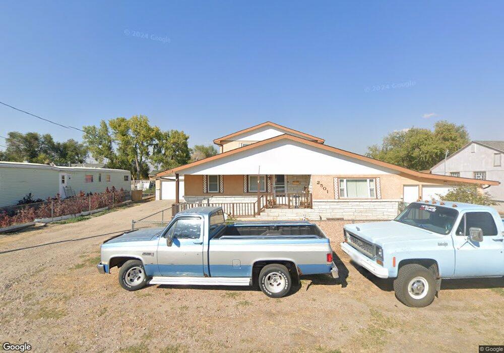
2501 W 15th St Scottsbluff, NE 69361
Estimated Value: $152,000 - $270,000
4
Beds
3
Baths
2,016
Sq Ft
$96/Sq Ft
Est. Value
About This Home
This home is located at 2501 W 15th St, Scottsbluff, NE 69361 and is currently estimated at $192,719, approximately $95 per square foot. 2501 W 15th St is a home located in Scotts Bluff County with nearby schools including Westmoor Elementary School, Bluffs Middle School, and Scottsbluff Senior High School.
Ownership History
Date
Name
Owned For
Owner Type
Purchase Details
Closed on
Aug 30, 2021
Sold by
Feagin Donna and Feagin Derek
Bought by
Rodriguez Gabriel and Rodriguez Stephanie
Current Estimated Value
Home Financials for this Owner
Home Financials are based on the most recent Mortgage that was taken out on this home.
Original Mortgage
$104,500
Outstanding Balance
$94,945
Interest Rate
2.7%
Mortgage Type
New Conventional
Estimated Equity
$97,774
Purchase Details
Closed on
Apr 17, 2020
Sold by
Feagin Donna R
Bought by
Feagin Donna and Feagin Derek
Create a Home Valuation Report for This Property
The Home Valuation Report is an in-depth analysis detailing your home's value as well as a comparison with similar homes in the area
Home Values in the Area
Average Home Value in this Area
Purchase History
| Date | Buyer | Sale Price | Title Company |
|---|---|---|---|
| Rodriguez Gabriel | $110,000 | Nebraska Ttl Co Scottsbluff | |
| Feagin Donna | -- | None Available |
Source: Public Records
Mortgage History
| Date | Status | Borrower | Loan Amount |
|---|---|---|---|
| Open | Rodriguez Gabriel | $104,500 |
Source: Public Records
Tax History Compared to Growth
Tax History
| Year | Tax Paid | Tax Assessment Tax Assessment Total Assessment is a certain percentage of the fair market value that is determined by local assessors to be the total taxable value of land and additions on the property. | Land | Improvement |
|---|---|---|---|---|
| 2024 | $1,574 | $123,675 | $21,780 | $101,895 |
| 2023 | $1,875 | $92,578 | $10,540 | $82,038 |
| 2022 | $1,875 | $92,578 | $10,540 | $82,038 |
| 2021 | $0 | $85,120 | $10,540 | $74,580 |
| 2020 | $0 | $82,252 | $10,540 | $71,712 |
| 2019 | $0 | $80,163 | $10,540 | $69,623 |
| 2018 | $186 | $80,163 | $10,540 | $69,623 |
| 2017 | $198 | $80,163 | $10,540 | $69,623 |
| 2016 | $334 | $80,163 | $10,540 | $69,623 |
| 2015 | $328 | $80,163 | $10,540 | $69,623 |
| 2014 | $319 | $76,848 | $10,540 | $66,308 |
| 2012 | -- | $76,848 | $10,540 | $66,308 |
Source: Public Records
Map
Nearby Homes
- 1816 W Overland
- 1426 Avenue P
- 1719 Avenue O
- 2113 Avenue O
- 1918 Avenue L
- 1526 Avenue J
- 717 W Overland
- 1410 Bryant Ave
- 54 Ridge Dr
- 1609 Avenue F
- 2015 Avenue E
- 1010 W 29th St
- 40 Crestview Rd
- 2990 Country Club Rd
- 2102 Avenue C
- 2906 Avenue H
- 1508 Avenue A
- 180123 Fort Mitchell Dr
- 2119 Broadway
- 2809 Avenue D