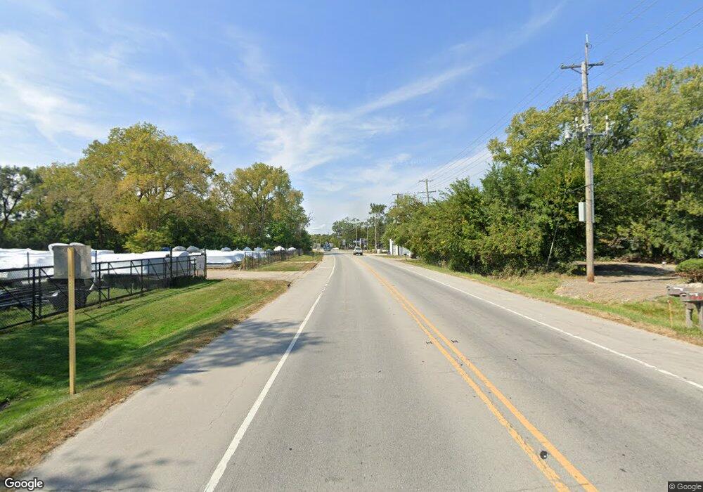
25013 W Il Route 173 Antioch, IL 60002
Tiffany Farms NeighborhoodEstimated Value: $331,000
3
Beds
2
Baths
1,407
Sq Ft
$235/Sq Ft
Est. Value
About This Home
This home is located at 25013 W Il Route 173, Antioch, IL 60002 and is currently priced at $331,000, approximately $235 per square foot. 25013 W Il Route 173 is a home located in Lake County with nearby schools including Antioch Community High School.
Ownership History
Date
Name
Owned For
Owner Type
Purchase Details
Closed on
Aug 8, 2017
Sold by
Upton Terry H and Upton Terry
Bought by
Skipper Real Estate Holdings Inc
Current Estimated Value
Purchase Details
Closed on
Dec 20, 2014
Sold by
Smith Robert F and Smith Steven M
Bought by
Upton Terry
Purchase Details
Closed on
Dec 22, 2006
Sold by
Badame Ellen M
Bought by
Marine Acquisitions Co Llc
Create a Home Valuation Report for This Property
The Home Valuation Report is an in-depth analysis detailing your home's value as well as a comparison with similar homes in the area
Home Values in the Area
Average Home Value in this Area
Purchase History
| Date | Buyer | Sale Price | Title Company |
|---|---|---|---|
| Skipper Real Estate Holdings Inc | $350,000 | Attorney | |
| Upton Terry | $120,000 | Fidelity National Title | |
| Marine Acquisitions Co Llc | $200,000 | First American Title |
Source: Public Records
Tax History Compared to Growth
Tax History
| Year | Tax Paid | Tax Assessment Tax Assessment Total Assessment is a certain percentage of the fair market value that is determined by local assessors to be the total taxable value of land and additions on the property. | Land | Improvement |
|---|---|---|---|---|
| 2024 | $2,541 | $25,780 | $25,780 | -- |
| 2023 | $2,541 | $23,084 | $23,084 | -- |
| 2022 | $5,499 | $48,957 | $7,061 | $41,896 |
| 2021 | $5,124 | $45,682 | $6,589 | $39,093 |
| 2020 | $5,441 | $48,052 | $6,931 | $41,121 |
| 2019 | $5,531 | $45,952 | $6,628 | $39,324 |
| 2018 | $5,331 | $44,678 | $6,731 | $37,947 |
| 2017 | $5,254 | $42,526 | $6,407 | $36,119 |
| 2016 | $4,703 | $41,040 | $6,183 | $34,857 |
| 2015 | $4,683 | $52,492 | $6,026 | $46,466 |
| 2014 | $6,118 | $54,208 | $6,743 | $47,465 |
| 2012 | $6,051 | $56,707 | $6,743 | $49,964 |
Source: Public Records
Map
Nearby Homes
- 42161 N 1st Ave
- 24816 W Il Route 173
- 25174 W Claridan Ave
- 25076 W Edgar Ave
- 1137 Oak Point Ct
- Truman III - Two-story Plan at Woodland Ridge
- Newport - Two-story Plan at Woodland Ridge
- Elway - Ranch Plan at Woodland Ridge
- Harrison - Ranch Plan at Woodland Ridge
- Dawson - Two-story Plan at Woodland Ridge
- Adams II - Ranch Plan at Woodland Ridge
- Pasadena II - Ranch Plan at Woodland Ridge
- Jefferson - Two-story Plan at Woodland Ridge
- Adams III - Ranch Plan at Woodland Ridge
- Roosevelt - Ranch Plan at Woodland Ridge
- Madison - Two-story Plan at Woodland Ridge
- Monroe II - Two-story Plan at Woodland Ridge
- Lincoln - Ranch Plan at Woodland Ridge
- Roosevelt II - Ranch Plan at Woodland Ridge
- 42425 N Park Ln
- 24965 W Il Route 173
- 25020 W Il Route 173
- 1063 W Il Route 173 Unit 1
- 1063 W Il Route 173
- 24970 W Il Route 173
- 25020 W Route 173
- 42201 N 1st Ave
- 25050 W Il Route 173
- 42191 N 1st Ave
- 42277 N Park Place
- 42169 N 1st Ave
- 42149 N 1st Ave
- 42309 N Park Place
- 42202 N 1st Ave
- 25121 W Il Route 173
- 42228 N 1st Ave
- 25080 W Il Route 173
- 24916 W Il Route 173
- 42176 N 1st Ave
- 26369 Park Place
