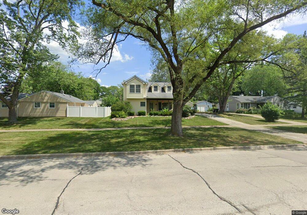
2502 Campbell St Rolling Meadows, IL 60008
Estimated Value: $414,000 - $456,000
3
Beds
2
Baths
1,884
Sq Ft
$231/Sq Ft
Est. Value
About This Home
This home is located at 2502 Campbell St, Rolling Meadows, IL 60008 and is currently estimated at $434,330, approximately $230 per square foot. 2502 Campbell St is a home located in Cook County with nearby schools including Kimball Hill Elementary School, Carl Sandburg Junior High School, and Rolling Meadows High School.
Ownership History
Date
Name
Owned For
Owner Type
Purchase Details
Closed on
Jan 15, 2021
Sold by
Volpe Michael A and Volpe Deborah J
Bought by
Volpe Michael A and Volpe Deborah J
Current Estimated Value
Purchase Details
Closed on
Jul 29, 2004
Sold by
Stiff Ronald L and Stiff Janet J
Bought by
Volpe Michael A and Volpe Deborah J
Create a Home Valuation Report for This Property
The Home Valuation Report is an in-depth analysis detailing your home's value as well as a comparison with similar homes in the area
Home Values in the Area
Average Home Value in this Area
Purchase History
| Date | Buyer | Sale Price | Title Company |
|---|---|---|---|
| Volpe Michael A | -- | None Available | |
| Volpe Michael A | $286,000 | Pntn |
Source: Public Records
Tax History
| Year | Tax Paid | Tax Assessment Tax Assessment Total Assessment is a certain percentage of the fair market value that is determined by local assessors to be the total taxable value of land and additions on the property. | Land | Improvement |
|---|---|---|---|---|
| 2025 | $7,677 | $38,000 | $8,681 | $29,319 |
| 2024 | $7,677 | $32,000 | $7,345 | $24,655 |
| 2023 | $7,585 | $32,000 | $7,345 | $24,655 |
| 2022 | $7,585 | $32,000 | $7,345 | $24,655 |
| 2021 | $6,439 | $22,773 | $4,340 | $18,433 |
| 2020 | $6,361 | $22,773 | $4,340 | $18,433 |
| 2019 | $6,405 | $25,445 | $4,340 | $21,105 |
| 2018 | $7,794 | $27,500 | $4,006 | $23,494 |
| 2017 | $7,655 | $27,500 | $4,006 | $23,494 |
| 2016 | $7,391 | $27,500 | $4,006 | $23,494 |
| 2015 | $6,917 | $24,592 | $3,672 | $20,920 |
| 2014 | $6,769 | $24,592 | $3,672 | $20,920 |
| 2013 | $6,588 | $24,592 | $3,672 | $20,920 |
Source: Public Records
Map
Nearby Homes
- 2705 Park St
- 3306 Trillium Cir Unit 3001
- 2709 Lily Ln
- 3209 Trillium Cir
- 3100 Town Square Dr Unit 308
- 3100 Town Square Dr Unit 204
- 2107 Kirchoff Rd
- 3135 Town Square Dr Unit 401
- 2201 Kingfisher Ln
- 3265 Kirchoff Rd Unit 116
- 3345 Kirchoff Rd Unit 5C
- 1215 W Sigwalt St Unit A
- 3605 Oriole Ln
- 2401 Rohlwing Rd
- 3200 Thrush Ln
- 3407 Pheasant Dr
- 3710 Meadow Dr
- 1506 W Northwest Hwy
- 912 N Chicago Ave
- 3712 Jay Ln
- 2500 Campbell St
- 2504 Meadow Dr
- 2502 Meadow Dr
- 2412 Campbell St
- 2410 Campbell St
- 2411 Wing St
- 2500 Meadow Dr
- 2507 Campbell St
- 2507 Campbell St Unit 1
- 2409 Wing St
- 2509 Meadow Dr
- 2408 Campbell St
- 2505 Campbell St
- 2503 Campbell St
- 2507 Meadow Dr
- 2407 Wing St
- 2501 Campbell St
- 2505 Meadow Dr
- 2406 Campbell St
- 2602 Meadow Dr
Your Personal Tour Guide
Ask me questions while you tour the home.