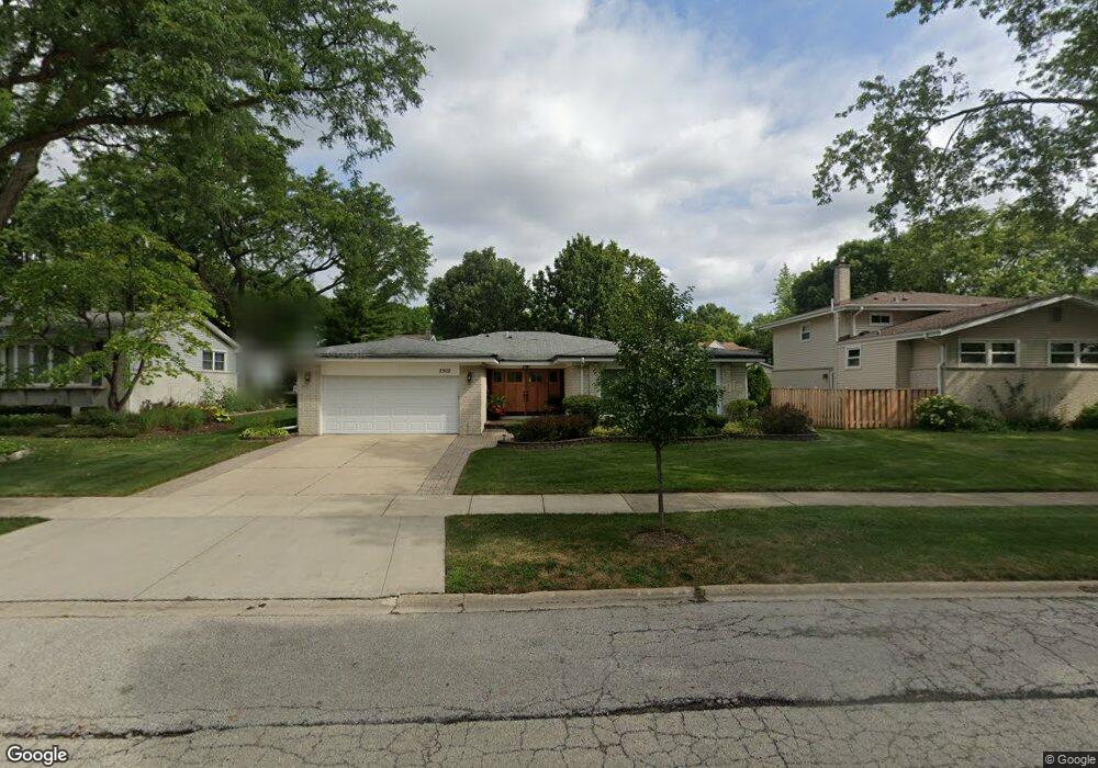
2502 E Sherwood Rd Arlington Heights, IL 60004
Estimated Value: $617,000 - $649,000
4
Beds
2
Baths
2,450
Sq Ft
$256/Sq Ft
Est. Value
About This Home
This home is located at 2502 E Sherwood Rd, Arlington Heights, IL 60004 and is currently estimated at $627,740, approximately $256 per square foot. 2502 E Sherwood Rd is a home located in Cook County with nearby schools including Dwight D Eisenhower Elementary School, Anne Sullivan Elementary School, and Betsy Ross Elementary School.
Ownership History
Date
Name
Owned For
Owner Type
Purchase Details
Closed on
Mar 17, 2003
Sold by
Faraci Joseph and Faraci Lina
Bought by
Faraci Joseph and Faraci Lina
Current Estimated Value
Purchase Details
Closed on
Mar 25, 2002
Sold by
Benjamin Fredrick Y
Bought by
Faraci Joseph and Faraci Andlina
Purchase Details
Closed on
Jun 20, 2001
Sold by
Benjamin Frederick Y and Benjamin Rita T
Bought by
Benjamin Frederick Y and Benjamin Rita T
Create a Home Valuation Report for This Property
The Home Valuation Report is an in-depth analysis detailing your home's value as well as a comparison with similar homes in the area
Home Values in the Area
Average Home Value in this Area
Purchase History
| Date | Buyer | Sale Price | Title Company |
|---|---|---|---|
| Faraci Joseph | -- | -- | |
| Faraci Joseph | $385,000 | Lawyers Title Insurance Corp | |
| Benjamin Frederick Y | -- | Chicago Title Insurance Co |
Source: Public Records
Tax History Compared to Growth
Tax History
| Year | Tax Paid | Tax Assessment Tax Assessment Total Assessment is a certain percentage of the fair market value that is determined by local assessors to be the total taxable value of land and additions on the property. | Land | Improvement |
|---|---|---|---|---|
| 2024 | $4,847 | $41,440 | $10,692 | $30,748 |
| 2023 | $4,775 | $41,440 | $10,692 | $30,748 |
| 2022 | $4,775 | $44,000 | $10,692 | $33,308 |
| 2021 | $5,415 | $36,433 | $6,075 | $30,358 |
| 2020 | $9,127 | $36,433 | $6,075 | $30,358 |
| 2019 | $9,110 | $40,617 | $6,075 | $34,542 |
| 2018 | $9,216 | $38,521 | $5,346 | $33,175 |
| 2017 | $5,350 | $38,521 | $5,346 | $33,175 |
| 2016 | $5,842 | $38,521 | $5,346 | $33,175 |
| 2015 | $6,625 | $26,790 | $4,617 | $22,173 |
| 2014 | $6,566 | $26,790 | $4,617 | $22,173 |
| 2013 | $7,463 | $30,538 | $4,617 | $25,921 |
Source: Public Records
Map
Nearby Homes
- 2611 E Radford Ct
- 1949 N Charter Point Dr Unit 1949
- 1912 N Coldspring Rd Unit 96
- 1961 N Coldspring Rd Unit 63
- 1956 N Silver Lake Rd
- 2026 N Stillwater Rd Unit 24
- 307 Anne Ct
- 1532 N Courtland Dr Unit 6
- 2315 E Olive St Unit 3G
- 2315 E Olive St Unit 2G
- 1519 E Arbor Ln
- 1510 N Kendal Ct Unit 11510
- 105 W Ridge Ave
- 1215 N Waterman Ave Unit 3L
- 2424 E Oakton St Unit 3C
- 2420 E Brandenberry Ct Unit 4C
- 13 W Kenilworth Ave
- 1511 N Windsor Dr Unit 208
- 2403 E Brandenberry Ct Unit 2A
- 11 W Palatine Rd
- 2418 E Sherwood Rd
- 1714 N Dale Ave
- 2507 E Lillian Ln
- 2419 E Lillian Ln
- 2414 E Sherwood Rd
- 1718 N Dale Ave
- 2415 E Lillian Ln
- 2503 E Sherwood Rd
- 2419 E Sherwood Rd
- 1702 N Dale Ave
- 2410 E Sherwood Rd
- 2411 E Lillian Ln
- 2415 E Sherwood Rd
- 1715 N Dale Ave
- 1711 N Dale Ave
- 1719 N Dale Ave
- 1707 N Dale Ave
- 2411 E Sherwood Rd
- 2406 E Sherwood Rd
- 1624 N Dale Ave