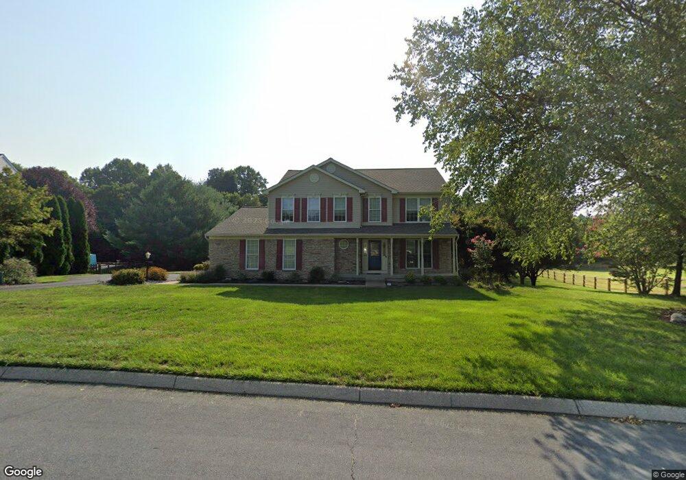
2502 Lora Mae Ct Forest Hill, MD 21050
Estimated Value: $707,339 - $847,000
Studio
3
Baths
2,824
Sq Ft
$272/Sq Ft
Est. Value
About This Home
This home is located at 2502 Lora Mae Ct, Forest Hill, MD 21050 and is currently estimated at $767,835, approximately $271 per square foot. 2502 Lora Mae Ct is a home located in Harford County with nearby schools including Forest Hill Elementary School, North Harford Middle School, and North Harford High School.
Ownership History
Date
Name
Owned For
Owner Type
Purchase Details
Closed on
Jul 19, 2019
Sold by
Kouneski Edward A and Kouneski Cynthia A
Bought by
Ward Timothy B and Ward Janice
Current Estimated Value
Home Financials for this Owner
Home Financials are based on the most recent Mortgage that was taken out on this home.
Original Mortgage
$520,400
Outstanding Balance
$454,022
Interest Rate
3.62%
Mortgage Type
FHA
Estimated Equity
$313,813
Purchase Details
Closed on
Feb 18, 1999
Sold by
Bacland Development Llc
Bought by
Kouneski Edward A and Kouneski Cynthia A
Create a Home Valuation Report for This Property
The Home Valuation Report is an in-depth analysis detailing your home's value as well as a comparison with similar homes in the area
Purchase History
| Date | Buyer | Sale Price | Title Company |
|---|---|---|---|
| Ward Timothy B | $530,000 | None Available | |
| Kouneski Edward A | $282,131 | -- |
Source: Public Records
Mortgage History
| Date | Status | Borrower | Loan Amount |
|---|---|---|---|
| Open | Ward Timothy B | $520,400 | |
| Closed | Kouneski Edward A | -- |
Source: Public Records
Tax History
| Year | Tax Paid | Tax Assessment Tax Assessment Total Assessment is a certain percentage of the fair market value that is determined by local assessors to be the total taxable value of land and additions on the property. | Land | Improvement |
|---|---|---|---|---|
| 2025 | $5,878 | $553,200 | $152,400 | $400,800 |
| 2024 | $5,878 | $533,767 | $0 | $0 |
| 2023 | $5,666 | $514,333 | $0 | $0 |
| 2022 | $5,454 | $494,900 | $152,400 | $342,500 |
| 2021 | $11,001 | $481,400 | $0 | $0 |
| 2020 | $5,460 | $467,900 | $0 | $0 |
| 2019 | $5,304 | $454,400 | $152,400 | $302,000 |
| 2018 | $5,150 | $446,233 | $0 | $0 |
| 2017 | $4,976 | $454,400 | $0 | $0 |
| 2016 | -- | $429,900 | $0 | $0 |
| 2015 | $4,959 | $429,900 | $0 | $0 |
| 2014 | $4,959 | $429,900 | $0 | $0 |
Source: Public Records
Map
Nearby Homes
- 209 Christopher Rd
- 2419 Edwards Manor Dr
- 106 Bower Ln
- 2433 Maxa Meadows Ln
- 2322 Rock Spring Rd
- 332 Ponfield Rd E
- 2135 Mardic Dr
- 2033 Mardic Dr
- 2027 Mardic Dr
- 407 Shellbark Ct
- 305 Esther Dr
- 310 Willrich Cir
- 313 Willrich Cir Unit E
- 311 Willrich Cir Unit G
- 2013 Columbine Ln
- 16 Wagner Way
- 2229-A Ady Rd
- 2804 Rocks Rd
- 138 Paden Ct
- 2027 Brandy Dr
- 2504 Lora Mae Ct
- 2500 Lora Mae Ct
- 2506 Lora Mae Ct
- 213 Christopher Rd
- 2503 Lora Mae Ct
- 2425 Feather Mae Ct
- 2507 Lora Mae Ct
- 2424 Feather Mae Ct
- 210 Christopher Rd
- 2505 Lora Mae Ct
- 2503 Edwards Manor Ct
- 217 Christopher Rd
- 2422 Feather Mae Ct
- 2505 Edwards Manor Ct
- 208 Christopher Rd
- 2425 Edwards Manor Dr
- 215 Nicholas Ct
- 2420 Feather Mae Ct
- 219 Christopher Rd
- 2502 Edwards Manor Ct
Your Personal Tour Guide
Ask me questions while you tour the home.