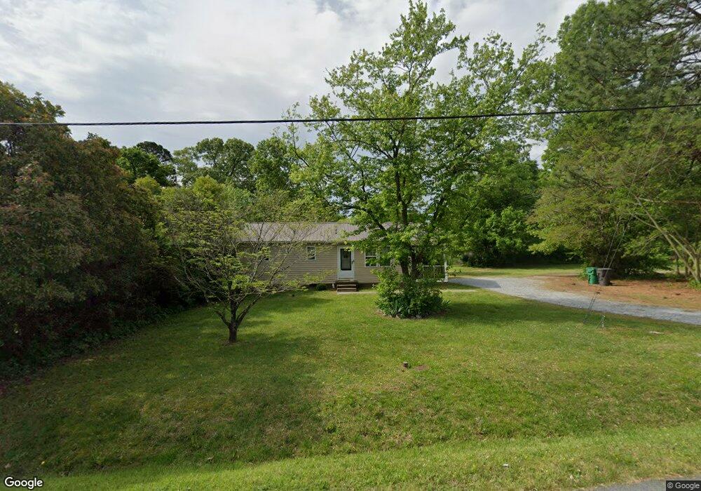
2502 Lowe Ave High Point, NC 27260
Greater High Point NeighborhoodEstimated Value: $108,000 - $138,254
2
Beds
2
Baths
864
Sq Ft
$147/Sq Ft
Est. Value
About This Home
This home is located at 2502 Lowe Ave, High Point, NC 27260 and is currently estimated at $127,314, approximately $147 per square foot. 2502 Lowe Ave is a home located in Guilford County with nearby schools including Fairview Elementary School, Ferndale Middle School, and High Point Central High School.
Ownership History
Date
Name
Owned For
Owner Type
Purchase Details
Closed on
Oct 29, 2015
Bought by
Wright Rental Holdings Llc
Current Estimated Value
Purchase Details
Closed on
Mar 28, 2002
Sold by
Wright Carl R and Wright Caryn H
Bought by
2503 Lowe Avenue Trust and J Hayworth
Purchase Details
Closed on
Nov 5, 1998
Sold by
Campbell Nakia L
Bought by
Wright Carl R
Home Financials for this Owner
Home Financials are based on the most recent Mortgage that was taken out on this home.
Original Mortgage
$36,000
Interest Rate
6.65%
Create a Home Valuation Report for This Property
The Home Valuation Report is an in-depth analysis detailing your home's value as well as a comparison with similar homes in the area
Home Values in the Area
Average Home Value in this Area
Purchase History
| Date | Buyer | Sale Price | Title Company |
|---|---|---|---|
| Wright Rental Holdings Llc | -- | -- | |
| 2503 Lowe Avenue Trust | -- | -- | |
| Wright Carl R | $36,000 | -- |
Source: Public Records
Mortgage History
| Date | Status | Borrower | Loan Amount |
|---|---|---|---|
| Previous Owner | Wright Carl R | $36,000 |
Source: Public Records
Tax History Compared to Growth
Tax History
| Year | Tax Paid | Tax Assessment Tax Assessment Total Assessment is a certain percentage of the fair market value that is determined by local assessors to be the total taxable value of land and additions on the property. | Land | Improvement |
|---|---|---|---|---|
| 2025 | $821 | $59,600 | $11,000 | $48,600 |
| 2024 | $821 | $59,600 | $11,000 | $48,600 |
| 2023 | $821 | $59,600 | $11,000 | $48,600 |
| 2022 | $803 | $59,600 | $11,000 | $48,600 |
| 2021 | $733 | $53,200 | $8,800 | $44,400 |
| 2020 | $733 | $53,200 | $8,800 | $44,400 |
| 2019 | $733 | $53,200 | $0 | $0 |
| 2018 | $729 | $53,200 | $0 | $0 |
| 2017 | $733 | $53,200 | $0 | $0 |
| 2016 | $673 | $48,000 | $0 | $0 |
| 2015 | $677 | $48,000 | $0 | $0 |
| 2014 | $688 | $48,000 | $0 | $0 |
Source: Public Records
Map
Nearby Homes
- 1605 Mossbrook Cir
- 1222 Carter St
- 1907 Apex Place
- 430 New St
- 2317 Purdy Ave
- 640 Wesley Dr
- 650 Wesley Dr
- 511 Hines St
- 811 Worth St
- 507 Hines St
- 1908 Leonard Ave
- 1423 E Commerce Ave
- 901 Hickory Chapel Rd
- 709 Habersham Rd
- 901 Richland St
- 504 Meredith St
- 1010 Grace St
- 1035 Asheboro St
- 408 Meredith St
- 413 Cable St
- 2504 Lowe Ave
- 2410 Lowe Ave
- 2408 Lowe Ave
- 2506 Lowe Ave
- 2501 Friends Ave
- 2503 Friends Ave
- 2411 Friends Ave
- 2505 Friends Ave
- 620 Manley St
- 2404 Lowe Ave
- 2501 Lowe Ave
- 2507 Friends Ave
- 2508 Lowe Ave
- 2407 Friends Ave
- 2407 Lowe Ave Unit 2409
- 2505 Lowe Ave
- 2509 Friends Ave
- 2405 Friends Ave
- 2402 Lowe Ave
- 2405 Lowe Ave