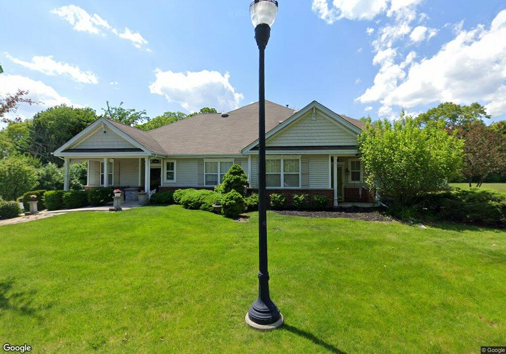
2504 Burnside Way Waukegan, IL 60087
Estimated Value: $245,000 - $282,000
3
Beds
2
Baths
1,930
Sq Ft
$137/Sq Ft
Est. Value
About This Home
This home is located at 2504 Burnside Way, Waukegan, IL 60087 and is currently estimated at $264,005, approximately $136 per square foot. 2504 Burnside Way is a home located in Lake County with nearby schools including John S. Clark Elementary School, Jack Benny Middle School, and Waukegan High School.
Ownership History
Date
Name
Owned For
Owner Type
Purchase Details
Closed on
May 5, 2020
Sold by
Mivshek Lori and Mivshek Dennis
Bought by
Mivshek Lori A and The Certain Trust
Current Estimated Value
Purchase Details
Closed on
Sep 26, 2016
Sold by
Scherwat Donald H
Bought by
Lori Mivshek Dennis and Lori Mivsh5k
Purchase Details
Closed on
Sep 1, 2005
Sold by
Traditions At Glen Flora Llc
Bought by
Scherwat Donald H and Scherwat Rosemary G
Create a Home Valuation Report for This Property
The Home Valuation Report is an in-depth analysis detailing your home's value as well as a comparison with similar homes in the area
Home Values in the Area
Average Home Value in this Area
Purchase History
| Date | Buyer | Sale Price | Title Company |
|---|---|---|---|
| Mivshek Lori A | -- | Attorney | |
| Lori Mivshek Dennis | $170,000 | Ct | |
| Scherwat Donald H | $257,500 | -- |
Source: Public Records
Tax History Compared to Growth
Tax History
| Year | Tax Paid | Tax Assessment Tax Assessment Total Assessment is a certain percentage of the fair market value that is determined by local assessors to be the total taxable value of land and additions on the property. | Land | Improvement |
|---|---|---|---|---|
| 2024 | $5,752 | $76,504 | $10,073 | $66,431 |
| 2023 | $6,233 | $68,995 | $9,084 | $59,911 |
| 2022 | $6,233 | $69,759 | $12,425 | $57,334 |
| 2021 | $6,963 | $72,792 | $12,980 | $59,812 |
| 2020 | $6,440 | $67,814 | $12,092 | $55,722 |
| 2019 | $6,385 | $62,140 | $11,080 | $51,060 |
| 2018 | $6,690 | $61,406 | $14,256 | $47,150 |
| 2017 | $6,163 | $54,328 | $12,613 | $41,715 |
| 2016 | $6,368 | $47,209 | $10,960 | $36,249 |
| 2015 | $6,124 | $42,252 | $9,809 | $32,443 |
| 2014 | $6,642 | $45,229 | $9,687 | $35,542 |
| 2012 | $7,669 | $49,003 | $10,495 | $38,508 |
Source: Public Records
Map
Nearby Homes
- 0 Traditions Dr
- 301 W Eagle Ct
- 2246 Alta Vista Dr
- 2213 Alta Vista Dr
- 37231 N Ganster Rd
- 2232 Walnut St
- 10241 W Bairstow Ave
- 1905 Linden Ave
- 616 W Keith Ave
- 37789 N Sheridan Rd
- 1612 Whitney St
- 1018 W Atlantic Ave
- 1636 Rice St
- 2613 N Lewis Ave
- 37905 N Loyola Ave
- 1336 N Ash St
- 2350 N Lewis Ave
- 1335 Chestnut St
- 38101 N Sheridan Rd
- 1312 N Linden Ave
- 2504 Burnside Way Unit 2504
- 2506 Burnside Way
- 2500 Burnside Way
- 2502 Burnside Way
- 2512 Burnside Way
- LOT 1 N Sheridan Rd
- 37015-21 N Sheridan Rd
- 2520 Burnside Way
- 2345 N Sheridan Rd
- 2337 N Sheridan Rd
- 135 Montesano Ave
- 2329 N Sheridan Rd
- 2536 Burnside Way
- 2532 Burnside Way
- 2401 N Sheridan Rd
- 2411 N Sheridan Rd
- 2538 Burnside Way
- 2538 Burnside Way
- 2534 Burnside Way
- 2334 Corona Rd