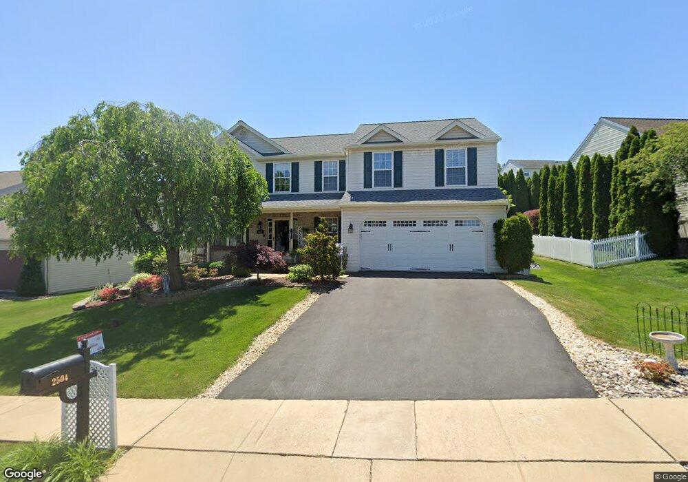
2504 Simon Dr Reading, PA 19608
Estimated Value: $439,540 - $492,000
4
Beds
3
Baths
2,224
Sq Ft
$212/Sq Ft
Est. Value
About This Home
This home is located at 2504 Simon Dr, Reading, PA 19608 and is currently estimated at $471,385, approximately $211 per square foot. 2504 Simon Dr is a home located in Berks County with nearby schools including Cornwall Terrace Elementary School, Wilson Southern Middle School, and Wilson High School.
Ownership History
Date
Name
Owned For
Owner Type
Purchase Details
Closed on
Mar 24, 2006
Sold by
Longstreth Breslin G and Longstreth Kristina R
Bought by
Salvatori Robert F and Salvatori Lori Jo
Current Estimated Value
Home Financials for this Owner
Home Financials are based on the most recent Mortgage that was taken out on this home.
Original Mortgage
$220,800
Outstanding Balance
$126,257
Interest Rate
6.37%
Mortgage Type
New Conventional
Estimated Equity
$345,128
Purchase Details
Closed on
Aug 20, 2004
Sold by
Greth Development Group Inc
Bought by
Longstreth Breslin G and Longstreth Kristina R
Home Financials for this Owner
Home Financials are based on the most recent Mortgage that was taken out on this home.
Original Mortgage
$200,800
Interest Rate
5.5%
Mortgage Type
Purchase Money Mortgage
Create a Home Valuation Report for This Property
The Home Valuation Report is an in-depth analysis detailing your home's value as well as a comparison with similar homes in the area
Home Values in the Area
Average Home Value in this Area
Purchase History
| Date | Buyer | Sale Price | Title Company |
|---|---|---|---|
| Salvatori Robert F | $276,000 | None Available | |
| Longstreth Breslin G | $251,762 | First American |
Source: Public Records
Mortgage History
| Date | Status | Borrower | Loan Amount |
|---|---|---|---|
| Open | Salvatori Robert F | $220,800 | |
| Previous Owner | Longstreth Breslin G | $200,800 | |
| Closed | Longstreth Breslin G | $37,500 |
Source: Public Records
Tax History
| Year | Tax Paid | Tax Assessment Tax Assessment Total Assessment is a certain percentage of the fair market value that is determined by local assessors to be the total taxable value of land and additions on the property. | Land | Improvement |
|---|---|---|---|---|
| 2025 | $3,056 | $176,800 | $29,300 | $147,500 |
| 2024 | $7,564 | $176,800 | $29,300 | $147,500 |
| 2023 | $7,208 | $176,800 | $29,300 | $147,500 |
| 2022 | $7,031 | $176,800 | $29,300 | $147,500 |
| 2021 | $6,783 | $176,800 | $29,300 | $147,500 |
| 2020 | $6,783 | $176,800 | $29,300 | $147,500 |
| 2019 | $6,591 | $176,800 | $29,300 | $147,500 |
| 2018 | $6,534 | $176,800 | $29,300 | $147,500 |
| 2017 | $6,424 | $176,800 | $29,300 | $147,500 |
| 2016 | $2,140 | $176,800 | $29,300 | $147,500 |
| 2015 | $2,140 | $176,800 | $29,300 | $147,500 |
| 2014 | $2,140 | $176,800 | $29,300 | $147,500 |
Source: Public Records
Map
Nearby Homes
- 2400 John Henry Dr
- 2508 John Henry Dr
- 3002 Susanna Dr
- 514 Arrowhead Trail
- 2313 Washington
- 27 Rosemont Ave
- 217 Revere Blvd
- 207 Revere Blvd
- 514 Dorchester Ave
- 315 Dorchester Ave
- 2214 Mckinley Ave
- 629 Lawrence Ave
- 902 Bedford Ave
- 2601 Reading Blvd
- 28 Charlemont Ct
- 17 Charlemont Ct
- 665 Fairmont Ave
- 20 Charlemont Ct
- 220 Sturbridge Dr
- 2266 Reading Blvd
- 2502 Simon Dr
- 2506 Simon Dr
- 2314 Overland Ave
- 2312 Overland Ave
- 2508 Simon Dr
- 2500 Simon Dr
- 2316 Overland Ave
- 2505 Simon Dr
- 2310 Overland Ave
- 2503 Simon Dr
- 2507 Simon Dr
- 2501 Simon Dr
- 2510 Simon Dr
- 2318 Overland Ave
- 2509 Simon Dr
- 2308 Overland Ave
- 2508 Andrew Dr
- 2506 Andrew Dr
- 2510 Andrew Dr
- 2503 Andrew Dr
Your Personal Tour Guide
Ask me questions while you tour the home.