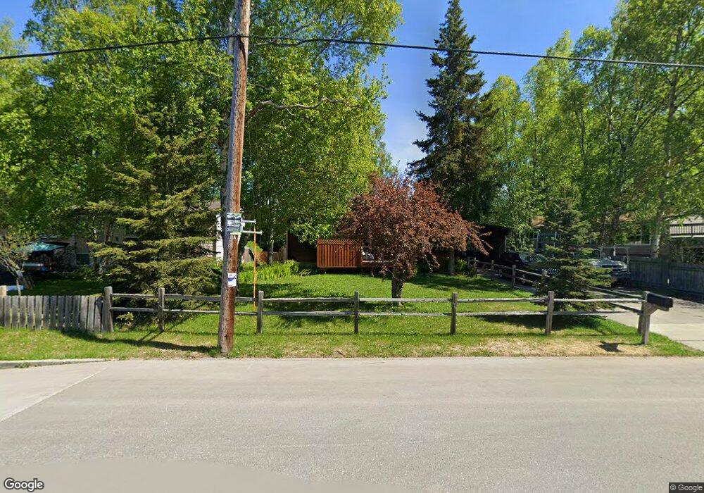
2505 Mckenzie Dr Anchorage, AK 99517
Turnagain NeighborhoodEstimated Value: $282,000 - $678,000
4
Beds
3
Baths
1,312
Sq Ft
$409/Sq Ft
Est. Value
About This Home
This home is located at 2505 Mckenzie Dr, Anchorage, AK 99517 and is currently estimated at $536,459, approximately $408 per square foot. 2505 Mckenzie Dr is a home located in Anchorage Municipality with nearby schools including Turnagain Elementary School, Romig Middle School, and West High School.
Ownership History
Date
Name
Owned For
Owner Type
Purchase Details
Closed on
May 31, 2024
Sold by
Spencer Ricky L and Wise Brenda S
Bought by
Spencer Ricky L and Wise Brenda S
Current Estimated Value
Home Financials for this Owner
Home Financials are based on the most recent Mortgage that was taken out on this home.
Original Mortgage
$200,000
Outstanding Balance
$197,118
Interest Rate
6.38%
Mortgage Type
New Conventional
Estimated Equity
$339,341
Purchase Details
Closed on
Aug 29, 2010
Sold by
Evans Joyce Carol
Bought by
Spencer Rick L
Purchase Details
Closed on
Nov 14, 2001
Sold by
Evans Richard J and Evans Lucille H
Bought by
Evans Carol
Create a Home Valuation Report for This Property
The Home Valuation Report is an in-depth analysis detailing your home's value as well as a comparison with similar homes in the area
Home Values in the Area
Average Home Value in this Area
Purchase History
| Date | Buyer | Sale Price | Title Company |
|---|---|---|---|
| Spencer Ricky L | -- | First American Title Insurance | |
| Spencer Rick L | -- | None Available | |
| Evans Carol | -- | -- |
Source: Public Records
Mortgage History
| Date | Status | Borrower | Loan Amount |
|---|---|---|---|
| Open | Spencer Ricky L | $200,000 |
Source: Public Records
Tax History
| Year | Tax Paid | Tax Assessment Tax Assessment Total Assessment is a certain percentage of the fair market value that is determined by local assessors to be the total taxable value of land and additions on the property. | Land | Improvement |
|---|---|---|---|---|
| 2025 | $8,489 | $553,700 | $202,100 | $351,600 |
| 2024 | $8,489 | $525,800 | $189,300 | $336,500 |
| 2023 | $8,326 | $488,900 | $189,300 | $299,600 |
| 2022 | $8,183 | $485,900 | $189,300 | $296,600 |
| 2021 | $7,731 | $429,000 | $189,300 | $239,700 |
| 2020 | $7,439 | $437,600 | $189,300 | $248,300 |
| 2019 | $6,942 | $424,300 | $189,300 | $235,000 |
| 2018 | $6,927 | $422,400 | $189,300 | $233,100 |
| 2017 | $6,737 | $430,200 | $189,300 | $240,900 |
| 2016 | $6,194 | $440,100 | $178,900 | $261,200 |
| 2015 | $6,194 | $440,100 | $178,900 | $261,200 |
| 2014 | $6,194 | $401,100 | $178,900 | $222,200 |
Source: Public Records
Map
Nearby Homes
- 2401 W Marston Dr
- 000 Chilligan Dr
- 2921 W 29th Ave Unit 5B
- 2335 Lord Baranof Dr
- 2540 Lord Baranof Dr
- 2906 W 29th Ave
- 4111 Woronzof Dr
- 2934 Marston Dr
- 3171 Horizon St
- 2543 La Honda Dr Unit 7
- 2140 Atwood Dr
- 3240 Wiley Post Loop
- 3517 Vintage Cir
- Tr A W Northern Lights Blvd
- 2511 Abbey Ln
- 2064 Belair Dr
- 2201 Belmont Dr
- 1936 Wildwood Ln
- 3333 Lakeshore Dr Unit 2
- 4000 Iowa Dr
- 2467 Mckenzie Dr
- 2528 Susitna Dr
- 2531 Mckenzie Dr
- 2455 Mckenzie Dr
- 2516 Susitna Dr
- 2540 Susitna Dr
- 2500 Mckenzie Dr
- 2500 Susitna Dr
- 2552 Susitna Dr
- 2522 Mckenzie Dr
- 2445 Mckenzie Dr
- 2541 Mckenzie Dr
- 3423 Knik Ave
- 2438 Susitna Dr
- 2440 Mckenzie Dr
- 3518 Clay Products Dr
- 3505 Knik Ave
- 3401 Knik Ave
- 2431 Mckenzie Dr
- 2527 Susitna Dr
Your Personal Tour Guide
Ask me questions while you tour the home.