Estimated Value: $563,855 - $598,000
3
Beds
3
Baths
1,288
Sq Ft
$451/Sq Ft
Est. Value
About This Home
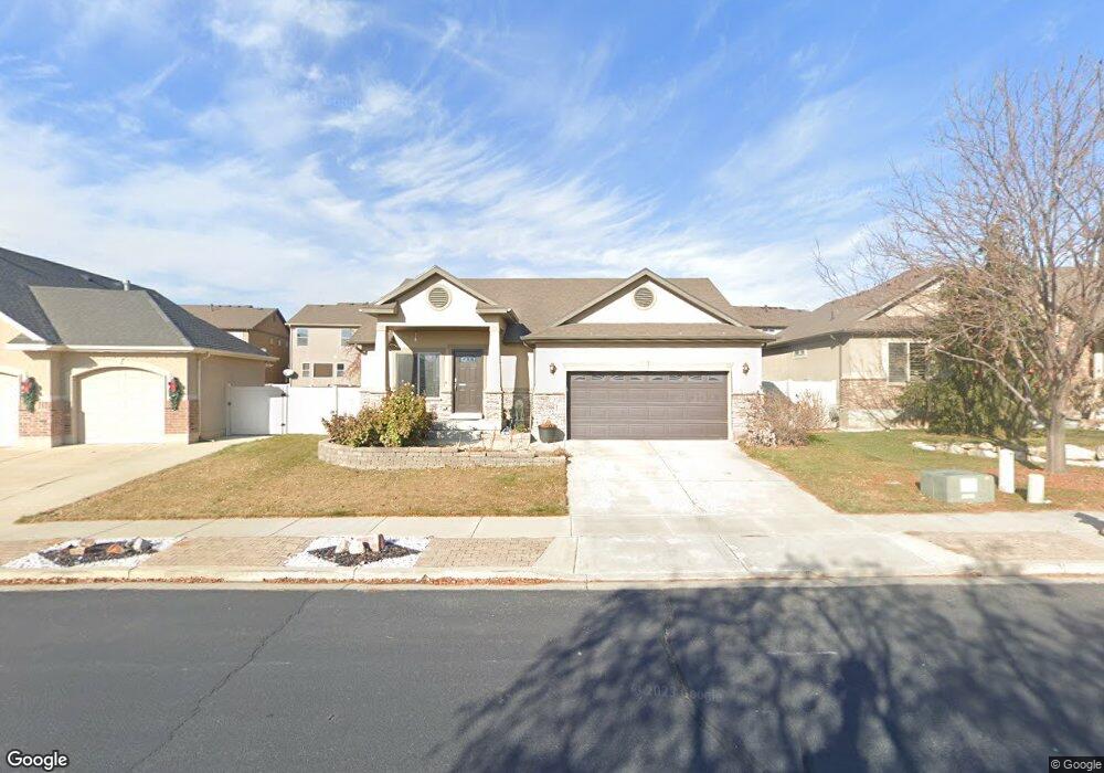
This home is located at 2506 W 2400 N, Lehi, UT 84043 and is currently estimated at $581,464, approximately $451 per square foot. 2506 W 2400 N is a home located in Utah County with nearby schools including Liberty Hills Elementary School, Skyridge High School, and Ascent Academies of Utah - Lehi Campus.
Ownership History
Date
Name
Owned For
Owner Type
Purchase Details
Closed on
Mar 9, 2020
Sold by
Berendson Stephen
Bought by
Berendson Stephen and Berendson Kelly
Current Estimated Value
Home Financials for this Owner
Home Financials are based on the most recent Mortgage that was taken out on this home.
Original Mortgage
$255,000
Outstanding Balance
$225,408
Interest Rate
3.4%
Mortgage Type
New Conventional
Estimated Equity
$356,056
Purchase Details
Closed on
Jun 15, 2007
Sold by
Ivory Homes Ltd
Bought by
Berendson Stephen
Home Financials for this Owner
Home Financials are based on the most recent Mortgage that was taken out on this home.
Original Mortgage
$253,750
Interest Rate
8.7%
Mortgage Type
Purchase Money Mortgage
Create a Home Valuation Report for This Property
The Home Valuation Report is an in-depth analysis detailing your home's value as well as a comparison with similar homes in the area
Home Values in the Area
Average Home Value in this Area
Purchase History
| Date | Buyer | Sale Price | Title Company |
|---|---|---|---|
| Berendson Stephen | -- | Servicelink East Escrow | |
| Berendson Stephen | -- | Cottonwood Title | |
| Ivory Homes Ltd | -- | Cottonwood Title |
Source: Public Records
Mortgage History
| Date | Status | Borrower | Loan Amount |
|---|---|---|---|
| Open | Berendson Stephen | $255,000 | |
| Closed | Berendson Stephen | $253,750 |
Source: Public Records
Tax History Compared to Growth
Tax History
| Year | Tax Paid | Tax Assessment Tax Assessment Total Assessment is a certain percentage of the fair market value that is determined by local assessors to be the total taxable value of land and additions on the property. | Land | Improvement |
|---|---|---|---|---|
| 2025 | $2,382 | $294,415 | $211,400 | $323,900 |
| 2024 | $2,382 | $278,795 | $0 | $0 |
| 2023 | $2,243 | $285,065 | $0 | $0 |
| 2022 | $2,443 | $300,960 | $0 | $0 |
| 2021 | $1,952 | $363,500 | $122,300 | $241,200 |
| 2020 | $1,839 | $338,600 | $113,200 | $225,400 |
| 2019 | $1,675 | $320,500 | $113,200 | $207,300 |
| 2018 | $1,655 | $299,500 | $106,700 | $192,800 |
| 2017 | $1,526 | $146,795 | $0 | $0 |
| 2016 | $1,545 | $137,885 | $0 | $0 |
| 2015 | $1,547 | $131,065 | $0 | $0 |
| 2014 | $1,466 | $123,420 | $0 | $0 |
Source: Public Records
Map
Nearby Homes
- 2464 W 2250 N
- 2189 N 2600 W
- 2196 N 2350 W
- 1968 N 2040 W Unit 40
- 1969 N 2040 St W
- 2013 N 2040 W
- 1990 N 2040 W
- 1990 N 2040 W Unit 41
- 2673 N Double Eagle Dr
- Huntington Plan at Pioneer Meadows
- Silver Lake Plan at Pioneer Meadows
- Summit Plan at Pioneer Meadows
- Palisade Plan at Pioneer Meadows
- 2669 N Turnberry Ct
- 1912 W 2250 N
- 2419 N 3130 W
- 1970 N 2090 St W
- 1898 W Pointe Meadow Loop
- 3199 W 2450 N
- 2886 Desert Forest Ln
- 2520 W 2400 N
- 2494 W 2400 N
- 2547 W Cottonwood Dr
- 2525 W Cottonwood Dr
- 2549 W Cottonwood Dr
- 2521 W Cottonwood Dr
- 2532 W 2400 N
- 2478 W 2400 N
- 2517 W Cottonwood Dr
- 2579 W Cottonwood Dr
- 2581 W Cottonwood Dr
- 2576 Cottonwood Dr
- 2592 Cottonwood Dr
- 2447 N Garden Dr
- 2449 N Garden Dr
- 2604 Cottonwood Dr
- 2610 Cottonwood Dr
- 2595 W Cottonwood Dr
- 2546 W 2400 N
- 2525 W 2400 N