
Seller's Agent in 2026
Troy Doty
Northwest Realty Source
(503) 997-4169
1 in this area
140 Total Sales
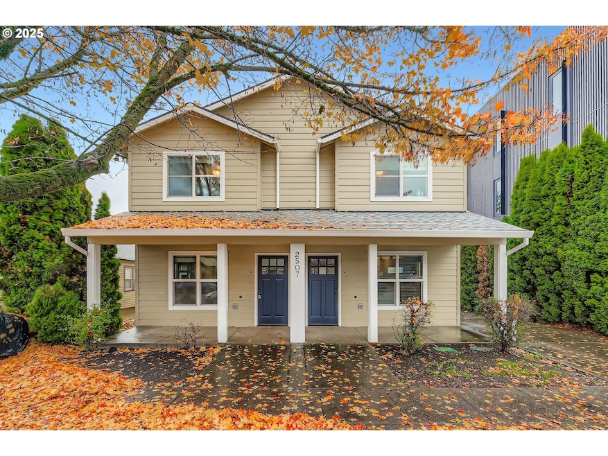
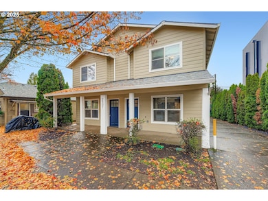
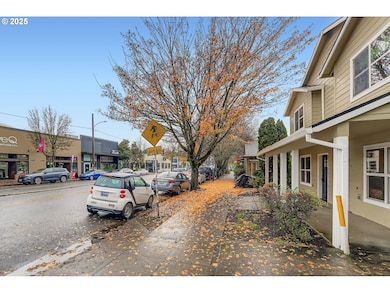
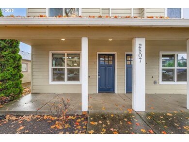
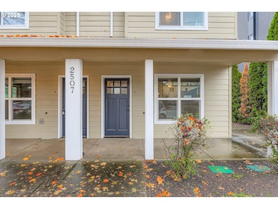
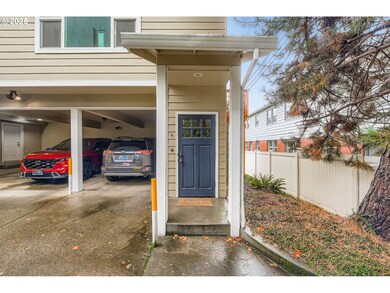
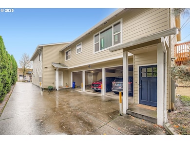
A rare chance to secure a well-kept triplex in the heart of Laurelhurst. Two townhouse-style units sit at the front of the property, while the rear unit offers convenient single-level living with its own private deck. One unit is currently vacant, giving a buyer the option to live on-site and reduce ownership costs or lease it out to maximize returns. Each unit includes dedicated covered parking beneath the building, providing dependable off-street space. The exterior was repainted in 2021 and the interiors have been refreshed with updated finishes. New roof in 2023. All appliances stay, including washers and dryers. Durable wood-style flooring adds a clean, modern feel throughout. The location is hard to beat, with popular dining, shopping, and daily conveniences just steps away. Walk Score 97, Bike Score 100.
Last Agent to Sell the Property
Northwest Realty Source Brokerage Email: info@nwrealtysource.com License #200104205 Listed on: 12/10/2025
| Date | Type | Sale Price | Title Company |
|---|---|---|---|
| Warranty Deed | $975,000 | Fidelity National Title | |
| Warranty Deed | $420,000 | Chicago Title Insurance Comp | |
| Warranty Deed | $55,000 | Chicago Title Insurance Co |
| Date | Status | Loan Amount | Loan Type |
|---|---|---|---|
| Open | $682,500 | New Conventional | |
| Previous Owner | $315,000 | Purchase Money Mortgage |
| Date | Event | Price | List to Sale | Price per Sq Ft |
|---|---|---|---|---|
| 02/27/2026 02/27/26 | Sold | $975,000 | -1.4% | $354 / Sq Ft |
| 01/05/2026 01/05/26 | Pending | -- | -- | -- |
| 12/10/2025 12/10/25 | For Sale | $989,000 | -- | $359 / Sq Ft |
| Year | Tax Paid | Tax Assessment Tax Assessment Total Assessment is a certain percentage of the fair market value that is determined by local assessors to be the total taxable value of land and additions on the property. | Land | Improvement |
|---|---|---|---|---|
| 2025 | $9,770 | $362,580 | -- | -- |
| 2024 | $9,418 | $352,020 | -- | -- |
| 2023 | $9,056 | $341,770 | $0 | $0 |
| 2022 | $8,860 | $331,820 | $0 | $0 |
| 2021 | $8,710 | $322,160 | $0 | $0 |
| 2020 | $7,991 | $312,780 | $0 | $0 |
| 2019 | $7,697 | $303,670 | $0 | $0 |
| 2018 | $7,470 | $294,830 | $0 | $0 |
| 2017 | $7,160 | $286,250 | $0 | $0 |
| 2016 | $6,553 | $277,920 | $0 | $0 |
| 2015 | $6,381 | $269,830 | $0 | $0 |
| 2014 | $6,285 | $261,980 | $0 | $0 |
Seller's Agent in 2026
Troy Doty
Northwest Realty Source
(503) 997-4169
1 in this area
140 Total Sales
Buyer's Agent in 2026
Cody Willner
Willner Properties LLC
(503) 349-4952
1 in this area
69 Total Sales
Source: Regional Multiple Listing Service (RMLS)
MLS Number: 396251395
APN: R158630
Disclaimer: Certain information contained herein is derived from information provided by parties other than Homes.com. All information provided is deemed reliable, but is not guaranteed to be accurate and should be independently verified.
![]() The content relating to real estate for sale on this web site comes in part from the IDX program of the RMLS™ of Portland, Oregon. Real estate listings held by brokerage firms other than Ten-X are marked with the RMLS™ logo, and detailed information about these properties includes the names of the listing brokers. Listing content is copyright © 2026 RMLS™, Portland, Oregon. Some properties which appear for sale on this web site may subsequently have sold or may no longer be available. All information provided is deemed reliable but is not guaranteed and should be independently verified.
The content relating to real estate for sale on this web site comes in part from the IDX program of the RMLS™ of Portland, Oregon. Real estate listings held by brokerage firms other than Ten-X are marked with the RMLS™ logo, and detailed information about these properties includes the names of the listing brokers. Listing content is copyright © 2026 RMLS™, Portland, Oregon. Some properties which appear for sale on this web site may subsequently have sold or may no longer be available. All information provided is deemed reliable but is not guaranteed and should be independently verified.
Ask me questions while you tour the home.