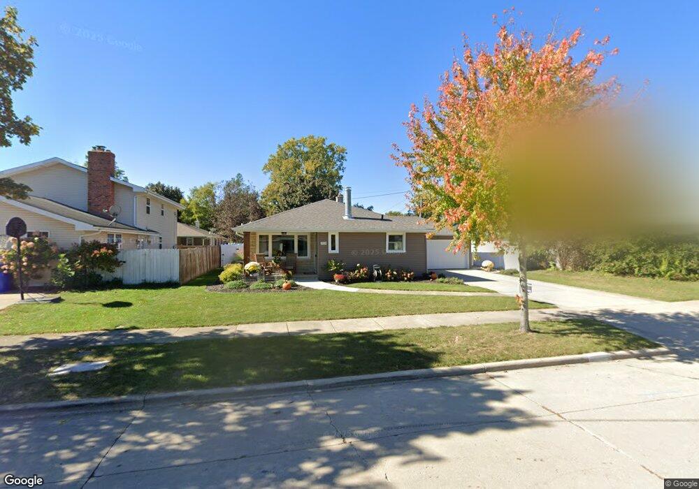
2509 Kirkland Ct Appleton, WI 54911
Huntley Houses NeighborhoodEstimated Value: $275,000 - $290,000
3
Beds
2
Baths
2,134
Sq Ft
$132/Sq Ft
Est. Value
About This Home
This home is located at 2509 Kirkland Ct, Appleton, WI 54911 and is currently estimated at $281,916, approximately $132 per square foot. 2509 Kirkland Ct is a home located in Outagamie County with nearby schools including Huntley Elementary School, Appleton North High School, and Classical School.
Ownership History
Date
Name
Owned For
Owner Type
Purchase Details
Closed on
Jan 6, 2014
Sold by
Zimbler Robert D and Zimbler Laura A
Bought by
Nevins David and Nevins Brenda
Current Estimated Value
Purchase Details
Closed on
Feb 19, 2010
Sold by
Wells Fargo Bank N A
Bought by
Zimbler Robert D and Zimbler Laura A
Purchase Details
Closed on
Sep 3, 2009
Sold by
Kleinschmidt Rebecca
Bought by
Wells Fargo Bank N A Suc By Merger To We
Create a Home Valuation Report for This Property
The Home Valuation Report is an in-depth analysis detailing your home's value as well as a comparison with similar homes in the area
Home Values in the Area
Average Home Value in this Area
Purchase History
| Date | Buyer | Sale Price | Title Company |
|---|---|---|---|
| Nevins David | $123,500 | -- | |
| Zimbler Robert D | $111,000 | -- | |
| Wells Fargo Bank N A Suc By Merger To We | $112,200 | -- |
Source: Public Records
Tax History
| Year | Tax Paid | Tax Assessment Tax Assessment Total Assessment is a certain percentage of the fair market value that is determined by local assessors to be the total taxable value of land and additions on the property. | Land | Improvement |
|---|---|---|---|---|
| 2023 | $2,976 | $200,200 | $33,600 | $166,600 |
| 2022 | $2,944 | $146,400 | $27,900 | $118,500 |
| 2021 | $2,804 | $146,400 | $27,900 | $118,500 |
| 2020 | $2,809 | $146,400 | $27,900 | $118,500 |
| 2019 | $2,718 | $146,400 | $27,900 | $118,500 |
| 2018 | $2,595 | $122,500 | $25,200 | $97,300 |
| 2017 | $2,588 | $122,500 | $25,200 | $97,300 |
| 2016 | $2,540 | $122,500 | $25,200 | $97,300 |
| 2015 | $2,584 | $122,500 | $25,200 | $97,300 |
| 2014 | $2,560 | $122,500 | $25,200 | $97,300 |
| 2013 | $2,568 | $122,500 | $25,200 | $97,300 |
Source: Public Records
Map
Nearby Homes
- 1011 E Lindbergh St
- 1437 E Glendale Ave
- 1009 E Northwood Dr
- 920 E Marquette St
- 921 E Windfield Place Unit A
- 841 E Windfield Place
- 1815 N Ullman St
- 1833 N Charlotte St
- 1809 N Charlotte St
- 2105 N Ballard Rd
- 701 E Longview Dr
- 1813 E Pauline St
- 2916 N Rankin St
- 1801 N Racine St
- 433 E Parkway Blvd
- 1430 N Graceland Ave
- 3401 N Fiesta Dr
- 8 Fiesta Ct Unit E
- 1426 N Meade St
- 507 E Roosevelt St
- 2509 N Kirkland Ct
- 2517 Kirkland Ct
- 1236 E Pershing St
- 2510 Hillwood Ct
- 2516 Hillwood Ct
- 1230 E Pershing St
- 2521 Kirkland Ct
- 2510 Kirkland Ct
- 2518 Kirkland Ct
- 2524 Hillwood Ct
- 1310 E Pershing St
- 2527 Kirkland Ct
- 2524 Kirkland Ct
- 1237 E Pershing St
- 2600 Hillwood Ct
- 1301 E Pershing St
- 1311 E Pershing St
- 2600 N Hillwood Ct
- 1229 E Pershing St
- 1307 E Pershing St
Your Personal Tour Guide
Ask me questions while you tour the home.