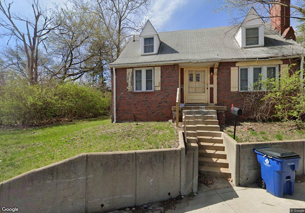
2509 N Hanley Rd Saint Louis, MO 63114
Estimated Value: $83,000 - $125,415
3
Beds
2
Baths
1,490
Sq Ft
$67/Sq Ft
Est. Value
About This Home
This home is located at 2509 N Hanley Rd, Saint Louis, MO 63114 and is currently estimated at $99,604, approximately $66 per square foot. 2509 N Hanley Rd is a home located in St. Louis County with nearby schools including Normandy High School, The Leadership School, and Incarnate Word Academy.
Ownership History
Date
Name
Owned For
Owner Type
Purchase Details
Closed on
Jan 28, 2004
Sold by
Langston Carl and Langston Mary Ellen Weatherford
Bought by
Langston Carl and Langston Mary
Current Estimated Value
Home Financials for this Owner
Home Financials are based on the most recent Mortgage that was taken out on this home.
Original Mortgage
$68,850
Interest Rate
5.78%
Mortgage Type
New Conventional
Purchase Details
Closed on
Sep 25, 1998
Sold by
Jessie Weatherford
Bought by
Langston Mary Ellen Weatherford
Create a Home Valuation Report for This Property
The Home Valuation Report is an in-depth analysis detailing your home's value as well as a comparison with similar homes in the area
Home Values in the Area
Average Home Value in this Area
Purchase History
| Date | Buyer | Sale Price | Title Company |
|---|---|---|---|
| Langston Carl | -- | -- | |
| Langston Mary Ellen Weatherford | -- | -- |
Source: Public Records
Mortgage History
| Date | Status | Borrower | Loan Amount |
|---|---|---|---|
| Closed | Langston Carl | $68,850 |
Source: Public Records
Tax History Compared to Growth
Tax History
| Year | Tax Paid | Tax Assessment Tax Assessment Total Assessment is a certain percentage of the fair market value that is determined by local assessors to be the total taxable value of land and additions on the property. | Land | Improvement |
|---|---|---|---|---|
| 2025 | $1,553 | $20,670 | $1,820 | $18,850 |
| 2024 | $1,553 | $17,520 | $2,550 | $14,970 |
| 2023 | $1,553 | $17,520 | $2,550 | $14,970 |
| 2022 | $1,311 | $12,350 | $1,820 | $10,530 |
| 2021 | $1,272 | $12,350 | $1,820 | $10,530 |
| 2020 | $1,287 | $11,700 | $1,480 | $10,220 |
| 2019 | $1,269 | $11,700 | $1,480 | $10,220 |
| 2018 | $1,010 | $8,650 | $1,200 | $7,450 |
| 2017 | $1,010 | $8,650 | $1,200 | $7,450 |
| 2016 | $1,018 | $8,820 | $1,200 | $7,620 |
| 2015 | $1,014 | $8,820 | $1,200 | $7,620 |
| 2014 | $1,012 | $8,670 | $970 | $7,700 |
Source: Public Records
Map
Nearby Homes
- 8133 Toddy Ave
- 8209 Saint Charles Ln
- 8122 Shellbark Ave
- 8233 Albin Ave
- 2820 Old Hanley Rd
- 2816 Lyndhurst Ave
- 7707 Horatio Dr
- 8109 Cler Ave
- 2823 Darwin Ct
- 1988 Driftway Dr
- 8425 Ann Ave
- 8315 Jefferson Ave
- 7619 Chorman Ave
- 2937 N Hanley Rd
- 8431 Midland Blvd
- 2435 Ackerman Ave
- 8341 Jefferson Ave
- 8705 Kendale Dr
- 8338 Jefferson Ave
- 2414 Gilrose Ave
- 8009 Nola Ave
- 8011 Nola Ave
- 8007 Nola Ave
- 8015 Nola Ave
- 8005 Nola Ave
- 8025 Nola Ave
- 8003 Nola Ave
- 2512 Wheaton Ave
- 2506 Wheaton Ave
- 8031 Nola Ave
- 2514 Wheaton Ave
- 8012 Nola Ave
- 8018 Nola Ave
- 8016 Nola Ave
- 8020 Nola Ave
- 8006 Nola Ave
- 8020 Saint Charles Rock Rd
- 8024 Nola Ave
- 8026 Nola Ave
- 8007 Allen Ave