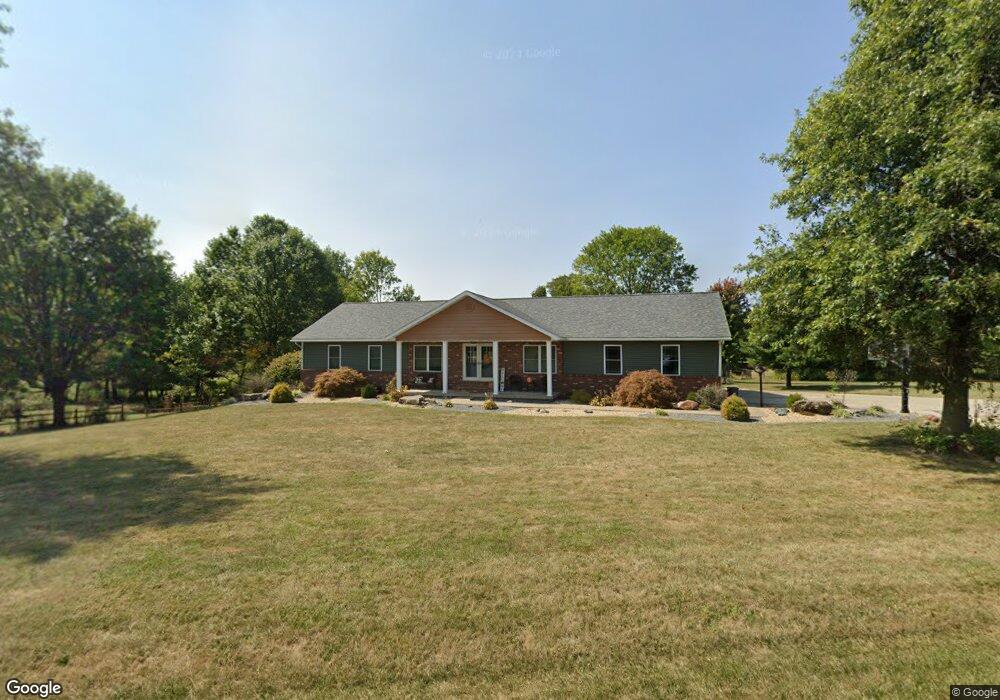
25099 Natalie Ln Jerseyville, IL 62052
Estimated Value: $277,671 - $335,000
--
Bed
--
Bath
1,728
Sq Ft
$179/Sq Ft
Est. Value
About This Home
This home is located at 25099 Natalie Ln, Jerseyville, IL 62052 and is currently estimated at $308,668, approximately $178 per square foot. 25099 Natalie Ln is a home with nearby schools including Jersey Community High School, St Francis/Holy Ghost Catholic School, and Victory Baptist School.
Ownership History
Date
Name
Owned For
Owner Type
Purchase Details
Closed on
May 23, 2016
Sold by
Snyder Allen B
Bought by
Challans Dennis Albert and Challans Heather L
Current Estimated Value
Home Financials for this Owner
Home Financials are based on the most recent Mortgage that was taken out on this home.
Original Mortgage
$245,000
Outstanding Balance
$194,591
Interest Rate
3.59%
Mortgage Type
Commercial
Estimated Equity
$114,077
Create a Home Valuation Report for This Property
The Home Valuation Report is an in-depth analysis detailing your home's value as well as a comparison with similar homes in the area
Home Values in the Area
Average Home Value in this Area
Purchase History
| Date | Buyer | Sale Price | Title Company |
|---|---|---|---|
| Challans Dennis Albert | $185,000 | Jersey County Title |
Source: Public Records
Mortgage History
| Date | Status | Borrower | Loan Amount |
|---|---|---|---|
| Open | Challans Dennis Albert | $245,000 |
Source: Public Records
Tax History Compared to Growth
Tax History
| Year | Tax Paid | Tax Assessment Tax Assessment Total Assessment is a certain percentage of the fair market value that is determined by local assessors to be the total taxable value of land and additions on the property. | Land | Improvement |
|---|---|---|---|---|
| 2024 | $4,370 | $83,020 | $14,415 | $68,605 |
| 2023 | $4,186 | $77,585 | $13,470 | $64,115 |
| 2022 | $4,052 | $72,510 | $12,590 | $59,920 |
| 2021 | $3,909 | $68,730 | $11,935 | $56,795 |
| 2020 | $3,345 | $59,860 | $7,850 | $52,010 |
| 2019 | $3,345 | $58,400 | $7,660 | $50,740 |
| 2018 | $3,259 | $57,965 | $7,605 | $50,360 |
| 2017 | $3,366 | $57,535 | $7,550 | $49,985 |
| 2016 | $3,428 | $57,930 | $7,600 | $50,330 |
| 2015 | -- | $58,810 | $7,715 | $51,095 |
| 2014 | -- | $58,895 | $7,725 | $51,170 |
Source: Public Records
Map
Nearby Homes
- 36 Witt Mill Rd
- 40 Witt Mill Rd
- 46 Witt Mill Rd
- 34 Witt Mill Rd
- 38 Witt Mill Rd
- 42 Witt Mill Rd
- 33 Witt Mill Rd
- 48 Witt Mill Rd
- 44 Witt Mill Rd
- 50 Witt Mill Rd
- 1141 Warren St
- 402 Minard St
- 1137 Warren St
- 119 Dressel Dr
- 809 N Giddings Ave
- 820 N Liberty St
- 713 N State St
- 502 Snedeker St
- 404 Lott St
- 105 Hollow Ave
- 25081 Natalie Ln
- 25125 Natalie Ln
- 25050 White Rose Ln
- 25049 Natalie Ln
- 25220 Witt Mill Rd
- 25029 Natalie Ln
- 25106 White Rose Ln
- 25046 Natalie Ln
- 25019 Natalie Ln
- 25318 Witt Mill Rd
- 25304 Erin Ct
- 25175 Natalie Ln
- 25014 Natalie Ln
- 25291 Erin Dr
- 25336 Erin Dr
- XXX Erin Dr
- 25319 Erin Dr
- 25306 White Rose Ln
- 25332 White Rose Ln
- 25369 Erin Dr