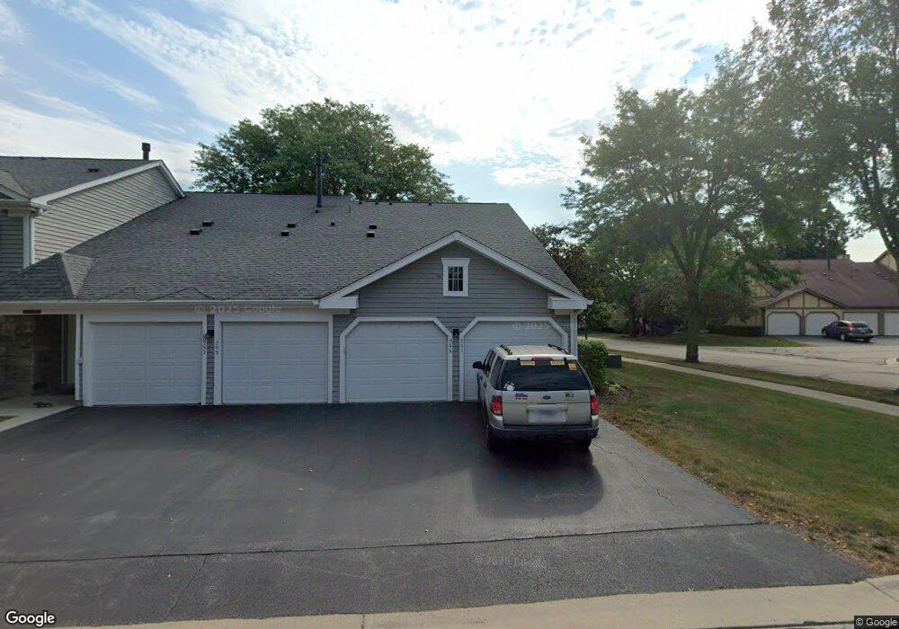
251 Appletree Ct Unit 251 Buffalo Grove, IL 60089
Estimated Value: $275,000 - $290,051
2
Beds
2
Baths
1,200
Sq Ft
$235/Sq Ft
Est. Value
About This Home
This home is located at 251 Appletree Ct Unit 251, Buffalo Grove, IL 60089 and is currently estimated at $281,763, approximately $234 per square foot. 251 Appletree Ct Unit 251 is a home located in Lake County with nearby schools including Ivy Hall Elementary School, Twin Groves Middle School, and Adlai E Stevenson High School.
Ownership History
Date
Name
Owned For
Owner Type
Purchase Details
Closed on
Jan 10, 2025
Sold by
Roth Family Trust and Roth Eileen J
Bought by
Urbanek Elzbieta and Urbanek Grzegorz
Current Estimated Value
Home Financials for this Owner
Home Financials are based on the most recent Mortgage that was taken out on this home.
Original Mortgage
$200,000
Interest Rate
7.75%
Mortgage Type
New Conventional
Purchase Details
Closed on
Sep 20, 2024
Sold by
Roth Eileen J and Roth Arthur F
Bought by
Roth Family Trust and Roth
Purchase Details
Closed on
Sep 13, 2017
Sold by
Roth Arthur F and Roth Eileen J
Bought by
Roth Raymond W and Roth Arthur F
Purchase Details
Closed on
Jan 16, 1998
Sold by
Roth Arthur F
Bought by
Roth Arthur F and Roth Eileen J
Create a Home Valuation Report for This Property
The Home Valuation Report is an in-depth analysis detailing your home's value as well as a comparison with similar homes in the area
Home Values in the Area
Average Home Value in this Area
Purchase History
| Date | Buyer | Sale Price | Title Company |
|---|---|---|---|
| Urbanek Elzbieta | $270,000 | Proper Title | |
| Roth Family Trust | -- | None Listed On Document | |
| Roth Raymond W | -- | None Available | |
| Roth Arthur F | -- | -- |
Source: Public Records
Mortgage History
| Date | Status | Borrower | Loan Amount |
|---|---|---|---|
| Previous Owner | Urbanek Elzbieta | $200,000 |
Source: Public Records
Tax History Compared to Growth
Tax History
| Year | Tax Paid | Tax Assessment Tax Assessment Total Assessment is a certain percentage of the fair market value that is determined by local assessors to be the total taxable value of land and additions on the property. | Land | Improvement |
|---|---|---|---|---|
| 2024 | $6,004 | $71,918 | $23,270 | $48,648 |
| 2023 | $6,004 | $66,529 | $21,526 | $45,003 |
| 2022 | $6,083 | $64,339 | $20,817 | $43,522 |
| 2021 | $5,849 | $63,646 | $20,593 | $43,053 |
| 2020 | $5,712 | $63,863 | $20,663 | $43,200 |
| 2019 | $5,637 | $63,628 | $20,587 | $43,041 |
| 2018 | $5,039 | $53,164 | $22,376 | $30,788 |
| 2017 | $4,946 | $51,923 | $21,854 | $30,069 |
| 2016 | $4,828 | $49,720 | $20,927 | $28,793 |
| 2015 | $4,717 | $46,498 | $19,571 | $26,927 |
| 2014 | $5,757 | $55,940 | $21,021 | $34,919 |
| 2012 | $5,673 | $56,052 | $21,063 | $34,989 |
Source: Public Records
Map
Nearby Homes
- 1112 Auburn Ln
- 872 Old Checker Rd Unit E3
- 746 Old Checker Rd Unit E5
- 98 Stonegate Rd
- 390 Springside Ln
- 329 Timber Hill Rd
- 800 Clohesey Dr
- 610 Checker Dr
- 921 Bernard Dr
- 4116 N Terramere Ave
- 412 Chateau Dr
- 408 Indian Hill Dr
- 1130 Bernard Dr
- 410 Chatham Cir
- 1545 Chickamauga Ln
- 887 Saybrook Ln Unit 2
- 711 Woodhollow Ln
- 1514 Sumter Dr
- 310 Rosewood Ave
- 715 W Whiting Ln
- 251 Appletree Ct
- 253 Appletree Ct
- 253 Appletree Ct Unit 253
- 255 Appletree Ct
- 257 Appletree Ct
- 261 Appletree Ct
- 252 Appletree Ct
- 252 Appletree Ct Unit 252
- 277 Ashland Ct
- 254 Appletree Ct
- 263 Appletree Ct
- 265 Appletree Ct
- 265 Appletree Ct Unit 1
- 246 Thornapple Ct
- 234 Thornapple Ct
- 208 Thornapple Ct
- 228 Thornapple Ct
- 226 Thornapple Ct
- 224 Thornapple Ct
- 222 Thornapple Ct Unit 2