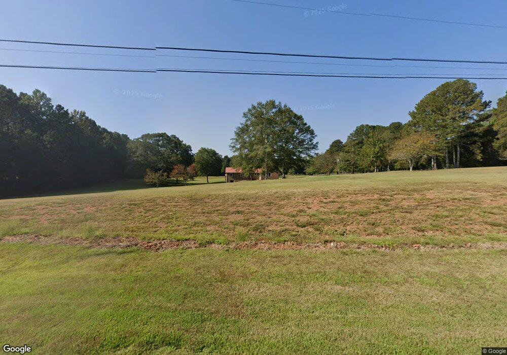
251 Baxter Rd Carrollton, GA 30117
Estimated Value: $286,000 - $350,000
3
Beds
2
Baths
1,238
Sq Ft
$265/Sq Ft
Est. Value
About This Home
This home is located at 251 Baxter Rd, Carrollton, GA 30117 and is currently estimated at $327,950, approximately $264 per square foot. 251 Baxter Rd is a home located in Carroll County with nearby schools including Roopville Elementary School, Central Middle School, and Central High School.
Ownership History
Date
Name
Owned For
Owner Type
Purchase Details
Closed on
Jan 2, 2015
Sold by
Whitaker Marie E
Bought by
Craig Patrick Dale
Current Estimated Value
Purchase Details
Closed on
Jul 8, 2011
Sold by
Whitaker H E Estate
Bought by
Whitaker Marie E
Purchase Details
Closed on
Dec 18, 2000
Sold by
Whitaker H E
Bought by
Whitaker Whitaker H and Whitaker Marie
Purchase Details
Closed on
Jul 13, 1995
Sold by
Crook
Bought by
Hogan Beth Ann
Purchase Details
Closed on
Dec 31, 1993
Bought by
Crook
Create a Home Valuation Report for This Property
The Home Valuation Report is an in-depth analysis detailing your home's value as well as a comparison with similar homes in the area
Home Values in the Area
Average Home Value in this Area
Purchase History
| Date | Buyer | Sale Price | Title Company |
|---|---|---|---|
| Craig Patrick Dale | $145,080 | -- | |
| Whitaker Marie E | -- | -- | |
| Whitaker Whitaker H | -- | -- | |
| Whitaker H E | $153,000 | -- | |
| Hogan Beth Ann | -- | -- | |
| Hogan Beth Ann | -- | -- | |
| Crook | $12,000 | -- |
Source: Public Records
Tax History Compared to Growth
Tax History
| Year | Tax Paid | Tax Assessment Tax Assessment Total Assessment is a certain percentage of the fair market value that is determined by local assessors to be the total taxable value of land and additions on the property. | Land | Improvement |
|---|---|---|---|---|
| 2024 | $301 | $120,463 | $38,036 | $82,427 |
| 2023 | $301 | $106,210 | $30,429 | $75,781 |
| 2022 | $358 | $81,199 | $20,286 | $60,913 |
| 2021 | $361 | $68,834 | $16,229 | $52,605 |
| 2020 | $362 | $62,381 | $14,753 | $47,628 |
| 2019 | $372 | $59,687 | $14,753 | $44,934 |
| 2018 | $390 | $55,252 | $13,788 | $41,464 |
| 2017 | $394 | $55,252 | $13,788 | $41,464 |
| 2016 | $395 | $55,252 | $13,788 | $41,464 |
| 2015 | $1,349 | $48,236 | $13,282 | $34,954 |
| 2014 | $341 | $48,236 | $13,282 | $34,954 |
Source: Public Records
Map
Nearby Homes
- 450 Baxter Rd
- 1575 Bethesda Church Rd
- 1593 Bethesda Church Rd
- 1611 Bethesda Church Rd
- 1629 Bethesda Church Rd
- 0 Needmore Rd Unit (345 37 Acres)
- 195 Gold Dust Trail
- 1531 Tyus Carrollton Rd
- 4144 Tyus Carrollton Rd
- 4228 Tyus Carrollton Rd
- 1358 W 5 Hwy
- 1698 Georgia 5
- 191 Tumlin Creek Rd
- 305 West Dr
- 1810 Victory Church Rd
- 0 Needmore Road- (345 37 Acres)
- 0 W Highway 5 Unit 10519663
- 0 Needmore Rd Unit (345.37 ACRES)
- 534 Craven Rd
- 534 Craven Rd Unit 137
- 220 Baxter Rd
- 340 Baxter Rd
- 292 Baxter Rd
- 0 Baxter Rd Unit 8163723
- 0 Baxter Rd Unit 7341907
- 350 Baxter Rd
- 416 Baxter Rd
- 416 Baxter Rd
- 472 Baxter Rd
- 472 Baxter Rd
- 403 Baxter Rd
- 403 Baxter Rd
- 484 Baxter Rd
- 102 Baxter Rd
- 105 Baxter Rd
- 487 Baxter Rd
- 1507 Bethesda Church Rd
- 1539 Bethesda Church Rd
- 1387 Bethesda Church Rd
- 1440 Bethesda Church Rd