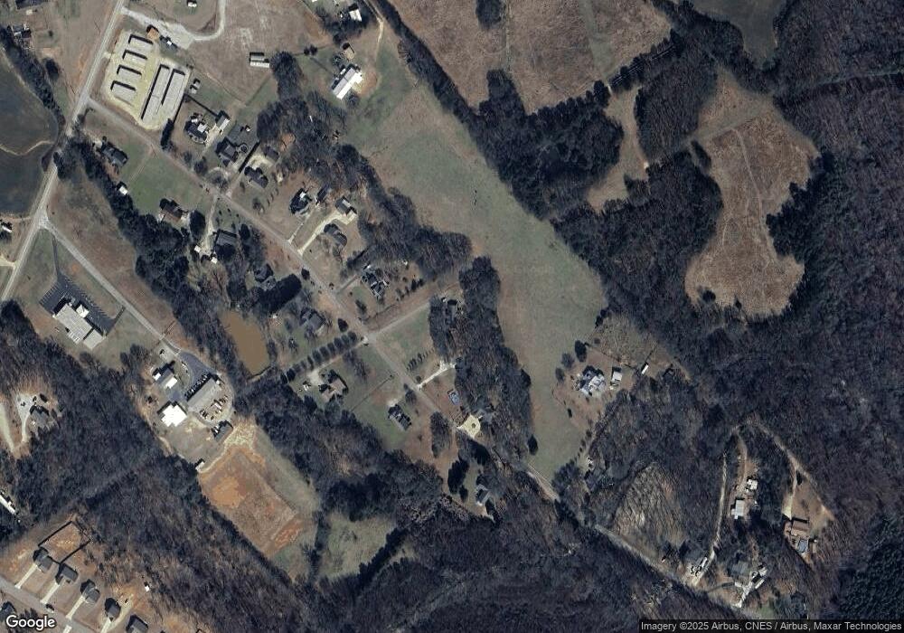
251 Cedar Pond Rd Hartwell, GA 30643
Estimated Value: $295,516 - $354,000
4
Beds
4
Baths
1,776
Sq Ft
$184/Sq Ft
Est. Value
About This Home
This home is located at 251 Cedar Pond Rd, Hartwell, GA 30643 and is currently estimated at $326,629, approximately $183 per square foot. 251 Cedar Pond Rd is a home located in Hart County with nearby schools including Hart County High School and Barnes Academy.
Ownership History
Date
Name
Owned For
Owner Type
Purchase Details
Closed on
Sep 21, 2021
Sold by
Hudlow Elizabeth W
Bought by
Hudlow Howard G
Current Estimated Value
Purchase Details
Closed on
Aug 8, 2017
Sold by
Milford Dorothy Ann
Bought by
Hudlow Howard G and Hudlow Elizabeth W
Purchase Details
Closed on
May 5, 2015
Sold by
Ashworth Misty Dawn
Bought by
Milford Dorothy Ann
Purchase Details
Closed on
Jun 16, 2010
Sold by
Milford Dorothy Ann
Bought by
Ashworth Misty Dawn
Home Financials for this Owner
Home Financials are based on the most recent Mortgage that was taken out on this home.
Original Mortgage
$140,000
Interest Rate
4.83%
Mortgage Type
New Conventional
Purchase Details
Closed on
Sep 1, 1995
Create a Home Valuation Report for This Property
The Home Valuation Report is an in-depth analysis detailing your home's value as well as a comparison with similar homes in the area
Home Values in the Area
Average Home Value in this Area
Purchase History
| Date | Buyer | Sale Price | Title Company |
|---|---|---|---|
| Hudlow Howard G | -- | -- | |
| Hudlow Howard G | $154,000 | -- | |
| Milford Dorothy Ann | $130,580 | -- | |
| Ashworth Misty Dawn | $150,000 | -- | |
| -- | -- | -- |
Source: Public Records
Mortgage History
| Date | Status | Borrower | Loan Amount |
|---|---|---|---|
| Previous Owner | Ashworth Misty Dawn | $140,000 |
Source: Public Records
Tax History Compared to Growth
Tax History
| Year | Tax Paid | Tax Assessment Tax Assessment Total Assessment is a certain percentage of the fair market value that is determined by local assessors to be the total taxable value of land and additions on the property. | Land | Improvement |
|---|---|---|---|---|
| 2024 | $1,311 | $101,375 | $10,000 | $91,375 |
| 2023 | $1,244 | $89,678 | $10,000 | $79,678 |
| 2022 | $1,062 | $75,179 | $4,000 | $71,179 |
| 2021 | $1,069 | $69,114 | $4,000 | $65,114 |
| 2020 | $1,039 | $63,661 | $4,000 | $59,661 |
| 2019 | $1,178 | $60,288 | $3,200 | $57,088 |
| 2018 | $1,201 | $60,736 | $3,200 | $57,536 |
| 2017 | $1,107 | $55,683 | $3,200 | $52,483 |
| 2016 | $1,136 | $55,398 | $3,200 | $52,198 |
| 2015 | $1,047 | $53,792 | $2,600 | $51,192 |
| 2014 | $1,037 | $52,232 | $2,600 | $49,632 |
| 2013 | -- | $52,852 | $2,600 | $50,252 |
Source: Public Records
Map
Nearby Homes
- 277 Rachel Ln
- 11 Rachel Ln
- 166 Rachel Ln
- 184 Rachel Ln
- 116 Joseph Ln
- 2370 Anderson Hwy
- 0 Anderson Hwy Unit 10544510
- 3078 Anderson Hwy
- 28 Lake Pointe Rd
- 0 LOT 20 Lake Pointe Rd
- 155 Berryman Rd
- 35 Villa Ct
- 3689 Anderson Hwy
- 60 Villa Courts
- 94 S Pointe Dr
- 78 S Pointe Dr
- 19 S Pointe Dr
- 122 S Pointe Dr
- 30 Melody Farms Dr
- 537 Liberty Hill Rd Unit 27
- 299 Cedar Pond Rd Unit 8
- 299 Cedar Pond Rd
- lot 21&2 Cedar Pond Rd
- 0 Cedar Pond Rd Unit 8588963
- 0 Cedar Pond Rd Unit 8233847
- 0 Cedar Pond Rd Unit 8150199
- 0 Cedar Pond Rd Unit 8098465
- 0 Cedar Pond Rd Unit 3189034
- 0 Cedar Pond Rd Unit 7053520
- 0 Cedar Pond Rd Unit 7184103
- 0 Cedar Pond Rd Unit 7388989
- 0 Cedar Pond Rd Unit 7635189
- 0 Cedar Pond Rd
- 215 Cedar Pond Rd
- 345 Cedar Pond Rd
- 298 Cedar Pond Rd
- 252 Cedar Pond Rd
- 208 Cedar Pond Rd
- 177 Cedar Pond Rd
- 421 Cedar Pond Rd
