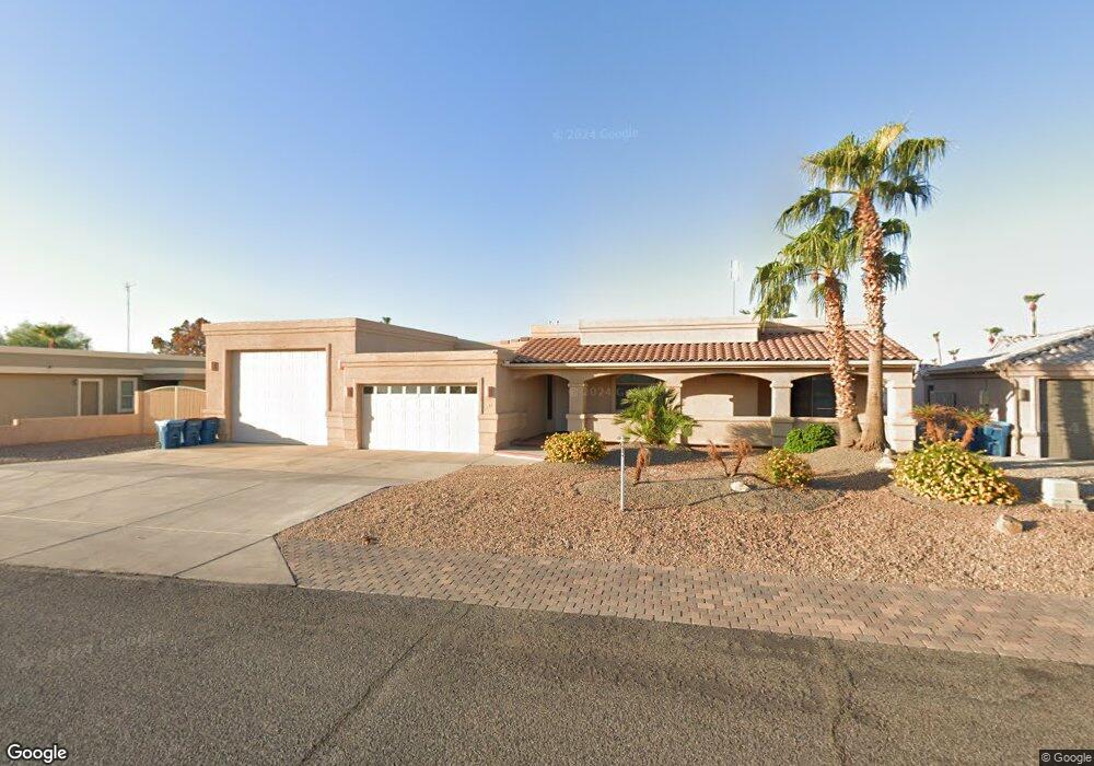
251 Cottonwood Dr Lake Havasu City, AZ 86403
Estimated Value: $756,000 - $884,000
3
Beds
3
Baths
2,618
Sq Ft
$318/Sq Ft
Est. Value
About This Home
This home is located at 251 Cottonwood Dr, Lake Havasu City, AZ 86403 and is currently estimated at $831,587, approximately $317 per square foot. 251 Cottonwood Dr is a home located in Mohave County with nearby schools including Starline Elementary School, Thunderbolt Middle School, and Lake Havasu High School.
Ownership History
Date
Name
Owned For
Owner Type
Purchase Details
Closed on
Jul 9, 2024
Sold by
Galli Living Trust and Galli Gregory Alan
Bought by
Maclean Richard and Dunbar Lori A
Current Estimated Value
Home Financials for this Owner
Home Financials are based on the most recent Mortgage that was taken out on this home.
Original Mortgage
$165,000
Interest Rate
6.77%
Mortgage Type
New Conventional
Purchase Details
Closed on
Jul 11, 2023
Sold by
Galli Greg
Bought by
Galli Living Trust and Galli
Purchase Details
Closed on
Nov 13, 2020
Sold by
Galli Greg and Galli Vicki S
Bought by
Galli Greg and Galli Vicki S
Purchase Details
Closed on
Nov 3, 2020
Sold by
Galli Greg and Galli Vicki S
Bought by
Galli Trust and Galli
Purchase Details
Closed on
Aug 1, 2019
Sold by
Southside Holdings Inc
Bought by
Galli Greg and Galli Vicki S
Home Financials for this Owner
Home Financials are based on the most recent Mortgage that was taken out on this home.
Original Mortgage
$170,000
Interest Rate
3.7%
Mortgage Type
New Conventional
Purchase Details
Closed on
Feb 22, 2018
Sold by
Blake Janice and Blake Richard A
Bought by
Southside Holdings Inc
Purchase Details
Closed on
Apr 4, 2012
Sold by
Blake Richard A and Blake Janice
Bought by
Blake Janice and Blake Richard A
Home Financials for this Owner
Home Financials are based on the most recent Mortgage that was taken out on this home.
Original Mortgage
$202,000
Interest Rate
3.9%
Mortgage Type
New Conventional
Purchase Details
Closed on
Jul 5, 2005
Sold by
Bishop William R and Bishop Diane M
Bought by
Blake Richard A and Blake Janice
Purchase Details
Closed on
Mar 11, 2002
Sold by
Troutman David D
Bought by
Bishop William R and Bishop Diane M
Home Financials for this Owner
Home Financials are based on the most recent Mortgage that was taken out on this home.
Original Mortgage
$24,900
Interest Rate
6.94%
Mortgage Type
Seller Take Back
Purchase Details
Closed on
Jul 10, 2001
Sold by
Mcnabb Eleonore
Bought by
Troutman David D
Purchase Details
Closed on
Mar 4, 1999
Sold by
Blevens Sharon L
Bought by
Blevens Lawrence D
Create a Home Valuation Report for This Property
The Home Valuation Report is an in-depth analysis detailing your home's value as well as a comparison with similar homes in the area
Home Values in the Area
Average Home Value in this Area
Purchase History
| Date | Buyer | Sale Price | Title Company |
|---|---|---|---|
| Maclean Richard | $830,000 | Summerlin Title Agency | |
| Galli Living Trust | -- | None Listed On Document | |
| Galli Greg | -- | None Available | |
| Galli Trust | -- | Galli Greg | |
| Galli Greg | $550,000 | Premier Title Agency | |
| Southside Holdings Inc | $505,000 | Premier Title Agency | |
| Blake Janice | -- | Pioneer Title Agency | |
| Blake Richard A | $140,000 | First American Title Ins Co | |
| Bishop William R | $29,900 | State Title Agency Inc | |
| Troutman David D | $15,000 | First American Title | |
| Blevens Lawrence D | -- | Fidelity National Title |
Source: Public Records
Mortgage History
| Date | Status | Borrower | Loan Amount |
|---|---|---|---|
| Previous Owner | Maclean Richard | $165,000 | |
| Previous Owner | Galli Greg | $170,000 | |
| Previous Owner | Blake Janice | $202,000 | |
| Previous Owner | Bishop William R | $24,900 |
Source: Public Records
Tax History Compared to Growth
Tax History
| Year | Tax Paid | Tax Assessment Tax Assessment Total Assessment is a certain percentage of the fair market value that is determined by local assessors to be the total taxable value of land and additions on the property. | Land | Improvement |
|---|---|---|---|---|
| 2026 | $1,794 | -- | -- | -- |
| 2025 | $3,636 | $71,087 | $0 | $0 |
| 2024 | $3,636 | $86,482 | $0 | $0 |
| 2023 | $3,636 | $70,498 | $0 | $0 |
| 2022 | $3,480 | $55,952 | $0 | $0 |
| 2021 | $3,693 | $50,091 | $0 | $0 |
| 2019 | $3,501 | $45,873 | $0 | $0 |
| 2018 | $3,377 | $43,542 | $0 | $0 |
| 2017 | $2,784 | $39,439 | $0 | $0 |
| 2016 | $2,454 | $37,242 | $0 | $0 |
| 2015 | $2,386 | $34,069 | $0 | $0 |
Source: Public Records
Map
Nearby Homes
- 1958 Montana Vista Unit D
- 1852 Montana Vista Unit B
- 1884 Montana Vista Unit 63B
- 1840 Montana Vista Unit D
- 1838 Montana Vista Unit C
- 190 Aspen Dr
- 1824 Montana Vista Unit D
- 1793 Montana Vista Unit C
- 371 Cottonwood Dr
- 1827 Combat Dr
- 1786 Los Lagos Dr Unit A
- 160 Aspen Dr
- 1723 Montana Vista Unit D
- 220 White Oak Dr
- 1771 Los Lagos Dr Unit D
- 1775 Los Lagos Dr Unit B
- 1962 Cliffrose Dr
- 1711 Combat Dr Unit 12
- 1939 Pine Ln
- 211 Columbine Dr
- 251 Cottonwood Dr
- 261 Cottonwood Dr
- 241 Cottonwood Dr
- 1943 Montana Vista Unit B52
- 1945 Montana Vista
- 1935 Montana Vista Unit B51
- 1933 Montana Vista Unit 51A
- 1941 Montana Vista Unit 52A
- 1947 Montana Vista Unit 52D
- 1947 Montana Vista Unit D
- 1939 Montana Vista
- 1937 Montana Vista
- 1949 Montana Vista Unit A
- 240 Cottonwood Dr
- 271 Cottonwood Dr
- 1951 Montana Vista Unit B53
- 1953 Montana Vista Unit 53C
- 1953 Montana Vista Unit 43C
- 1955 Montana Vista Unit 53D
- 1955 Montana Vista Unit 1955 D