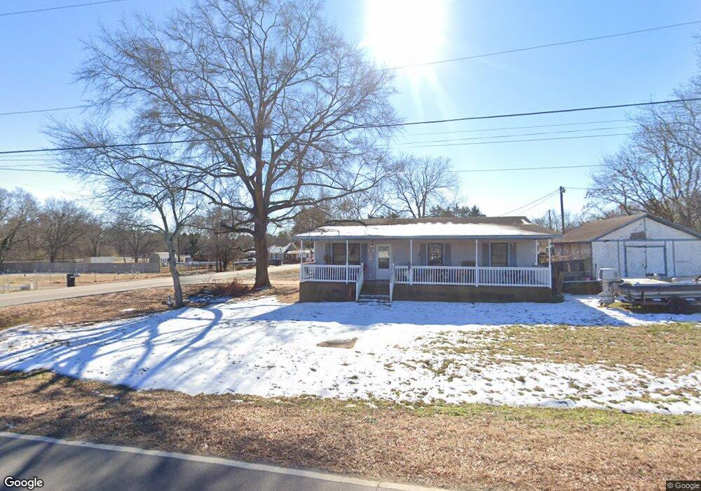
251 Craig St Roanoke Rapids, NC 27870
Estimated Value: $91,000 - $107,648
3
Beds
1
Bath
960
Sq Ft
$105/Sq Ft
Est. Value
About This Home
This home is located at 251 Craig St, Roanoke Rapids, NC 27870 and is currently estimated at $100,912, approximately $105 per square foot. 251 Craig St is a home located in Halifax County with nearby schools including Roanoke Rapids High School and Victory Christian Academy.
Ownership History
Date
Name
Owned For
Owner Type
Purchase Details
Closed on
Jun 14, 2021
Sold by
Wilson Timothy Lane and Wilson Jennifer Michele
Bought by
Collier Julie Taylor and Collier Michael
Current Estimated Value
Home Financials for this Owner
Home Financials are based on the most recent Mortgage that was taken out on this home.
Original Mortgage
$48,800
Outstanding Balance
$37,052
Interest Rate
2.9%
Mortgage Type
New Conventional
Estimated Equity
$63,860
Purchase Details
Closed on
Apr 30, 2001
Bought by
Wilson Timothy Lane and Wilson,Julie Taylor
Create a Home Valuation Report for This Property
The Home Valuation Report is an in-depth analysis detailing your home's value as well as a comparison with similar homes in the area
Home Values in the Area
Average Home Value in this Area
Purchase History
| Date | Buyer | Sale Price | Title Company |
|---|---|---|---|
| Collier Julie Taylor | -- | None Available | |
| Wilson Timothy Lane | $57,000 | -- |
Source: Public Records
Mortgage History
| Date | Status | Borrower | Loan Amount |
|---|---|---|---|
| Open | Collier Julie Taylor | $48,800 |
Source: Public Records
Tax History Compared to Growth
Tax History
| Year | Tax Paid | Tax Assessment Tax Assessment Total Assessment is a certain percentage of the fair market value that is determined by local assessors to be the total taxable value of land and additions on the property. | Land | Improvement |
|---|---|---|---|---|
| 2025 | $9 | $59,600 | $9,500 | $50,100 |
| 2024 | $9 | $59,600 | $9,500 | $50,100 |
| 2023 | $711 | $45,100 | $9,500 | $35,600 |
| 2022 | $727 | $45,100 | $9,500 | $35,600 |
| 2021 | $702 | $45,100 | $9,500 | $35,600 |
| 2020 | $704 | $45,100 | $9,500 | $35,600 |
| 2019 | $727 | $46,300 | $9,500 | $36,800 |
| 2018 | $711 | $46,300 | $9,500 | $36,800 |
| 2017 | $714 | $46,300 | $9,500 | $36,800 |
| 2016 | $724 | $46,300 | $9,500 | $36,800 |
| 2015 | $686 | $46,300 | $9,500 | $36,800 |
| 2014 | $750 | $56,390 | $11,490 | $44,900 |
Source: Public Records
Map
Nearby Homes
- Lot 52A Timmy Ln
- 1511 Dogwood St
- 1118 Mapleton St
- 410 Elkins Dr
- 104 Mina Dr
- 234 Mobley St
- 203 Mobley St
- 112 Mina Dr
- 135 Mina St
- 201 Azalea Rd
- 1104 Bolling Rd
- 117 Blue Water Ct
- 0 Lake Pointe Dr
- 188 Colonial Dr
- LOT 72 Lake Pointe Dr
- LOT 61 Lake Pointe Dr
- LOT 59 Lake Pointe Dr
- 521 Rapids St
- 108 Pinewood Rd
- 817 Vance St