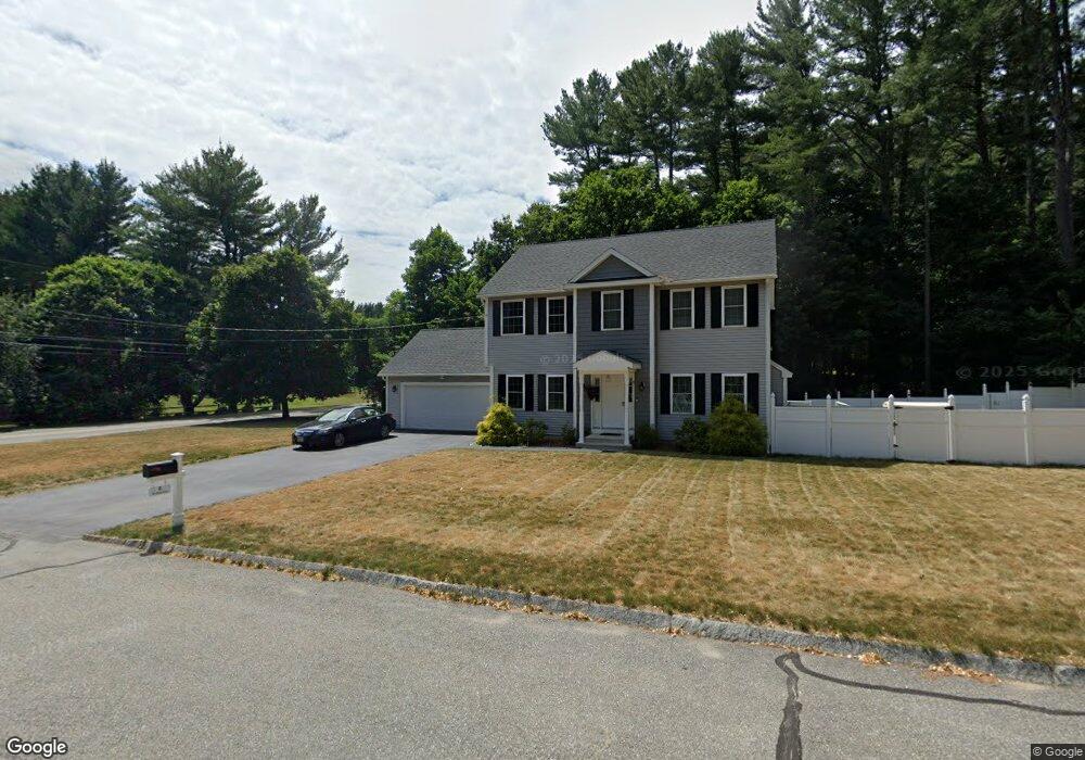
251 Dunstable Rd North Chelmsford, MA 01863
North Chelmsford NeighborhoodEstimated Value: $771,000 - $1,075,000
4
Beds
3
Baths
2,056
Sq Ft
$446/Sq Ft
Est. Value
About This Home
This home is located at 251 Dunstable Rd, North Chelmsford, MA 01863 and is currently estimated at $917,000, approximately $446 per square foot. 251 Dunstable Rd is a home located in Middlesex County with nearby schools including Charles D. Harrington Elementary School, Parker Middle School, and Chelmsford High School.
Ownership History
Date
Name
Owned For
Owner Type
Purchase Details
Closed on
Dec 19, 2018
Sold by
Caissie Matt M and Caissie Matthew M
Bought by
Turn Left Llc
Current Estimated Value
Purchase Details
Closed on
Oct 28, 2014
Sold by
Caissie Irt and Caissie
Bought by
Caissie Matt M
Purchase Details
Closed on
Dec 4, 2002
Sold by
Caissie Jeannette E
Bought by
Cassie Irt Rt and Caissie
Create a Home Valuation Report for This Property
The Home Valuation Report is an in-depth analysis detailing your home's value as well as a comparison with similar homes in the area
Home Values in the Area
Average Home Value in this Area
Purchase History
| Date | Buyer | Sale Price | Title Company |
|---|---|---|---|
| Turn Left Llc | $219,000 | -- | |
| Caissie Matt M | $165,000 | -- | |
| Caissie Matt M | $165,000 | -- | |
| Cassie Irt Rt | -- | -- | |
| Cassie Irt Rt | -- | -- |
Source: Public Records
Tax History Compared to Growth
Tax History
| Year | Tax Paid | Tax Assessment Tax Assessment Total Assessment is a certain percentage of the fair market value that is determined by local assessors to be the total taxable value of land and additions on the property. | Land | Improvement |
|---|---|---|---|---|
| 2025 | $10,218 | $735,100 | $260,700 | $474,400 |
| 2024 | $9,952 | $730,700 | $260,700 | $470,000 |
| 2023 | $9,318 | $648,400 | $280,300 | $368,100 |
| 2022 | $8,713 | $552,500 | $243,700 | $308,800 |
| 2021 | $8,666 | $550,600 | $225,700 | $324,900 |
| 2020 | $8,184 | $497,500 | $100,600 | $396,900 |
| 2019 | $3,301 | $201,900 | $99,700 | $102,200 |
| 2018 | $9,123 | $189,500 | $89,800 | $99,700 |
| 2017 | $3,172 | $177,000 | $84,100 | $92,900 |
| 2016 | $2,968 | $164,600 | $81,100 | $83,500 |
| 2015 | $2,902 | $155,200 | $71,900 | $83,300 |
| 2014 | $2,843 | $149,800 | $70,000 | $79,800 |
Source: Public Records
Map
Nearby Homes
- 10 Worden Rd
- 5 Mission Rd Unit 107
- 1 Hope St
- 863 Wellman Ave Unit 863
- 23 Morrison Ln
- 10 Dickens Ln
- 20 Merrimac Way Unit 20E
- 330 Wellman Ave
- 126 Groton Rd
- 436 Wellman Ave
- 10 Butterfield St
- 271 Wellman Ave
- 251 Wellman Ave Unit 251
- 739 Wellman Ave
- 0 Dunstable Rd
- 24 Old Tyng Rd
- 30 Russell Rd
- 76 Russells Way
- 730 Wellman Ave
- 123 Sherburne Ave
- 250 Dunstable Rd
- 270 Dunstable Rd
- 2 Stonehill Rd
- 248 Dunstable Rd
- C27 Scotty Hollow Dr Unit 27C
- A-11 Scotty Hollow Dr Unit A-11
- Unit 2 Robin Hill Meadows Unit 2
- D10 Scotty Hollow Dr Unit D10
- B10 Sinai Cir Unit B10
- c26 Scotty Hollow Unit C26
- Unit 2 Robin Hill Meadows
- Lot 2 Pine Hill Rd
- LOT 3 Arthur Ave #13
- LOT 31 Twelfth Ave
- LOT 33 Willis Dr
- LOT 9 Marion St
- LOT 4 Rolling Green Ln
- LOT 2 Parkerville Rd
- LOT 2 Archambault Way
- LOT 1 Archambault Way