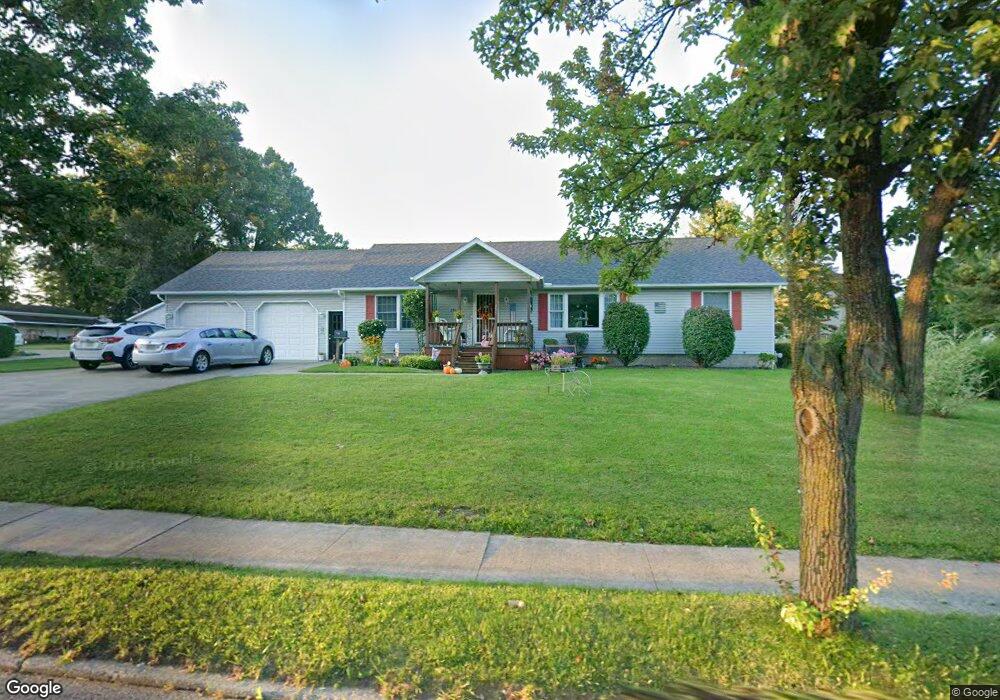
251 E State St Albion, PA 16401
Estimated Value: $196,000 - $216,000
3
Beds
2
Baths
1,456
Sq Ft
$142/Sq Ft
Est. Value
About This Home
This home is located at 251 E State St, Albion, PA 16401 and is currently estimated at $206,713, approximately $141 per square foot. 251 E State St is a home located in Erie County with nearby schools including Northwestern Senior High School and Cranesville Christian Academy.
Ownership History
Date
Name
Owned For
Owner Type
Purchase Details
Closed on
Dec 19, 2024
Sold by
Way Sheila K and Rushworth Shirley A
Bought by
Way Sheila K and Rushworth Shirley A
Current Estimated Value
Purchase Details
Closed on
Aug 4, 2022
Sold by
Mcadoo Donald E and Revoc Helen
Bought by
Way Sheila K and Rushworth Shirley A
Purchase Details
Closed on
Jul 25, 2003
Sold by
Mcadoo Donald E and Mcadoo Helen L
Bought by
Livi Donald E and Livi Helen L Mcadoo Revocable
Create a Home Valuation Report for This Property
The Home Valuation Report is an in-depth analysis detailing your home's value as well as a comparison with similar homes in the area
Home Values in the Area
Average Home Value in this Area
Purchase History
| Date | Buyer | Sale Price | Title Company |
|---|---|---|---|
| Way Sheila K | -- | None Listed On Document | |
| Way Sheila K | $150,000 | None Listed On Document | |
| Livi Donald E | -- | -- |
Source: Public Records
Tax History Compared to Growth
Tax History
| Year | Tax Paid | Tax Assessment Tax Assessment Total Assessment is a certain percentage of the fair market value that is determined by local assessors to be the total taxable value of land and additions on the property. | Land | Improvement |
|---|---|---|---|---|
| 2025 | $3,393 | $123,830 | $22,600 | $101,230 |
| 2024 | $3,337 | $123,830 | $22,600 | $101,230 |
| 2023 | $2,899 | $123,830 | $22,600 | $101,230 |
| 2022 | $2,803 | $123,830 | $22,600 | $101,230 |
| 2021 | $2,774 | $123,830 | $22,600 | $101,230 |
| 2020 | $2,712 | $123,830 | $22,600 | $101,230 |
| 2019 | $2,669 | $123,830 | $22,600 | $101,230 |
| 2018 | $2,588 | $123,830 | $22,600 | $101,230 |
| 2017 | $2,340 | $123,830 | $22,600 | $101,230 |
| 2016 | $2,498 | $123,830 | $22,600 | $101,230 |
| 2015 | $2,467 | $123,830 | $22,600 | $101,230 |
| 2014 | $1,431 | $123,830 | $22,600 | $101,230 |
Source: Public Records
Map
Nearby Homes
- 15 Thornton Ave
- 95 3rd Ave
- 16 Highland Ave
- 60 Park Ave
- 86 S Main St
- 0 Route 6n
- 22 Cherry St
- 9958 Bateman Ave
- 9840 Bateman Ave
- 9834 Bateman Ave
- 10023 Reservoir Rd
- 0 Winchester Dr Unit 178085
- 0 Winchester Dr Unit 178083
- 10210 Knapp Rd
- 9749 9801 Moses Rd
- 10650 Bowmantown Rd
- 11120 West Rd
- Lot3 West Rd
- Lot1 West Rd
- 8574 Kinsey Rd