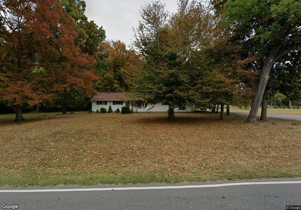
251 Free Soil Rd Georgetown, OH 45121
Estimated Value: $320,987 - $335,000
3
Beds
3
Baths
1,971
Sq Ft
$166/Sq Ft
Est. Value
About This Home
This home is located at 251 Free Soil Rd, Georgetown, OH 45121 and is currently estimated at $327,497, approximately $166 per square foot. 251 Free Soil Rd is a home located in Brown County with nearby schools including Georgetown Elementary School and Georgetown Jr/Sr High School.
Ownership History
Date
Name
Owned For
Owner Type
Purchase Details
Closed on
Oct 18, 2016
Sold by
Ernst Ricahrd L and Ernst Kathy K
Bought by
Gray Nick L and Gray Amy S
Current Estimated Value
Home Financials for this Owner
Home Financials are based on the most recent Mortgage that was taken out on this home.
Original Mortgage
$152,000
Outstanding Balance
$121,934
Interest Rate
3.48%
Mortgage Type
New Conventional
Estimated Equity
$205,563
Purchase Details
Closed on
Nov 13, 1997
Sold by
Pittman Michael
Bought by
Singler Timothy M
Create a Home Valuation Report for This Property
The Home Valuation Report is an in-depth analysis detailing your home's value as well as a comparison with similar homes in the area
Home Values in the Area
Average Home Value in this Area
Purchase History
| Date | Buyer | Sale Price | Title Company |
|---|---|---|---|
| Gray Nick L | $195,000 | None Available | |
| Singler Timothy M | $15,000 | -- |
Source: Public Records
Mortgage History
| Date | Status | Borrower | Loan Amount |
|---|---|---|---|
| Open | Gray Nick L | $152,000 |
Source: Public Records
Tax History Compared to Growth
Tax History
| Year | Tax Paid | Tax Assessment Tax Assessment Total Assessment is a certain percentage of the fair market value that is determined by local assessors to be the total taxable value of land and additions on the property. | Land | Improvement |
|---|---|---|---|---|
| 2024 | $3,264 | $90,010 | $8,620 | $81,390 |
| 2023 | $3,264 | $68,000 | $6,630 | $61,370 |
| 2022 | $2,681 | $68,000 | $6,630 | $61,370 |
| 2021 | $2,657 | $68,000 | $6,630 | $61,370 |
| 2020 | $2,348 | $56,650 | $5,510 | $51,140 |
| 2019 | $2,332 | $56,650 | $5,510 | $51,140 |
| 2018 | $2,317 | $56,650 | $5,510 | $51,140 |
| 2017 | $1,603 | $46,250 | $5,640 | $40,610 |
| 2016 | $1,558 | $46,250 | $5,640 | $40,610 |
| 2015 | $1,578 | $46,250 | $5,640 | $40,610 |
| 2014 | $1,626 | $45,730 | $5,120 | $40,610 |
| 2013 | $1,621 | $45,730 | $5,120 | $40,610 |
Source: Public Records
Map
Nearby Homes
- 59 Williams Dr
- 27 Marilyn Dr
- 155 Free Soil Rd
- 20 Heritage Hill Dr
- 20 Lakeview Acres Dr
- 470 Free Soil Rd
- 175 Douglas Cir
- 0 Douglas Ln Unit 1641744
- 418 Home St
- 25 Douglas Ln
- 505 S Water St
- 402 S Pleasant St
- 306 W 2nd St
- 0 St Rt 221 & Footbridge Unit 1826509
- 666 E State St
- 708 E State St
- 104 Elm St
- 102 Bill Dee Dr
- 406 E North St
- 405 N Main St
- 251 Free Soil Rd
- 285 Free Soil Rd
- 168 Lakeview Acres Dr
- 278 Free Soil Rd
- 266 Free Soil Rd
- 312 Free Soil Rd
- 239 Free Soil Rd
- 246 Free Soil Rd
- 134 Lakeview Acres Dr
- 324 Free Soil Rd
- 29 Williams Dr
- 40 Williams Dr
- 341 Free Soil Rd
- 39 Williams Dr
- 334 Free Soil Rd
- 234 Free Soil Rd
- 219 Free Soil Rd
- 30 Curry Ridge Rd
- 44 Marilyn Dr
- 49 Williams Dr