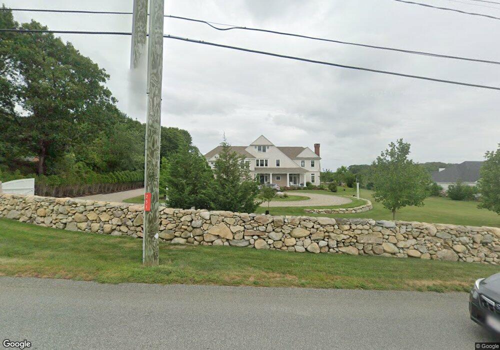
251 Gulf Rd South Dartmouth, MA 02748
Wilburtie Corner NeighborhoodEstimated Value: $2,135,000 - $2,547,000
4
Beds
5
Baths
5,406
Sq Ft
$419/Sq Ft
Est. Value
About This Home
This home is located at 251 Gulf Rd, South Dartmouth, MA 02748 and is currently estimated at $2,264,935, approximately $418 per square foot. 251 Gulf Rd is a home with nearby schools including Dartmouth High School and Friends Academy.
Ownership History
Date
Name
Owned For
Owner Type
Purchase Details
Closed on
Apr 4, 2019
Sold by
Weinshel Gale P and Weinshel Alan J
Bought by
Barnard Duncan N and Barnard Gillian S
Current Estimated Value
Home Financials for this Owner
Home Financials are based on the most recent Mortgage that was taken out on this home.
Original Mortgage
$1,200,000
Outstanding Balance
$1,055,013
Interest Rate
4.3%
Mortgage Type
Purchase Money Mortgage
Estimated Equity
$1,209,922
Create a Home Valuation Report for This Property
The Home Valuation Report is an in-depth analysis detailing your home's value as well as a comparison with similar homes in the area
Home Values in the Area
Average Home Value in this Area
Purchase History
| Date | Buyer | Sale Price | Title Company |
|---|---|---|---|
| Barnard Duncan N | $1,500,000 | -- |
Source: Public Records
Mortgage History
| Date | Status | Borrower | Loan Amount |
|---|---|---|---|
| Open | Barnard Duncan N | $1,200,000 |
Source: Public Records
Tax History Compared to Growth
Tax History
| Year | Tax Paid | Tax Assessment Tax Assessment Total Assessment is a certain percentage of the fair market value that is determined by local assessors to be the total taxable value of land and additions on the property. | Land | Improvement |
|---|---|---|---|---|
| 2025 | $17,631 | $2,047,700 | $423,200 | $1,624,500 |
| 2024 | $16,974 | $1,953,300 | $411,300 | $1,542,000 |
| 2023 | $16,346 | $1,782,600 | $341,300 | $1,441,300 |
| 2022 | $14,958 | $1,510,900 | $341,300 | $1,169,600 |
| 2021 | $14,444 | $1,394,200 | $296,000 | $1,098,200 |
| 2020 | $11,899 | $1,146,300 | $284,300 | $862,000 |
| 2019 | $11,211 | $1,078,000 | $290,100 | $787,900 |
| 2018 | $7,313 | $539,900 | $276,500 | $263,400 |
| 2017 | $2,466 | $246,100 | $246,100 | $0 |
| 2016 | $2,403 | $236,500 | $236,500 | $0 |
| 2015 | $2,212 | $218,100 | $218,100 | $0 |
| 2014 | $2,197 | $215,200 | $215,200 | $0 |
Source: Public Records
Map
Nearby Homes
- 248 Bakerville Rd
- 34 Country Way
- 75 Country Way Unit 75
- 76 Shipyard Ln
- 738 Smith Neck Rd
- 48 Wilson St
- 360 Russells Mills Rd
- 105 Rock Odundee Rd
- 21 Avis St
- 3 Mishawum Dr
- 5 Samosett Dr
- 40 School St
- 212 Rockland St
- 24 White Alder Way
- 61 Pardon Hill Rd
- 23 High St
- 00 Prospect St
- 6 Jacob Dr
- 0 Stoneledge Rd
- 1150 Russells Mills Rd