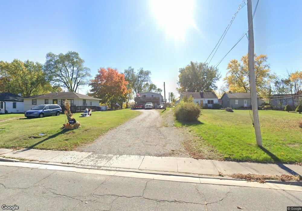
251 Idlewild Place Lowell, IN 46356
Cedar Creek NeighborhoodEstimated Value: $281,011 - $314,000
3
Beds
2
Baths
2,430
Sq Ft
$123/Sq Ft
Est. Value
About This Home
This home is located at 251 Idlewild Place, Lowell, IN 46356 and is currently estimated at $297,753, approximately $122 per square foot. 251 Idlewild Place is a home located in Lake County with nearby schools including Lowell Middle School and Lowell Senior High School.
Ownership History
Date
Name
Owned For
Owner Type
Purchase Details
Closed on
Jun 25, 2015
Sold by
Thompson Eugene R
Bought by
Thompson Julie A
Current Estimated Value
Home Financials for this Owner
Home Financials are based on the most recent Mortgage that was taken out on this home.
Original Mortgage
$99,389
Interest Rate
4.4%
Mortgage Type
FHA
Create a Home Valuation Report for This Property
The Home Valuation Report is an in-depth analysis detailing your home's value as well as a comparison with similar homes in the area
Home Values in the Area
Average Home Value in this Area
Purchase History
| Date | Buyer | Sale Price | Title Company |
|---|---|---|---|
| Thompson Julie A | -- | Fidelity National Title Co |
Source: Public Records
Mortgage History
| Date | Status | Borrower | Loan Amount |
|---|---|---|---|
| Closed | Thompson Julie A | $99,389 |
Source: Public Records
Tax History Compared to Growth
Tax History
| Year | Tax Paid | Tax Assessment Tax Assessment Total Assessment is a certain percentage of the fair market value that is determined by local assessors to be the total taxable value of land and additions on the property. | Land | Improvement |
|---|---|---|---|---|
| 2024 | $5,225 | $208,600 | $21,600 | $187,000 |
| 2023 | $2,015 | $197,100 | $21,600 | $175,500 |
| 2022 | $1,864 | $188,100 | $21,600 | $166,500 |
| 2021 | $1,781 | $180,100 | $15,800 | $164,300 |
| 2020 | $1,696 | $171,900 | $15,800 | $156,100 |
| 2019 | $1,640 | $158,200 | $15,800 | $142,400 |
| 2018 | $1,633 | $152,000 | $15,800 | $136,200 |
| 2017 | $1,690 | $148,200 | $15,800 | $132,400 |
| 2016 | $1,505 | $145,400 | $15,800 | $129,600 |
| 2014 | $1,244 | $128,600 | $15,800 | $112,800 |
| 2013 | $1,220 | $123,300 | $15,800 | $107,500 |
Source: Public Records
Map
Nearby Homes
- 285 W Commercial Ave
- 288 W Commercial Ave
- 236 W Commercial Ave
- 409 Greenbrier Ln
- 115 N Nichols St
- 621 Meadow Brook Dr
- 124 N Liberty St
- 18405 Cline St
- 330 Willow St
- 609 Shawnee Dr
- 18542 Percy Ln
- 18532 Percy Ln
- 128 Halsted St
- 18522 Percy Ln
- 18502 Percy Ln
- 18512 Percy Ln
- Rutherford Plan at Kingston Ridge - Andare Series
- Darcy Plan at Kingston Ridge - Townhome Series
- Marianne Plan at Kingston Ridge - Townhome Series
- Charlotte Plan at Kingston Ridge - Townhome Series
- 255 Idlewild Place
- 249 Idlewild Place
- 259 Idlewild Place
- 247 Idlewild Place
- 307 S Nichols St
- 311 S Nichols St
- 301 S Nichols St
- 315 S Nichols St
- 239 Idlewild Place
- 252 Idlewild Place
- 248 Idlewild Place
- 256 Idlewild Place
- 260 Idlewild Place
- 270 Idlewild Place
- 235 Idlewild Place
- 302 Amber Ln
- 235 S Nichols St
- 310 S Nichols St
- 303 Amber Ln
- 312 Amber Ln