Estimated Value: $506,030 - $553,000
5
Beds
3
Baths
3,327
Sq Ft
$157/Sq Ft
Est. Value
About This Home
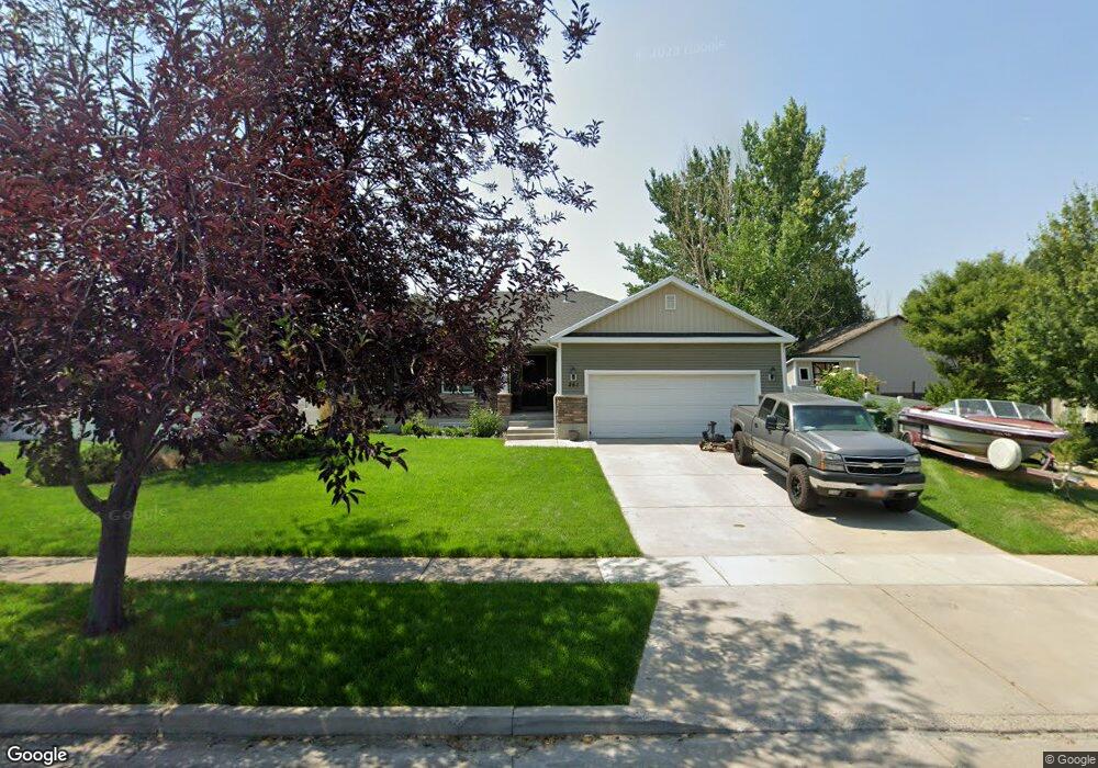
This home is located at 251 N 675 W, Hyrum, UT 84319 and is currently estimated at $523,758, approximately $157 per square foot. 251 N 675 W is a home located in Cache County with nearby schools including Lincoln School, South Cache Middle School, and Mountain Crest High School.
Ownership History
Date
Name
Owned For
Owner Type
Purchase Details
Closed on
Dec 4, 2017
Sold by
Hansen Michael R and Hansen Stacie
Bought by
Frenzel Anthony and Frenzel Camilla
Current Estimated Value
Home Financials for this Owner
Home Financials are based on the most recent Mortgage that was taken out on this home.
Original Mortgage
$200,000
Outstanding Balance
$109,124
Interest Rate
3.94%
Mortgage Type
New Conventional
Estimated Equity
$414,634
Purchase Details
Closed on
Jul 22, 2009
Sold by
Alexander John W and Alexander Annette S
Bought by
Hansen Michael R and Hansen Stacie
Home Financials for this Owner
Home Financials are based on the most recent Mortgage that was taken out on this home.
Original Mortgage
$165,600
Interest Rate
5.59%
Mortgage Type
Construction
Purchase Details
Closed on
May 3, 2006
Sold by
Mcbride Lavon
Bought by
Alexander John W and Alexander Annette S
Create a Home Valuation Report for This Property
The Home Valuation Report is an in-depth analysis detailing your home's value as well as a comparison with similar homes in the area
Home Values in the Area
Average Home Value in this Area
Purchase History
| Date | Buyer | Sale Price | Title Company |
|---|---|---|---|
| Frenzel Anthony | -- | -- | |
| Hansen Michael R | -- | Bonneville Superior Title | |
| Alexander John W | -- | Cache Title Company |
Source: Public Records
Mortgage History
| Date | Status | Borrower | Loan Amount |
|---|---|---|---|
| Open | Frenzel Anthony | $200,000 | |
| Previous Owner | Hansen Michael R | $165,600 |
Source: Public Records
Tax History Compared to Growth
Tax History
| Year | Tax Paid | Tax Assessment Tax Assessment Total Assessment is a certain percentage of the fair market value that is determined by local assessors to be the total taxable value of land and additions on the property. | Land | Improvement |
|---|---|---|---|---|
| 2025 | $2,057 | $295,295 | $0 | $0 |
| 2024 | $2,001 | $268,265 | $0 | $0 |
| 2023 | $2,231 | $286,000 | $0 | $0 |
| 2022 | $2,328 | $286,000 | $0 | $0 |
| 2021 | $1,962 | $371,445 | $75,000 | $296,445 |
| 2020 | $1,874 | $332,779 | $75,000 | $257,779 |
| 2019 | $1,782 | $297,779 | $40,000 | $257,779 |
| 2018 | $1,673 | $270,160 | $40,000 | $230,160 |
| 2017 | $1,701 | $142,560 | $0 | $0 |
| 2016 | $1,739 | $111,660 | $0 | $0 |
| 2015 | $1,366 | $111,660 | $0 | $0 |
| 2014 | $1,342 | $112,210 | $0 | $0 |
| 2013 | -- | $112,210 | $0 | $0 |
Source: Public Records
Map
Nearby Homes