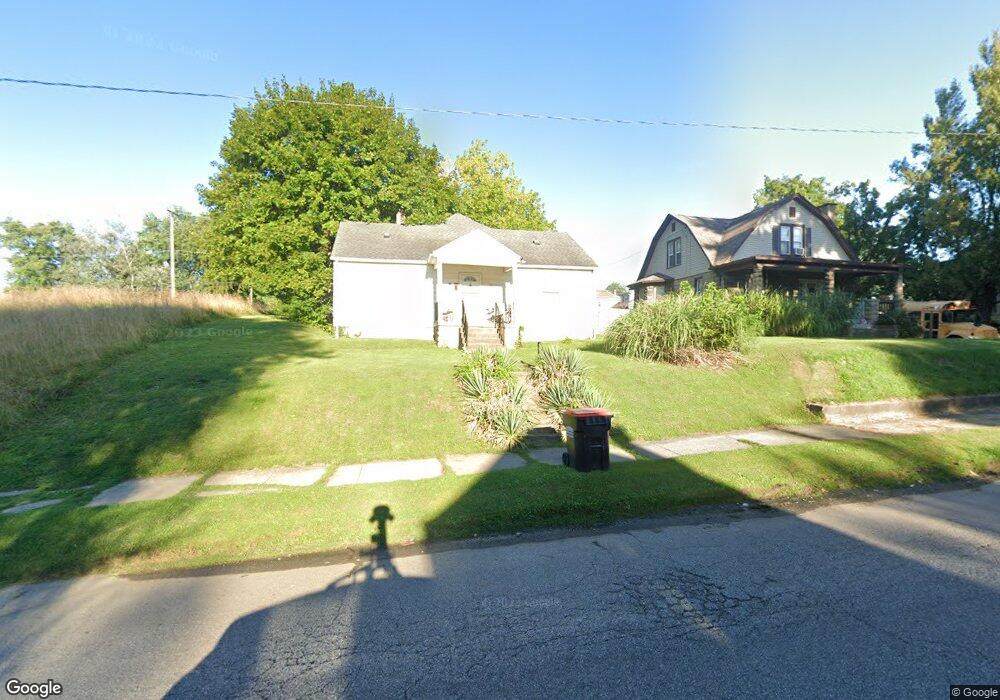
251 N Cedar St Newark, OH 43055
Estimated Value: $126,000 - $155,000
4
Beds
1
Bath
936
Sq Ft
$150/Sq Ft
Est. Value
About This Home
This home is located at 251 N Cedar St, Newark, OH 43055 and is currently estimated at $140,683, approximately $150 per square foot. 251 N Cedar St is a home located in Licking County with nearby schools including Carson Elementary School, Heritage Middle School, and Newark High School.
Ownership History
Date
Name
Owned For
Owner Type
Purchase Details
Closed on
Jul 12, 2024
Sold by
Newark Holding Llc
Bought by
Cornerstone Team Renovation Llc
Current Estimated Value
Purchase Details
Closed on
Jan 21, 2021
Sold by
Newark Cedar Street Ltd
Bought by
Newark Holding Llc
Purchase Details
Closed on
Jan 27, 2006
Sold by
Keenan Paul L and Keenan Lisa G
Bought by
Newark Cedar Street Ltd
Home Financials for this Owner
Home Financials are based on the most recent Mortgage that was taken out on this home.
Original Mortgage
$85,000
Interest Rate
6.37%
Mortgage Type
Purchase Money Mortgage
Purchase Details
Closed on
May 28, 2004
Sold by
Schwartz Mary C
Bought by
Keenan Paul L and Keenan Lisa G
Create a Home Valuation Report for This Property
The Home Valuation Report is an in-depth analysis detailing your home's value as well as a comparison with similar homes in the area
Home Values in the Area
Average Home Value in this Area
Purchase History
| Date | Buyer | Sale Price | Title Company |
|---|---|---|---|
| Cornerstone Team Renovation Llc | $80,000 | None Listed On Document | |
| Newark Holding Llc | -- | None Listed On Document | |
| Newark Cedar Street Ltd | $85,000 | None Available | |
| Keenan Paul L | $66,500 | -- |
Source: Public Records
Mortgage History
| Date | Status | Borrower | Loan Amount |
|---|---|---|---|
| Previous Owner | Newark Cedar Street Ltd | $85,000 |
Source: Public Records
Tax History Compared to Growth
Tax History
| Year | Tax Paid | Tax Assessment Tax Assessment Total Assessment is a certain percentage of the fair market value that is determined by local assessors to be the total taxable value of land and additions on the property. | Land | Improvement |
|---|---|---|---|---|
| 2024 | $1,567 | $42,710 | $7,880 | $34,830 |
| 2023 | $1,643 | $42,710 | $7,880 | $34,830 |
| 2022 | $1,229 | $29,820 | $6,160 | $23,660 |
| 2021 | $1,289 | $29,820 | $6,160 | $23,660 |
| 2020 | $1,318 | $29,820 | $6,160 | $23,660 |
| 2019 | $1,054 | $22,930 | $4,730 | $18,200 |
| 2018 | $1,055 | $0 | $0 | $0 |
| 2017 | $1,250 | $0 | $0 | $0 |
| 2016 | $1,459 | $0 | $0 | $0 |
| 2015 | $1,490 | $0 | $0 | $0 |
| 2014 | $817 | $0 | $0 | $0 |
| 2013 | $2,313 | $0 | $0 | $0 |
Source: Public Records
Map
Nearby Homes
- 160 N Cedar St
- 232 Rosehill Ave
- 408 Cedarcrest Ave
- 167 Essex St
- 204 Hunter St
- 424 Ridge Ave
- 136 Hunter St
- 284 Everett Ave
- 491 Garfield Ave
- 240 N Wing St
- 76 Oakwood Ave
- 554 Garfield Ave
- 460 Allston Ave
- 483 Allston Ave
- 194 Fielde Dr
- 430 E Main St
- 203 Lawrence St
- 506 Lexington Ave
- 51 Mill St
- 16 N Buena Vista St
- 255 N Cedar St
- 239 N Cedar St
- 465 Cedarcrest Ave
- 461 Cedarcrest Ave
- 263 N Cedar St
- 462 Clarendon St
- 254 N Cedar St
- 242 N Cedar St
- 258 N Cedar St
- 458 Clarendon St
- 271 N Cedar St
- 232 N Cedar St
- 466 Cedarcrest Ave
- 457 Cedarcrest Ave
- 457 Cedarcrest Ave
- 262 N Cedar St
- 230 N Cedar St
- 462 Cedarcrest Ave
- 456 Clarendon St
- 228 N Cedar St