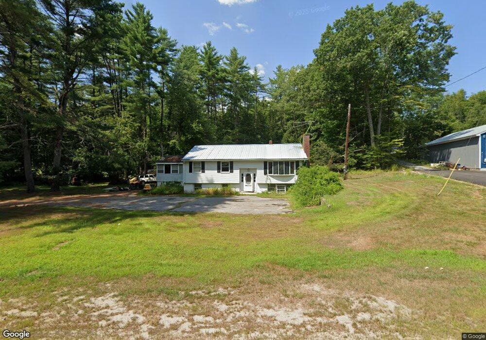
251 Ossipee Trail Porter, ME 04068
Estimated Value: $273,660 - $368,000
4
Beds
--
Bath
1,140
Sq Ft
$273/Sq Ft
Est. Value
About This Home
This home is located at 251 Ossipee Trail, Porter, ME 04068 and is currently estimated at $310,915, approximately $272 per square foot. 251 Ossipee Trail is a home located in Oxford County.
Ownership History
Date
Name
Owned For
Owner Type
Purchase Details
Closed on
Jul 2, 2018
Sold by
Waste Disposal Inc
Bought by
Taylor Gary
Current Estimated Value
Purchase Details
Closed on
Oct 25, 2017
Sold by
Waste Disposal Inc
Bought by
Schoonmaker John H and Schoonmaker Breann L
Home Financials for this Owner
Home Financials are based on the most recent Mortgage that was taken out on this home.
Original Mortgage
$120,772
Outstanding Balance
$100,282
Interest Rate
3.78%
Mortgage Type
FHA
Estimated Equity
$210,633
Create a Home Valuation Report for This Property
The Home Valuation Report is an in-depth analysis detailing your home's value as well as a comparison with similar homes in the area
Home Values in the Area
Average Home Value in this Area
Purchase History
| Date | Buyer | Sale Price | Title Company |
|---|---|---|---|
| Taylor Gary | -- | -- | |
| Taylor Gary | -- | -- | |
| Taylor Jeffrey | -- | -- | |
| Schoonmaker John H | -- | -- |
Source: Public Records
Mortgage History
| Date | Status | Borrower | Loan Amount |
|---|---|---|---|
| Open | Schoonmaker John H | $120,772 |
Source: Public Records
Tax History
| Year | Tax Paid | Tax Assessment Tax Assessment Total Assessment is a certain percentage of the fair market value that is determined by local assessors to be the total taxable value of land and additions on the property. | Land | Improvement |
|---|---|---|---|---|
| 2025 | $2,066 | $213,000 | $75,500 | $137,500 |
| 2024 | $2,709 | $227,644 | $62,400 | $165,244 |
| 2023 | $2,275 | $129,500 | $40,000 | $89,500 |
| 2022 | $2,150 | $129,513 | $40,000 | $89,513 |
| 2021 | $2,150 | $129,513 | $40,000 | $89,513 |
| 2020 | $2,108 | $129,513 | $40,000 | $89,513 |
| 2019 | $2,182 | $129,513 | $40,000 | $89,513 |
| 2018 | $2,182 | $129,513 | $40,000 | $89,513 |
| 2017 | $2,150 | $129,513 | $40,000 | $89,513 |
| 2016 | $1,956 | $129,513 | $40,000 | $89,513 |
| 2014 | $2,327 | $172,400 | $63,625 | $108,775 |
| 2013 | $2,327 | $172,400 | $63,625 | $108,775 |
Source: Public Records
Map
Nearby Homes
- 122 Ossipee Trail
- 12 Main St
- R3-32 Ossipee Trail
- 23 Pine St
- 62 Eastman Hill Rd
- 9 Roberts Ln
- 289 Pratt Rd
- 35 Mudgett Rd
- 0 S River Ln Unit 1641807
- 761 Pendexter Rd
- 272 Tripptown Rd
- 00 Pratt Rd
- 00 Brownfield Rd
- 944 North Rd
- 490 S Hiram Rd
- 42AC Ben Gilpatrick Rd
- 00 North Rd
- 00 North Rd Unit Lot 3
- 00 North Rd Unit Lot 2
- 00 North Rd Unit Lot 1
- 251 Ossipee Trail
- 342 Ossipee Trail
- 344 Ossipee Trail
- 213 Sokokis Rd
- 223 Sokokis Rd
- 00 Colcord Pond Rd Rd
- 191 Sokokis Rd
- 247 Sokokis Rd
- 203 Sokokis Rd
- 16 Colcord Pond Rd
- TBD Ossipee Trail
- 71 Colcord Pond Rd
- 198 Ossipee Trail
- 1 Colcord Pond Rd
- 164 Sokokis Rd
- 15 Colcord Pond Rd
- Lot 9 Colcord Pond Rd
- 155 Sokokis Rd
- 137 Sokokis Rd
- LOT17 Colcord Pond
Your Personal Tour Guide
Ask me questions while you tour the home.