Estimated Value: $457,000 - $540,000
4
Beds
3
Baths
2,448
Sq Ft
$205/Sq Ft
Est. Value
About This Home
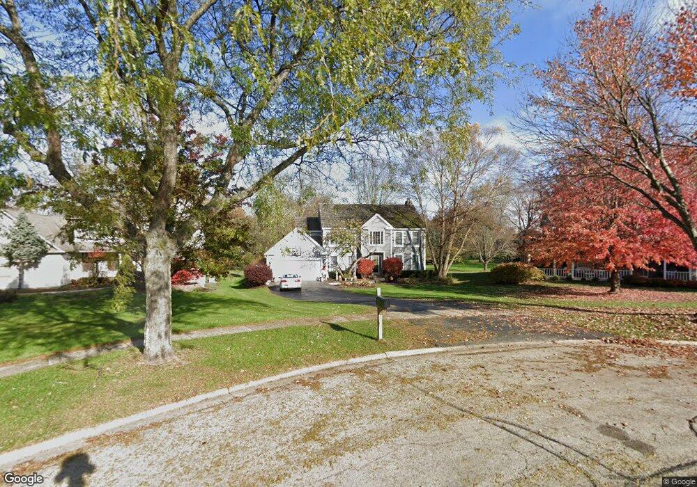
This home is located at 251 Perth Rd, Cary, IL 60013 and is currently estimated at $501,708, approximately $204 per square foot. 251 Perth Rd is a home located in McHenry County with nearby schools including Briargate Elementary School, Cary Jr High School, and Cary Grove High School.
Ownership History
Date
Name
Owned For
Owner Type
Purchase Details
Closed on
May 7, 2004
Sold by
Johnson Joanne F
Bought by
Cruz Michael A and Cruz Amy C
Current Estimated Value
Home Financials for this Owner
Home Financials are based on the most recent Mortgage that was taken out on this home.
Original Mortgage
$200,000
Outstanding Balance
$96,468
Interest Rate
5.91%
Mortgage Type
Unknown
Estimated Equity
$405,240
Purchase Details
Closed on
Nov 11, 2003
Sold by
Anderson Scott A and Anderson Nancy B
Bought by
Johnson Joanne F
Home Financials for this Owner
Home Financials are based on the most recent Mortgage that was taken out on this home.
Original Mortgage
$311,100
Interest Rate
5.81%
Mortgage Type
Unknown
Create a Home Valuation Report for This Property
The Home Valuation Report is an in-depth analysis detailing your home's value as well as a comparison with similar homes in the area
Home Values in the Area
Average Home Value in this Area
Purchase History
| Date | Buyer | Sale Price | Title Company |
|---|---|---|---|
| Cruz Michael A | -- | First Family Title Llc | |
| Johnson Joanne F | $366,000 | Ht |
Source: Public Records
Mortgage History
| Date | Status | Borrower | Loan Amount |
|---|---|---|---|
| Open | Cruz Michael A | $200,000 | |
| Previous Owner | Johnson Joanne F | $311,100 |
Source: Public Records
Tax History Compared to Growth
Tax History
| Year | Tax Paid | Tax Assessment Tax Assessment Total Assessment is a certain percentage of the fair market value that is determined by local assessors to be the total taxable value of land and additions on the property. | Land | Improvement |
|---|---|---|---|---|
| 2024 | $11,750 | $147,525 | $30,091 | $117,434 |
| 2023 | $11,473 | $131,943 | $26,913 | $105,030 |
| 2022 | $11,466 | $128,449 | $33,780 | $94,669 |
| 2021 | $10,937 | $119,665 | $31,470 | $88,195 |
| 2020 | $10,618 | $115,429 | $30,356 | $85,073 |
| 2019 | $10,414 | $110,479 | $29,054 | $81,425 |
| 2018 | $9,828 | $102,059 | $26,840 | $75,219 |
| 2017 | $9,647 | $96,146 | $25,285 | $70,861 |
| 2016 | $9,584 | $90,176 | $23,715 | $66,461 |
| 2013 | -- | $87,180 | $22,124 | $65,056 |
Source: Public Records
Map
Nearby Homes
- 60 S Seebert St
- 226 Aberdeen Rd
- 341 Cold Spring St
- 331 Cold Spring St
- 321 Cold Spring St
- 204 Country Commons Rd
- Lots 2,3,4 Northwest Hwy
- 589 Arthur Dr
- 641 Alida Dr
- 550 Norman Dr
- 124 E Main St Unit 2-3
- 411 Park Ave
- 2016 Grove Ln
- 2 Daybreak Ridge Trail
- 26 Wagner Dr
- 745 Harper Ave
- 2108 Beach Dr
- 324 Alma Terrace
- 413 Haber Rd Unit 5
- 417 Haber Rd Unit 6