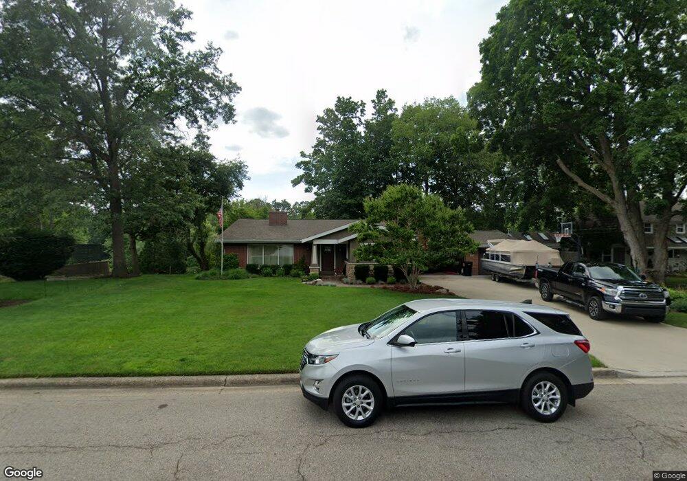
251 S Main St Rockford, MI 49341
Estimated Value: $480,000 - $548,000
3
Beds
2
Baths
2,427
Sq Ft
$212/Sq Ft
Est. Value
About This Home
This home is located at 251 S Main St, Rockford, MI 49341 and is currently estimated at $514,967, approximately $212 per square foot. 251 S Main St is a home located in Kent County with nearby schools including Meadow Ridge Elementary School, North Rockford Middle School, and Rockford High School Freshman Center.
Ownership History
Date
Name
Owned For
Owner Type
Purchase Details
Closed on
Sep 10, 2019
Sold by
Hulbert James S and Hulbert Maureen E
Bought by
James S And Maureen E Hulbert Trust
Current Estimated Value
Purchase Details
Closed on
May 21, 2004
Sold by
Hulbert James S and Hulbert Maureen E
Bought by
Hulbert James S and Hulbert Maureen E
Purchase Details
Closed on
Nov 22, 2002
Sold by
Hulbert Mary A and Vanprooyen James F
Bought by
Hulbert Mary A
Create a Home Valuation Report for This Property
The Home Valuation Report is an in-depth analysis detailing your home's value as well as a comparison with similar homes in the area
Home Values in the Area
Average Home Value in this Area
Purchase History
| Date | Buyer | Sale Price | Title Company |
|---|---|---|---|
| James S And Maureen E Hulbert Trust | -- | None Available | |
| Hulbert James S | -- | -- | |
| Hulbert James S | $184,000 | -- | |
| Hulbert Mary A | -- | -- | |
| Trustee Of The Steven E Hulbert Trust | -- | -- |
Source: Public Records
Tax History Compared to Growth
Tax History
| Year | Tax Paid | Tax Assessment Tax Assessment Total Assessment is a certain percentage of the fair market value that is determined by local assessors to be the total taxable value of land and additions on the property. | Land | Improvement |
|---|---|---|---|---|
| 2025 | $4,896 | $279,200 | $0 | $0 |
| 2024 | $4,896 | $245,300 | $0 | $0 |
| 2023 | $5,634 | $210,700 | $0 | $0 |
| 2022 | $5,412 | $195,200 | $0 | $0 |
| 2021 | $5,262 | $174,700 | $0 | $0 |
| 2020 | $4,286 | $165,300 | $0 | $0 |
| 2019 | $5,127 | $162,500 | $0 | $0 |
| 2018 | $5,137 | $151,500 | $0 | $0 |
| 2017 | $5,008 | $139,100 | $0 | $0 |
| 2016 | $4,636 | $112,200 | $0 | $0 |
| 2015 | -- | $112,200 | $0 | $0 |
| 2013 | -- | $100,100 | $0 | $0 |
Source: Public Records
Map
Nearby Homes
- 175 S Main St
- 131 S Monroe St NE
- 126 S Main St
- 153 Gaylord Dr
- 107 S Main St
- 142 E Division St NE
- 4286 Millpond Dr NE
- 8035 Jericho Ave NE
- 205 Hunters Ln NE Unit 23
- 7878 Northland Dr NE
- 126 N Monroe St
- 116 Kara Ct
- 4749 Windcliff Dr NE Unit 9
- 4777 Windcliff Dr NE
- 4985 Tiamo Ln NE
- 150 Glencarin Dr NE
- 8246 Autumn Acres Dr
- 5090 Natchez Ct NE
- 273 Summit Ave NE
- 8365 Atlanta Dr NE