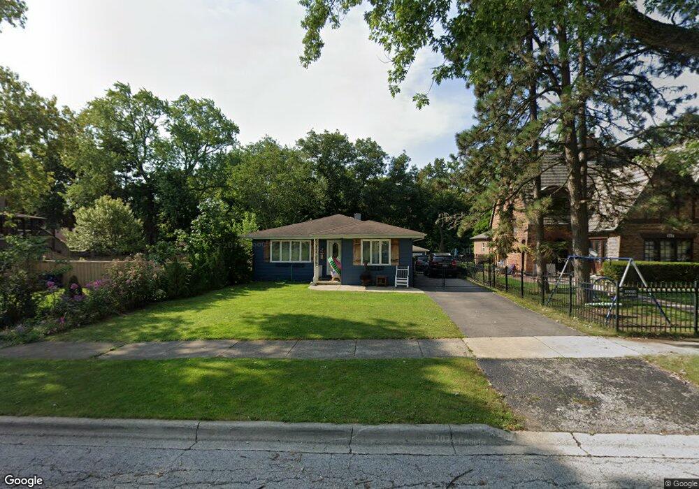
251 Stanley Ave Waukegan, IL 60085
Estimated Value: $272,000 - $306,000
3
Beds
2
Baths
1,448
Sq Ft
$199/Sq Ft
Est. Value
About This Home
This home is located at 251 Stanley Ave, Waukegan, IL 60085 and is currently estimated at $288,255, approximately $199 per square foot. 251 Stanley Ave is a home located in Lake County with nearby schools including Greenwood Elementary School, Edith M Smith Middle School, and Waukegan High School.
Ownership History
Date
Name
Owned For
Owner Type
Purchase Details
Closed on
Nov 30, 2018
Sold by
Morrissey Mary Alice
Bought by
Derose Mark X and Derose Martina E
Current Estimated Value
Purchase Details
Closed on
Apr 1, 2010
Sold by
Salata Felix J and Salata Gerara F
Bought by
Salata Gerard F and Morrissey Mary Alice
Purchase Details
Closed on
Aug 11, 2009
Sold by
Salata Felix J
Bought by
Salata Felix J and Salata Gerard F
Create a Home Valuation Report for This Property
The Home Valuation Report is an in-depth analysis detailing your home's value as well as a comparison with similar homes in the area
Home Values in the Area
Average Home Value in this Area
Purchase History
| Date | Buyer | Sale Price | Title Company |
|---|---|---|---|
| Derose Mark X | $115,000 | None Available | |
| Salata Gerard F | -- | None Available | |
| Salata Felix J | -- | None Available |
Source: Public Records
Tax History Compared to Growth
Tax History
| Year | Tax Paid | Tax Assessment Tax Assessment Total Assessment is a certain percentage of the fair market value that is determined by local assessors to be the total taxable value of land and additions on the property. | Land | Improvement |
|---|---|---|---|---|
| 2024 | $6,367 | $83,737 | $11,115 | $72,622 |
| 2023 | $6,652 | $75,519 | $10,024 | $65,495 |
| 2022 | $6,652 | $74,042 | $10,488 | $63,554 |
| 2021 | $5,735 | $61,013 | $9,355 | $51,658 |
| 2020 | $5,763 | $56,841 | $8,715 | $48,126 |
| 2019 | $5,748 | $52,086 | $7,986 | $44,100 |
| 2018 | $2,511 | $47,101 | $11,303 | $35,798 |
| 2017 | $2,598 | $41,671 | $10,000 | $31,671 |
| 2016 | $2,823 | $36,211 | $8,690 | $27,521 |
| 2015 | $3,086 | $32,410 | $7,778 | $24,632 |
| 2014 | $3,234 | $29,267 | $4,554 | $24,713 |
| 2012 | $5,195 | $31,707 | $4,933 | $26,774 |
Source: Public Records
Map
Nearby Homes
- 1613 North Ave
- 616 W Keith Ave
- 1336 N Ash St
- 1335 Chestnut St
- 1110 N Ash St
- 415 W Ridgeland Ave
- 918 N Ash St
- 1018 W Atlantic Ave
- 723 N County St
- 1312 N Linden Ave
- 325 4th St
- 1105 Woodlawn Cir
- 1905 Linden Ave
- 611 N Genesee St
- 917 N Linden Ave
- 620 N Poplar St
- 1000 Pine St
- 702 Franklin St
- 1109 Massena Ave
- 2213 Alta Vista Dr
- 253 Stanley Ave
- 1414 N Sheridan Rd
- 257 Stanley Ave
- 1400 N Sheridan Rd
- 265 Stanley Ave
- 250 Stanley Ave
- 260 Stanley Ave
- 1424 N Sheridan Rd
- 266 Stanley Ave
- 270 Stanley Ave
- 303 Stanley Ave
- 217 Sheridan Ct
- 1432 N Sheridan Rd
- 1433 Alexander Ct
- 300 Stanley Ave
- 309 Stanley Ave
- 1501 Alexander Ct
- 211 Sheridan Ct
- 308 Stanley Ave
- 1500 N Sheridan Rd