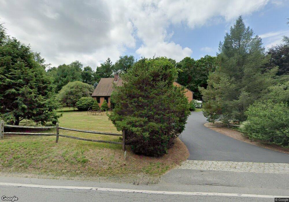
251 Thompson St Middleboro, MA 02346
Estimated Value: $652,341 - $786,000
3
Beds
2
Baths
2,976
Sq Ft
$240/Sq Ft
Est. Value
About This Home
This home is located at 251 Thompson St, Middleboro, MA 02346 and is currently estimated at $713,585, approximately $239 per square foot. 251 Thompson St is a home located in Plymouth County with nearby schools including Mary K. Goode Elementary School.
Ownership History
Date
Name
Owned For
Owner Type
Purchase Details
Closed on
Jan 5, 1996
Sold by
Gorman James L and Gorman Faith A
Bought by
Wyatt Jan H and Cates Penny L
Current Estimated Value
Purchase Details
Closed on
Jun 12, 1992
Sold by
Bridgewater Sb
Bought by
Gorman James L and Gorman Faith A
Purchase Details
Closed on
Dec 24, 1991
Sold by
Mcglone Michael J
Bought by
Bridgewater Sb
Create a Home Valuation Report for This Property
The Home Valuation Report is an in-depth analysis detailing your home's value as well as a comparison with similar homes in the area
Home Values in the Area
Average Home Value in this Area
Purchase History
| Date | Buyer | Sale Price | Title Company |
|---|---|---|---|
| Wyatt Jan H | $143,000 | -- | |
| Gorman James L | $120,000 | -- | |
| Bridgewater Sb | $102,500 | -- |
Source: Public Records
Mortgage History
| Date | Status | Borrower | Loan Amount |
|---|---|---|---|
| Open | Bridgewater Sb | $90,000 | |
| Open | Bridgewater Sb | $200,000 |
Source: Public Records
Tax History Compared to Growth
Tax History
| Year | Tax Paid | Tax Assessment Tax Assessment Total Assessment is a certain percentage of the fair market value that is determined by local assessors to be the total taxable value of land and additions on the property. | Land | Improvement |
|---|---|---|---|---|
| 2025 | $7,027 | $524,000 | $168,300 | $355,700 |
| 2024 | $6,647 | $490,900 | $160,400 | $330,500 |
| 2023 | $6,424 | $451,100 | $160,400 | $290,700 |
| 2022 | $5,800 | $377,100 | $139,500 | $237,600 |
| 2021 | $5,831 | $358,400 | $122,400 | $236,000 |
| 2020 | $5,612 | $353,400 | $122,400 | $231,000 |
| 2019 | $5,076 | $327,900 | $122,400 | $205,500 |
| 2018 | $5,034 | $322,700 | $116,200 | $206,500 |
| 2017 | $4,953 | $314,100 | $112,200 | $201,900 |
| 2016 | $4,633 | $291,000 | $103,300 | $187,700 |
| 2015 | $4,523 | $286,600 | $103,300 | $183,300 |
Source: Public Records
Map
Nearby Homes
- 37 Katrina Rd
- 52 Saddleworth Way
- 0 Thompson St
- Lot B Thompson St
- Lot A Thompson St
- Lot 3 Margot Rose Cir
- 58 Chadderton Way
- 6 Bryant Cir
- 102 Saddleworth Way
- 6 Rocky Meadow St
- 162 Plympton St
- 759 Plymouth St
- 105 Plain St
- 2602 Green St
- 408 Green St Unit 408GRE
- 1103 Green St
- 2404 Simmons Rd Unit 2404SIM
- 2804 Island Dr
- 3509 Fox Run Unit 3509FOX
- 2101 Pheasant Ln Unit 2101PHE
- 249 Thompson St
- 248 Thompson St
- 89 Meadowbrooke Ln
- 247 Thompson St
- 81 Meadowbrooke Ln
- 93 Meadowbrooke Ln
- 43 Meadowbrooke Ln
- Lot 187(6) Meadowbrooke Ln
- 79 Meadowbrooke Ln
- 73 Meadowbrooke Ln
- 21 Meadowbrooke Ln
- 21 Meadowbrooke Ln
- 19 Meadowbrooke Ln
- 69 Meadowbrooke Ln
- 9 Meadowbrooke Ln
- 25 Meadowbrooke Ln
- 33 Meadowbrooke Ln
- 41 Meadowbrooke Ln
- 5 Bon View Cir
- 51 Meadowbrooke Ln