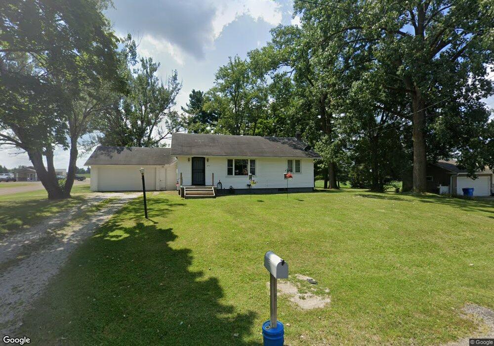
251 W Elm St Reading, MI 49274
Estimated Value: $155,000 - $168,000
2
Beds
1
Bath
1,224
Sq Ft
$131/Sq Ft
Est. Value
About This Home
This home is located at 251 W Elm St, Reading, MI 49274 and is currently estimated at $160,134, approximately $130 per square foot. 251 W Elm St is a home located in Hillsdale County with nearby schools including Reynolds Elementary School, Reading High School, and Cooper Amish School.
Ownership History
Date
Name
Owned For
Owner Type
Purchase Details
Closed on
May 25, 2022
Sold by
Mccavit Roxanne L and Goll Lucinda A
Bought by
Young Barry A and Young Dawn C
Current Estimated Value
Home Financials for this Owner
Home Financials are based on the most recent Mortgage that was taken out on this home.
Original Mortgage
$68,500
Outstanding Balance
$64,896
Interest Rate
5.11%
Estimated Equity
$95,238
Purchase Details
Closed on
Dec 8, 2016
Sold by
Lane Cora Lea and Lane Charles E
Bought by
Mccavit Roxanne L and Goll Lucinda A
Create a Home Valuation Report for This Property
The Home Valuation Report is an in-depth analysis detailing your home's value as well as a comparison with similar homes in the area
Home Values in the Area
Average Home Value in this Area
Purchase History
| Date | Buyer | Sale Price | Title Company |
|---|---|---|---|
| Young Barry A | $64,000 | -- | |
| Mccavit Roxanne L | -- | None Available |
Source: Public Records
Mortgage History
| Date | Status | Borrower | Loan Amount |
|---|---|---|---|
| Open | Young Barry A | $68,500 |
Source: Public Records
Tax History Compared to Growth
Tax History
| Year | Tax Paid | Tax Assessment Tax Assessment Total Assessment is a certain percentage of the fair market value that is determined by local assessors to be the total taxable value of land and additions on the property. | Land | Improvement |
|---|---|---|---|---|
| 2025 | $1,107 | $61,800 | $0 | $0 |
| 2024 | $692 | $59,900 | $0 | $0 |
| 2023 | $661 | $45,400 | $0 | $0 |
| 2022 | $1,009 | $37,600 | $0 | $0 |
| 2021 | $982 | $35,900 | $0 | $0 |
| 2020 | $973 | $31,400 | $0 | $0 |
| 2019 | $942 | $30,200 | $0 | $0 |
| 2018 | $905 | $30,100 | $0 | $0 |
| 2017 | $878 | $28,900 | $0 | $0 |
| 2016 | $870 | $28,400 | $0 | $0 |
| 2015 | $557 | $28,400 | $0 | $0 |
| 2013 | $540 | $22,990 | $0 | $0 |
| 2012 | $550 | $23,440 | $0 | $0 |
Source: Public Records
Map
Nearby Homes
- 0 W Silver St Unit 25044322
- 309 S Main St
- 203 E Michigan St
- 108 Lynn St
- 5411 Lilac Rd
- 5211 Long Lake Rd
- 5160 Quackenbush Rd
- 7944 Gilmore Rd
- 4421 Carpenter Rd
- 3870 Rus Dic Dr
- 4427 Carpenter Rd
- 9949 Indian Trail
- 7841 Topinabee Dr
- 4111 Blair Rd
- 6524 W Montgomery Rd
- 490 Kelley Rd
- 0 Dimmers Rd
- 2520 S Sand Lake Rd
- 4164 S Pleasant Dr
- 2408 Spruce Dr