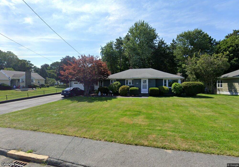
251 Worcester St North Grafton, MA 01536
Estimated Value: $470,000 - $532,581
3
Beds
2
Baths
1,470
Sq Ft
$336/Sq Ft
Est. Value
About This Home
This home is located at 251 Worcester St, North Grafton, MA 01536 and is currently estimated at $494,645, approximately $336 per square foot. 251 Worcester St is a home located in Worcester County with nearby schools including Grafton High School, Assumption School, and St Stephen Elementary School.
Ownership History
Date
Name
Owned For
Owner Type
Purchase Details
Closed on
Dec 4, 1998
Sold by
Koury Kenneth M
Bought by
Davidson Raymond and Davidson Hilda E
Current Estimated Value
Home Financials for this Owner
Home Financials are based on the most recent Mortgage that was taken out on this home.
Original Mortgage
$108,900
Outstanding Balance
$24,523
Interest Rate
6.68%
Mortgage Type
Purchase Money Mortgage
Estimated Equity
$470,122
Create a Home Valuation Report for This Property
The Home Valuation Report is an in-depth analysis detailing your home's value as well as a comparison with similar homes in the area
Home Values in the Area
Average Home Value in this Area
Purchase History
| Date | Buyer | Sale Price | Title Company |
|---|---|---|---|
| Davidson Raymond | $121,000 | -- | |
| Davidson Raymond | $121,000 | -- |
Source: Public Records
Mortgage History
| Date | Status | Borrower | Loan Amount |
|---|---|---|---|
| Open | Davidson Raymond | $108,900 | |
| Closed | Davidson Raymond | $108,900 | |
| Previous Owner | Davidson Raymond | $35,500 | |
| Previous Owner | Davidson Raymond | $30,000 |
Source: Public Records
Tax History Compared to Growth
Tax History
| Year | Tax Paid | Tax Assessment Tax Assessment Total Assessment is a certain percentage of the fair market value that is determined by local assessors to be the total taxable value of land and additions on the property. | Land | Improvement |
|---|---|---|---|---|
| 2025 | $6,141 | $440,500 | $148,000 | $292,500 |
| 2024 | $5,982 | $418,000 | $140,900 | $277,100 |
| 2023 | $5,753 | $366,200 | $140,900 | $225,300 |
| 2022 | $5,457 | $323,300 | $121,000 | $202,300 |
| 2021 | $5,314 | $309,300 | $109,900 | $199,400 |
| 2020 | $5,103 | $309,300 | $109,900 | $199,400 |
| 2019 | $4,860 | $291,700 | $106,700 | $185,000 |
| 2018 | $4,722 | $284,600 | $106,600 | $178,000 |
| 2017 | $4,244 | $258,800 | $80,800 | $178,000 |
| 2016 | $4,397 | $262,500 | $84,500 | $178,000 |
| 2015 | $4,368 | $264,700 | $84,500 | $180,200 |
| 2014 | $3,904 | $255,800 | $93,700 | $162,100 |
Source: Public Records
Map
Nearby Homes
- 1 Hastings Ave
- 21 Lordvale Blvd Unit 406
- 76 Samuel Dr
- 46 John Dr Unit 46
- 22 Beverly Rd
- 14 Northgate Ct Unit 14
- 5 Lincoln Ln Unit 5
- 194 Worcester St
- 11 Hovey Pond Dr Unit 11
- 7 Hovey Pond Dr Unit 7
- 5 Edward Dr
- 255 Riverlin St
- 28 Lincoln Ln
- 39 Pointe Rok Dr Unit 39
- 11 Maplewood Rd
- 95 Pineland Ave
- 30 Falmouth Dr
- 17 Hingham Rd
- 27 A-B Grafton St
- 156 Brigham Hill Rd
- 253 Worcester St
- 241 Brigham Hill Rd
- 18 Fairlawn St
- 16 Fairlawn St
- 255 Worcester St
- 22 Fairlawn St
- 239 Brigham Hill Rd
- 199 Fairlawn St
- 17,19,21 Fairlawn St
- 257 Worcester St
- 24 Fairlawn St
- 19 Fairlawn St
- 23 Maplewood Dr
- 26 Fairlawn St
- 259 Worcester St
- 23 Fairlawn St
- 21 Maplewood Dr
- 25 Fairlawn St
- 237 Brigham Hill Rd
- 28 Fairlawn St