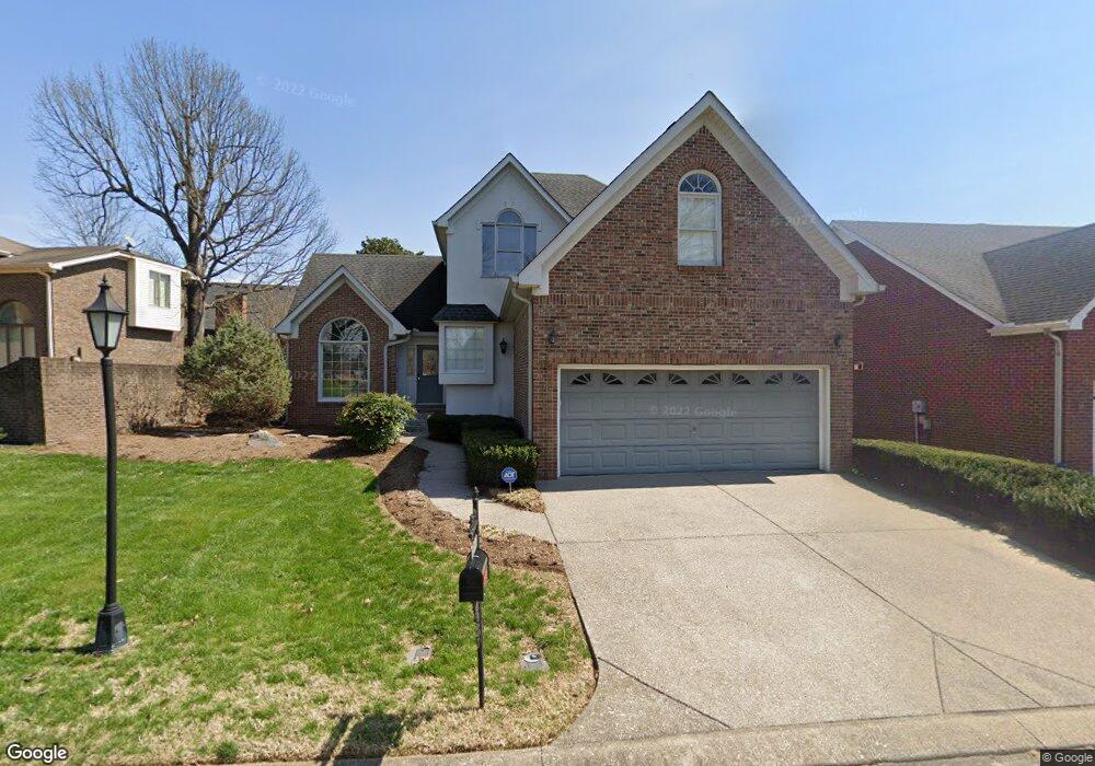
2510 Apache Trail Murfreesboro, TN 37129
Estimated Value: $420,286 - $485,000
Studio
3
Baths
2,282
Sq Ft
$198/Sq Ft
Est. Value
About This Home
This home is located at 2510 Apache Trail, Murfreesboro, TN 37129 and is currently estimated at $452,572, approximately $198 per square foot. 2510 Apache Trail is a home located in Rutherford County with nearby schools including Northfield Elementary School, Siegel Middle School, and Siegel High School.
Ownership History
Date
Name
Owned For
Owner Type
Purchase Details
Closed on
Jun 5, 2001
Sold by
Wilkerson Preston L and Wilkerson Sara
Bought by
Hayes Michael W and Hayes Angela C
Current Estimated Value
Home Financials for this Owner
Home Financials are based on the most recent Mortgage that was taken out on this home.
Original Mortgage
$166,257
Outstanding Balance
$63,192
Interest Rate
7.11%
Estimated Equity
$389,380
Create a Home Valuation Report for This Property
The Home Valuation Report is an in-depth analysis detailing your home's value as well as a comparison with similar homes in the area
Home Values in the Area
Average Home Value in this Area
Purchase History
| Date | Buyer | Sale Price | Title Company |
|---|---|---|---|
| Hayes Michael W | $169,000 | -- |
Source: Public Records
Mortgage History
| Date | Status | Borrower | Loan Amount |
|---|---|---|---|
| Open | Hayes Michael W | $166,257 |
Source: Public Records
Tax History
| Year | Tax Paid | Tax Assessment Tax Assessment Total Assessment is a certain percentage of the fair market value that is determined by local assessors to be the total taxable value of land and additions on the property. | Land | Improvement |
|---|---|---|---|---|
| 2025 | $2,567 | $89,425 | $13,750 | $75,675 |
| 2024 | $2,530 | $89,425 | $13,750 | $75,675 |
| 2023 | $1,678 | $89,425 | $13,750 | $75,675 |
| 2022 | $1,406 | $87,000 | $13,750 | $73,250 |
| 2021 | $1,398 | $62,975 | $11,875 | $51,100 |
| 2020 | $1,398 | $62,975 | $11,875 | $51,100 |
| 2019 | $1,398 | $62,975 | $11,875 | $51,100 |
| 2018 | $1,920 | $62,975 | $0 | $0 |
| 2017 | $2,058 | $52,950 | $0 | $0 |
| 2016 | $2,058 | $52,950 | $0 | $0 |
| 2015 | $2,058 | $52,950 | $0 | $0 |
| 2014 | $1,317 | $52,950 | $0 | $0 |
| 2013 | -- | $49,600 | $0 | $0 |
Source: Public Records
Map
Nearby Homes
- 1416 Mohawk Trail
- 1434 Sioux Place
- 1403 Cree Ct
- 1407 Ottawa Place
- 1454 Indian Place
- 2701 Slatewood Way
- 1606 Balsawood Ln Unit 19
- 1707 Berkeley St
- 1706 Wiltshire Dr
- 1604 Burlwood Ct
- 2250 Wiltshire Dr
- 1437 Twin Feather Dr
- 1426 Indian Place
- 2824 Wynthrope Hall Dr
- 2910 Sulphur Springs Rd
- 1719 Waterford Rd
- 1430 Arrowhead Place
- 2242 Surrey Dr
- 1611 Saltlick Place
- 2814 Saint Johns Dr
- 2506 Apache Trail
- 2514 Apache Trail
- 1511 Yuma Ct
- 1510 Yuma Ct
- 2518 Apache Trail
- 2526 Tomahawk Trace
- 2522 Tomahawk Trace
- 1506 Yuma Ct
- 2518 Tomahawk Trace
- 2522 Apache Trail
- 2519 Apache Trail
- 2506 Cornell Place
- 2514 Tomahawk Trace
- 1503 Mohawk Trail
- 1423 Mohawk Trail
- 2502 Cornell Place
- 2523 Apache Trail
- 1419 Mohawk Trail
- 1419 Ottawa Place
- 1507 Mohawk Trail
Your Personal Tour Guide
Ask me questions while you tour the home.