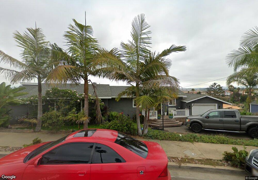
2510 Dunstan St Oceanside, CA 92054
Fire Mountain NeighborhoodEstimated Value: $1,021,842 - $1,233,000
3
Beds
3
Baths
1,599
Sq Ft
$731/Sq Ft
Est. Value
About This Home
This home is located at 2510 Dunstan St, Oceanside, CA 92054 and is currently estimated at $1,168,711, approximately $730 per square foot. 2510 Dunstan St is a home located in San Diego County with nearby schools including Palmquist Elementary School, Lincoln Middle School, and Oceanside High School.
Ownership History
Date
Name
Owned For
Owner Type
Purchase Details
Closed on
Oct 6, 2022
Sold by
Polanco Alika S and Polanco Samantha L
Bought by
Polanco Family Trust and Polanco
Current Estimated Value
Purchase Details
Closed on
Oct 11, 2011
Sold by
Vacinek Christopher B
Bought by
Polanco Alika Samuel and Polanco Samantha Leigh
Home Financials for this Owner
Home Financials are based on the most recent Mortgage that was taken out on this home.
Original Mortgage
$125,000
Interest Rate
4.01%
Mortgage Type
New Conventional
Purchase Details
Closed on
Aug 19, 2005
Sold by
Kreissig Dieter Alfred and Kreissig Rex Dieter
Bought by
Yant Richard C and Yant Patty J
Purchase Details
Closed on
Dec 30, 2003
Sold by
Rivera Roberto A
Bought by
Vacinek Christopher B
Home Financials for this Owner
Home Financials are based on the most recent Mortgage that was taken out on this home.
Original Mortgage
$360,000
Interest Rate
4.62%
Mortgage Type
Purchase Money Mortgage
Purchase Details
Closed on
Dec 30, 2002
Sold by
Gomez Hilda A
Bought by
Rivera Roberto A
Home Financials for this Owner
Home Financials are based on the most recent Mortgage that was taken out on this home.
Original Mortgage
$280,000
Interest Rate
5.33%
Purchase Details
Closed on
Oct 2, 2001
Sold by
Shale Austen and Shale Errol M
Bought by
Rivera Roberto A and Gomez Hilda A
Home Financials for this Owner
Home Financials are based on the most recent Mortgage that was taken out on this home.
Original Mortgage
$275,000
Interest Rate
6.62%
Purchase Details
Closed on
Oct 7, 1996
Sold by
Austen Shale and Austen Errol M
Bought by
Shale Austen and Shale Errol M
Purchase Details
Closed on
May 28, 1996
Sold by
Shale Austen and Shale Errol M
Bought by
Shale Austen and Shale Errol M
Home Financials for this Owner
Home Financials are based on the most recent Mortgage that was taken out on this home.
Original Mortgage
$75,000
Interest Rate
7.97%
Mortgage Type
Balloon
Create a Home Valuation Report for This Property
The Home Valuation Report is an in-depth analysis detailing your home's value as well as a comparison with similar homes in the area
Home Values in the Area
Average Home Value in this Area
Purchase History
| Date | Buyer | Sale Price | Title Company |
|---|---|---|---|
| Polanco Family Trust | -- | None Listed On Document | |
| Polanco Alika Samuel | $325,000 | Lawyers Title | |
| Yant Richard C | $100,000 | First American Title | |
| Vacinek Christopher B | $450,000 | California Title Company | |
| Rivera Roberto A | -- | Commerce Title Company | |
| Rivera Roberto A | $285,000 | First American Title | |
| Shale Austen | -- | -- | |
| Shale Austen | $75,000 | Old Republic Title Company |
Source: Public Records
Mortgage History
| Date | Status | Borrower | Loan Amount |
|---|---|---|---|
| Previous Owner | Polanco Alika Samuel | $125,000 | |
| Previous Owner | Vacinek Christopher B | $360,000 | |
| Previous Owner | Rivera Roberto A | $280,000 | |
| Previous Owner | Rivera Roberto A | $275,000 | |
| Previous Owner | Shale Austen | $75,000 | |
| Closed | Vacinek Christopher B | $90,000 |
Source: Public Records
Tax History
| Year | Tax Paid | Tax Assessment Tax Assessment Total Assessment is a certain percentage of the fair market value that is determined by local assessors to be the total taxable value of land and additions on the property. | Land | Improvement |
|---|---|---|---|---|
| 2025 | $4,941 | $446,090 | $286,282 | $159,808 |
| 2024 | $4,941 | $437,344 | $280,669 | $156,675 |
| 2023 | $4,789 | $428,769 | $275,166 | $153,603 |
| 2022 | $4,717 | $420,363 | $269,771 | $150,592 |
| 2021 | $4,735 | $412,122 | $264,482 | $147,640 |
| 2020 | $4,204 | $373,256 | $246,924 | $126,332 |
| 2019 | $4,082 | $365,938 | $242,083 | $123,855 |
| 2018 | $4,039 | $358,764 | $237,337 | $121,427 |
| 2017 | $3,965 | $351,731 | $232,684 | $119,047 |
| 2016 | $3,837 | $344,835 | $228,122 | $116,713 |
| 2015 | $3,725 | $339,656 | $224,696 | $114,960 |
| 2014 | $3,582 | $333,004 | $220,295 | $112,709 |
Source: Public Records
Map
Nearby Homes
- 2311 Loker Way
- 1355 Knoll Dr
- 2312 Loker Way
- 2308 Loker Way
- 2306 Loker Way
- 1305 Cornish Dr
- 2309 Loker Way
- 2241 California St
- 1535 Molly Cir
- 2277 Dunstan St
- 1520 Downs St
- 519 Camelot Dr
- 540 S Barnwell St
- 2619 Fire Mountain Dr
- 1824 Portofino Dr
- 1916 Laurel Rd
- 403 Foussat Rd
- 2807 Valley Vista Way
- 2835 Valley Vista Way
- 1850 Downs St
- 2514 Dunstan St
- 2514 Dunstan St Unit 8
- 2514 Dunstan St Unit A
- 2504 Dunstan St
- 2512 Dunstan St
- 2512 Dunstan St Unit 9
- 2512 Dunstan St Unit B
- 2520 Dunstan St
- 2500 Dunstan St
- 2451 Dunstan St
- 2525 Dunstan St
- 2501 Sarbonne Dr
- 2446 Dunstan St
- 2505 Sarbonne Dr
- 2526 Dunstan St
- 2465 Sarbonne Dr
- 2445 Dunstan St
- 2509 Sarbonne Dr
- 2448 Dunstan St
- 2513 Sarbonne Dr
Your Personal Tour Guide
Ask me questions while you tour the home.