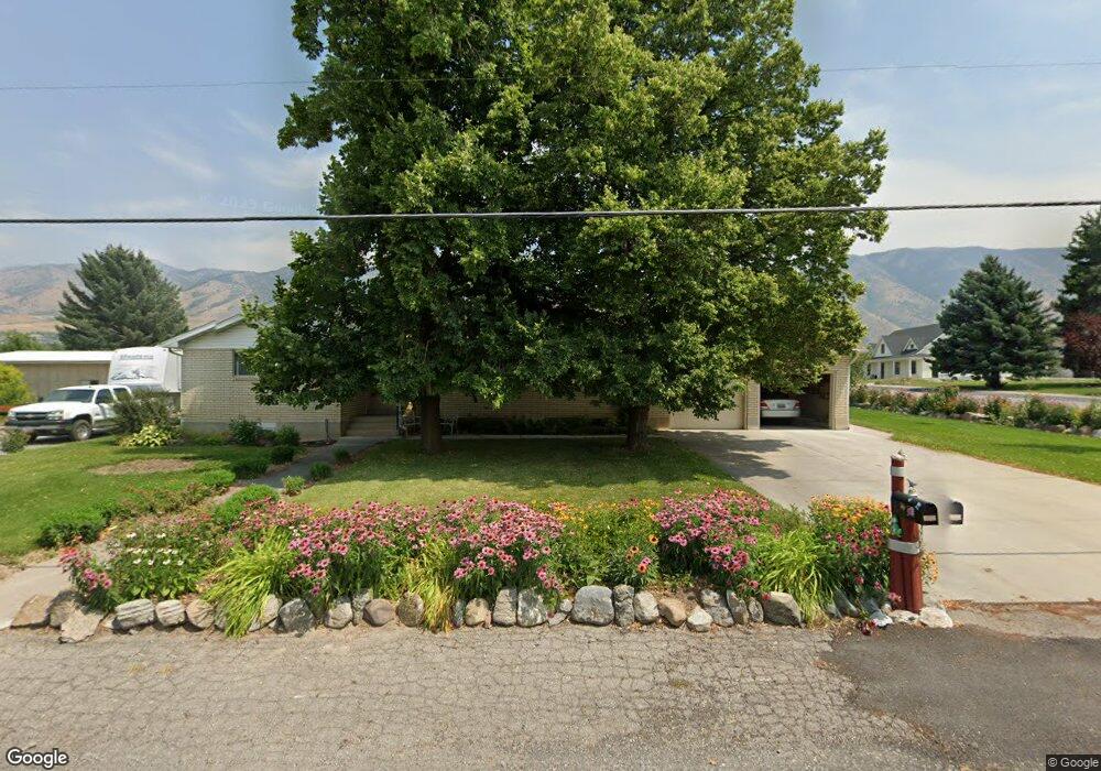
2510 N 1250 E North Logan, UT 84341
Estimated Value: $566,000 - $720,000
5
Beds
3
Baths
3,112
Sq Ft
$206/Sq Ft
Est. Value
About This Home
This home is located at 2510 N 1250 E, North Logan, UT 84341 and is currently estimated at $642,229, approximately $206 per square foot. 2510 N 1250 E is a home located in Cache County with nearby schools including North Park School, Cedar Ridge School, and North Cache Middle School.
Ownership History
Date
Name
Owned For
Owner Type
Purchase Details
Closed on
Aug 22, 2025
Sold by
Landmark Companies Llc
Bought by
Harvest Acres Llc
Current Estimated Value
Purchase Details
Closed on
Aug 23, 2018
Sold by
Robinson Brett D and Crookston Bradley J
Bought by
Jarrett Lynn R and Jarrett Christena P
Purchase Details
Closed on
Jan 8, 2018
Sold by
Jarrett Lynn R and Jarrett Christena P
Bought by
Jarrett Lynn R and Jarrett Christena P
Purchase Details
Closed on
Aug 30, 2016
Sold by
Jarrett Lynn R
Bought by
Jarrett Lynn R and Jarrett Christena P
Purchase Details
Closed on
Aug 29, 2016
Sold by
Ferrin Keith and Ferrin Julie
Bought by
Jarrett Lynn R
Purchase Details
Closed on
Oct 16, 2014
Sold by
Krebs Lynn and Hayes Linda
Bought by
Ferrin Keith and Ferrin Julie
Home Financials for this Owner
Home Financials are based on the most recent Mortgage that was taken out on this home.
Original Mortgage
$211,375
Interest Rate
4.08%
Mortgage Type
New Conventional
Create a Home Valuation Report for This Property
The Home Valuation Report is an in-depth analysis detailing your home's value as well as a comparison with similar homes in the area
Home Values in the Area
Average Home Value in this Area
Purchase History
| Date | Buyer | Sale Price | Title Company |
|---|---|---|---|
| Harvest Acres Llc | -- | Prospect Title Insurance | |
| Jarrett Lynn R | -- | Hickman Land Title Co | |
| Jarrett Lynn R | -- | -- | |
| Jarrett Lynn R | -- | None Available | |
| Jarrett Lynn R | -- | None Available | |
| Ferrin Keith | -- | American Secure Title |
Source: Public Records
Mortgage History
| Date | Status | Borrower | Loan Amount |
|---|---|---|---|
| Previous Owner | Ferrin Keith | $211,375 |
Source: Public Records
Tax History
| Year | Tax Paid | Tax Assessment Tax Assessment Total Assessment is a certain percentage of the fair market value that is determined by local assessors to be the total taxable value of land and additions on the property. | Land | Improvement |
|---|---|---|---|---|
| 2025 | $2,844 | $398,045 | $0 | $0 |
| 2024 | $2,959 | $385,445 | $0 | $0 |
| 2023 | $2,694 | $328,380 | $0 | $0 |
| 2022 | $2,819 | $328,380 | $0 | $0 |
| 2021 | $2,598 | $460,730 | $85,000 | $375,730 |
| 2020 | $2,273 | $376,400 | $85,000 | $291,400 |
| 2019 | $2,380 | $376,400 | $85,000 | $291,400 |
| 2018 | $1,982 | $303,136 | $61,000 | $242,136 |
| 2017 | $1,905 | $157,240 | $0 | $0 |
| 2016 | $1,935 | $135,740 | $0 | $0 |
| 2015 | $1,677 | $135,740 | $0 | $0 |
| 2014 | $1,694 | $140,460 | $0 | $0 |
| 2013 | -- | $139,605 | $0 | $0 |
Source: Public Records
Map
Nearby Homes
- 1185 E 2500 N
- 1495 E 2300 N
- 1872 N 515 W
- 1593 N 110 W Unit 201
- 611 E 2450 N Unit 1
- 1593 N 110 W Unit 202
- 1593 N 110 W Unit 204
- 1200 W 1400 N
- 2950 N Mahogony Valley Rd E Unit 7
- 1598 N Sharptail Cir
- 1000 W 2500 N
- 2284 N 740 E
- 741 E 2200 N
- 2025 N 1550 E
- 105 E 3100 N
- 2168 N 750 E
- 2469 N 620 E Unit 3
- 2477 N 620 E Unit 4
- 710 E 2160 N
- 1100 E 1900 N Unit 10
Your Personal Tour Guide
Ask me questions while you tour the home.