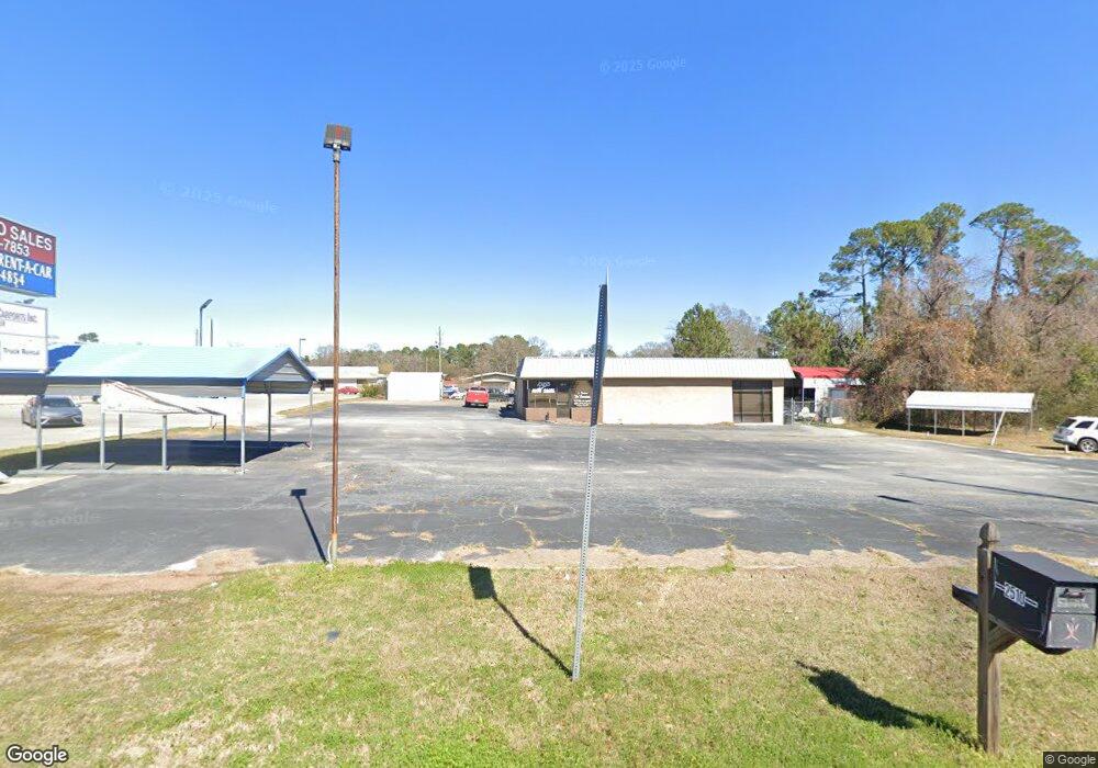
2510 Northside Dr W Statesboro, GA 30458
Estimated Value: $113,834
--
Bed
--
Bath
1,800
Sq Ft
$63/Sq Ft
Est. Value
About This Home
This home is located at 2510 Northside Dr W, Statesboro, GA 30458 and is currently priced at $113,834, approximately $63 per square foot. 2510 Northside Dr W is a home located in Bulloch County with nearby schools including Julia P. Bryant Elementary School, Statesboro High School, and William James Middle School.
Ownership History
Date
Name
Owned For
Owner Type
Purchase Details
Closed on
Sep 23, 2021
Sold by
Homeland Auto Grp Llc
Bought by
Bd Properties Llc
Current Estimated Value
Home Financials for this Owner
Home Financials are based on the most recent Mortgage that was taken out on this home.
Original Mortgage
$200,000
Interest Rate
2.8%
Mortgage Type
Commercial
Purchase Details
Closed on
Apr 16, 2012
Sold by
Altman Pontiac Company
Bought by
Pilcher Hodges F and Pilcher James W
Create a Home Valuation Report for This Property
The Home Valuation Report is an in-depth analysis detailing your home's value as well as a comparison with similar homes in the area
Home Values in the Area
Average Home Value in this Area
Purchase History
| Date | Buyer | Sale Price | Title Company |
|---|---|---|---|
| Bd Properties Llc | $80,000 | -- | |
| Pilcher Hodges F | -- | -- |
Source: Public Records
Mortgage History
| Date | Status | Borrower | Loan Amount |
|---|---|---|---|
| Closed | Bd Properties Llc | $200,000 |
Source: Public Records
Tax History Compared to Growth
Tax History
| Year | Tax Paid | Tax Assessment Tax Assessment Total Assessment is a certain percentage of the fair market value that is determined by local assessors to be the total taxable value of land and additions on the property. | Land | Improvement |
|---|---|---|---|---|
| 2024 | $822 | $30,000 | $21,280 | $8,720 |
| 2023 | $815 | $28,466 | $21,280 | $7,186 |
| 2022 | $628 | $35,683 | $28,460 | $7,223 |
| 2021 | $1,150 | $39,225 | $32,002 | $7,223 |
| 2020 | $1,183 | $39,225 | $32,002 | $7,223 |
| 2019 | $1,190 | $41,435 | $32,002 | $9,433 |
| 2018 | $1,241 | $39,024 | $32,002 | $7,022 |
| 2017 | $893 | $39,024 | $32,002 | $7,022 |
| 2016 | $916 | $39,024 | $32,002 | $7,022 |
| 2015 | $4,145 | $60,723 | $53,337 | $7,386 |
| 2014 | $3,807 | $207,768 | $128,720 | $79,048 |
Source: Public Records
Map
Nearby Homes
- 118 Roundtree St
- 113 Church St
- 0 Highway 80 W Unit 10534803
- 0 Oak St Unit OAK ST/ LOT 2
- 7 E Moore St
- 103 Floyd St
- 460 Martin Luther King jr Dr
- 318 N Main St
- 124 Pin Oak Ln
- 118 Pin Oak Ln Unit 47
- 328 N Main St
- 0 Highway 67 Unit 10541885
- 405 N Main St
- 0 U S 301 Unit 24576764
- 141 Williams Rd
- 0 Miller Street Extension Unit LOT 17 10595930
- 0 Miller Street Extension Unit LOT 18 10595926
- 0 Miller Street Extension Unit LOT 19 10595919
- 0 Miller Street Extension Unit LOT 20 10595908
- 0 Miller Street Extension Unit LOT 21 10595866
- 2538 Northside Dr W
- 400 Northside Dr
- 2538 Northside Dr W
- 2538 Northside Dr W
- 208 Northside Dr W
- 208 Northside Dr W
- 2513 Northside Dr W
- 111 Cone St Unit LOT 6
- 115 Cone St Unit LOT 8
- 14 Rountree St
- 112 Rountree St
- 116 Rountree St
- 2425 Northside Dr W
- 604 Martin Luther King jr Dr
- 604 Martin Luther King Junior Dr
- 118 Rountree St
- 867 Martin Luther King jr Dr
- W Rountree St
- 120 Rountree St
- 113 Cone St Unit LOT 7