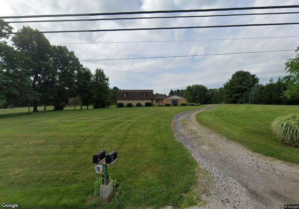
2510 State Route 430 Mansfield, OH 44903
Estimated Value: $296,000 - $473,000
3
Beds
3
Baths
2,208
Sq Ft
$161/Sq Ft
Est. Value
About This Home
This home is located at 2510 State Route 430, Mansfield, OH 44903 and is currently estimated at $354,698, approximately $160 per square foot. 2510 State Route 430 is a home located in Richland County with nearby schools including Madison High School, St. Mary Catholic School, and Temple-Christian School.
Ownership History
Date
Name
Owned For
Owner Type
Purchase Details
Closed on
Sep 23, 2021
Sold by
Hackman Lucy R
Bought by
Hackmanwho J Wesley
Current Estimated Value
Purchase Details
Closed on
Aug 1, 2003
Sold by
Scott Roosevelt and Scott Jacqueline L
Bought by
Hackman J Wesley and Hackman Lucy
Home Financials for this Owner
Home Financials are based on the most recent Mortgage that was taken out on this home.
Original Mortgage
$121,500
Interest Rate
4.2%
Mortgage Type
Purchase Money Mortgage
Purchase Details
Closed on
Nov 2, 1990
Purchase Details
Closed on
Jun 1, 1985
Create a Home Valuation Report for This Property
The Home Valuation Report is an in-depth analysis detailing your home's value as well as a comparison with similar homes in the area
Home Values in the Area
Average Home Value in this Area
Purchase History
| Date | Buyer | Sale Price | Title Company |
|---|---|---|---|
| Hackmanwho J Wesley | -- | -- | |
| Hackman J Wesley | $135,000 | Chicago Title Agency | |
| -- | $45,000 | -- | |
| -- | $12,000 | -- |
Source: Public Records
Mortgage History
| Date | Status | Borrower | Loan Amount |
|---|---|---|---|
| Previous Owner | Hackman J Wesley | $121,500 |
Source: Public Records
Tax History Compared to Growth
Tax History
| Year | Tax Paid | Tax Assessment Tax Assessment Total Assessment is a certain percentage of the fair market value that is determined by local assessors to be the total taxable value of land and additions on the property. | Land | Improvement |
|---|---|---|---|---|
| 2024 | $3,254 | $74,030 | $16,510 | $57,520 |
| 2023 | $3,254 | $74,030 | $16,510 | $57,520 |
| 2022 | $2,465 | $53,700 | $13,230 | $40,470 |
| 2021 | $2,464 | $53,700 | $13,230 | $40,470 |
| 2020 | $2,487 | $53,700 | $13,230 | $40,470 |
| 2019 | $2,187 | $45,530 | $11,120 | $34,410 |
| 2018 | $2,169 | $45,530 | $11,120 | $34,410 |
| 2017 | $2,216 | $45,530 | $11,120 | $34,410 |
| 2016 | $2,303 | $47,620 | $11,120 | $36,500 |
| 2015 | $1,151 | $47,620 | $11,120 | $36,500 |
| 2014 | $2,257 | $47,620 | $11,120 | $36,500 |
| 2012 | $1,020 | $47,620 | $11,120 | $36,500 |
Source: Public Records
Map
Nearby Homes
- 2641 State Route 430
- 2750 Lutz Ave
- 598 Impala Dr
- 0 Satinwood Dr
- 630 Impala Dr
- 2495 Emma Ln
- 0 McBride Road Parcel # 1 Unit 9066028
- 609 Mcbride Rd
- 0 Peterson Rd
- 775 Touby Ln
- 640 Running Brook Way
- 2270 Lakecrest Dr Unit 2272
- 641 Laver Rd
- 76 Ford Rd N
- 76 Ford Rd N Unit 20
- 1910 Crider Rd
- 0 Mcelroy Rd
- 1997 Hout Rd
- 304 Esley Ln
- 3290 Shad Dr W
- 2519 State Route 430
- 2550 State Route 430
- 2484 State Route 430
- 2474 State Route 430
- 2500 State Route 430
- 0 St Rt 430 Unit 602181
- 0 St Rt 430 Unit 603536
- 0 St Rt 430 Unit 502233
- 0 St Rt 430 Unit 9006030
- 0 St Rt 430 Unit 9038093
- 0 St Rt 430 Unit 9043567
- 0 St Rt 430 Unit 224434
- 0 St Rt 430 Unit 9054361
- 2417 State Route 430
- 2566 State Route 430
- 2494 State Route 430
- 2588 Ohio 430
- 2588 State Route 430
- 2588 Park Ave E
- 2612 State Route 430