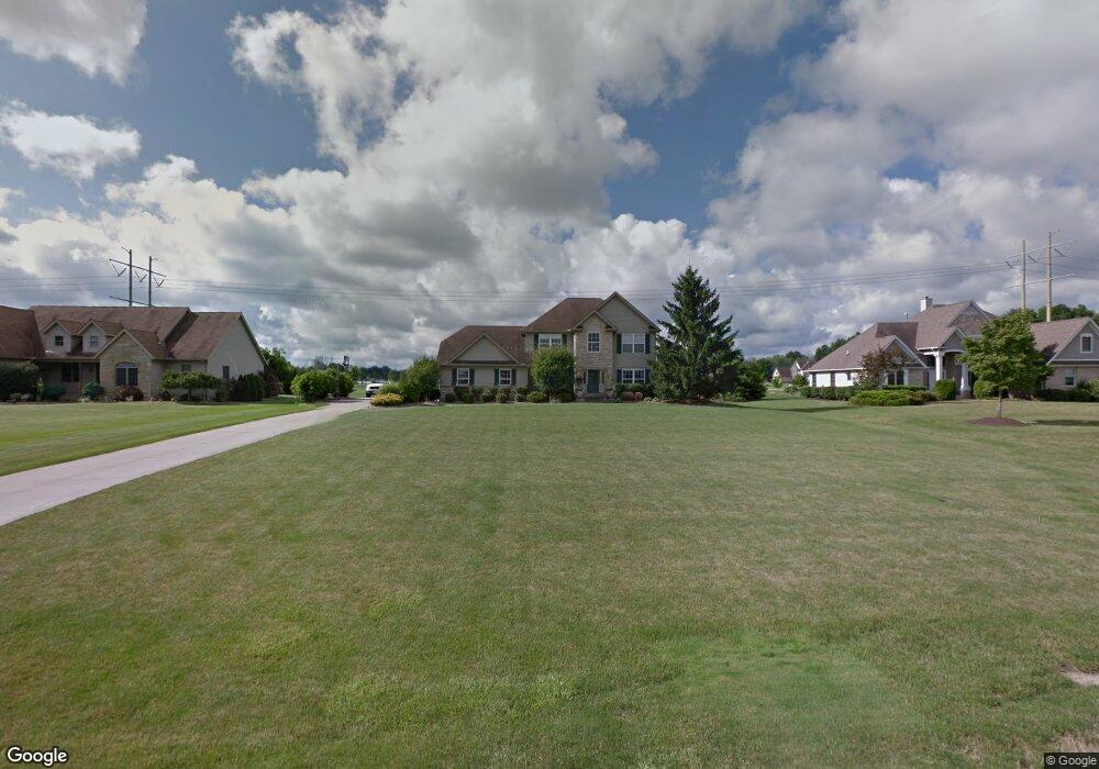
25105 Crosstie Trail Columbia Station, OH 44028
Estimated Value: $320,000 - $587,000
--
Bed
3
Baths
2,026
Sq Ft
$214/Sq Ft
Est. Value
About This Home
This home is located at 25105 Crosstie Trail, Columbia Station, OH 44028 and is currently estimated at $432,607, approximately $213 per square foot. 25105 Crosstie Trail is a home located in Lorain County with nearby schools including Copopa Elementary School, Columbia Middle School, and Columbia High School.
Ownership History
Date
Name
Owned For
Owner Type
Purchase Details
Closed on
Jul 6, 1999
Sold by
Gill Construction Company Inc
Bought by
Kile Jack J and Kile Michelle
Current Estimated Value
Home Financials for this Owner
Home Financials are based on the most recent Mortgage that was taken out on this home.
Original Mortgage
$189,600
Interest Rate
7.28%
Mortgage Type
Balloon
Create a Home Valuation Report for This Property
The Home Valuation Report is an in-depth analysis detailing your home's value as well as a comparison with similar homes in the area
Home Values in the Area
Average Home Value in this Area
Purchase History
| Date | Buyer | Sale Price | Title Company |
|---|---|---|---|
| Kile Jack J | $237,000 | Progressive Title Agency Inc |
Source: Public Records
Mortgage History
| Date | Status | Borrower | Loan Amount |
|---|---|---|---|
| Closed | Kile Jack J | $189,600 |
Source: Public Records
Tax History Compared to Growth
Tax History
| Year | Tax Paid | Tax Assessment Tax Assessment Total Assessment is a certain percentage of the fair market value that is determined by local assessors to be the total taxable value of land and additions on the property. | Land | Improvement |
|---|---|---|---|---|
| 2024 | $5,124 | $114,706 | $31,220 | $83,486 |
| 2023 | $4,652 | $90,878 | $24,294 | $66,584 |
| 2022 | $4,544 | $90,878 | $24,294 | $66,584 |
| 2021 | $4,588 | $90,878 | $24,294 | $66,584 |
| 2020 | $4,674 | $83,150 | $22,230 | $60,920 |
| 2019 | $4,648 | $83,150 | $22,230 | $60,920 |
| 2018 | $4,728 | $83,150 | $22,230 | $60,920 |
| 2017 | $4,774 | $78,890 | $21,800 | $57,090 |
| 2016 | $4,811 | $78,890 | $21,800 | $57,090 |
| 2015 | $4,850 | $78,890 | $21,800 | $57,090 |
| 2014 | $4,126 | $74,640 | $20,690 | $53,950 |
| 2013 | $4,126 | $74,640 | $20,690 | $53,950 |
Source: Public Records
Map
Nearby Homes
- Belleville Plan at The Estates of Columbia Ridge
- Ash Lawn Plan at The Estates of Columbia Ridge
- Brennan Plan at The Estates of Columbia Ridge
- Lyndhurst Plan at The Estates of Columbia Ridge
- Alden Plan at The Estates of Columbia Ridge
- Vanderburgh Plan at The Estates of Columbia Ridge
- Buchanan Plan at The Estates of Columbia Ridge
- 10700 Whitewing Way
- 12584 Caribou Ct
- 23213 Snell Rd
- 23789 Snell Rd
- Lehigh Plan at Ashford Cove
- Anderson Plan at Ashford Cove
- Ballenger Plan at Ashford Cove
- Columbia Plan at Ashford Cove
- Hudson Plan at Ashford Cove
- 8924 Leatherleaf Dr
- 8960 Leatherleaf Dr
- 8981 Leatherleaf Dr
- 8839 Leatherleaf Dr
- 25101 Crosstie Trail
- 25109 Crosstie Trail
- 25113 Crosstie Trail
- 25106 Crosstie Trail
- 10789 Bridle Path
- 25117 Crosstie Trail
- 25110 Crosstie Trail
- 10824 Bridle Path
- 10800 Bridle Path
- 10871 Bridle Path
- Land Bridle Path
- 25114 Crosstie Trail
- 10848 Bridle Path
- 10796 Bridle Path
- 25121 Crosstie Trail
- 10772 Bridle Path
- 10893 Bridle Path
- 10741 Bridle Path
- 10872 Bridle Path
- 25122 Crosstie Trail