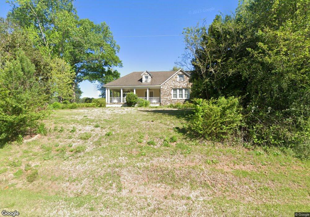
2511 Barnesville Hwy Thomaston, GA 30286
Estimated Value: $299,000 - $1,154,000
3
Beds
3
Baths
2,169
Sq Ft
$275/Sq Ft
Est. Value
About This Home
This home is located at 2511 Barnesville Hwy, Thomaston, GA 30286 and is currently estimated at $596,644, approximately $275 per square foot. 2511 Barnesville Hwy is a home located in Upson County with nearby schools including Upson-Lee South Elementary School, Upson-Lee North Elementary School, and Upson-Lee Middle School.
Ownership History
Date
Name
Owned For
Owner Type
Purchase Details
Closed on
Jul 1, 2013
Sold by
Keadle Land Co Lllp
Bought by
Interfor Us Inc
Current Estimated Value
Purchase Details
Closed on
May 1, 2009
Sold by
Keadle Steve C
Bought by
Keadle Land Co Lllp
Purchase Details
Closed on
Feb 5, 2009
Sold by
Keadle Sandra M
Bought by
Keadle Steve C
Purchase Details
Closed on
Apr 25, 2006
Sold by
Not Provided
Bought by
Keadle Land Company Lllp
Create a Home Valuation Report for This Property
The Home Valuation Report is an in-depth analysis detailing your home's value as well as a comparison with similar homes in the area
Home Values in the Area
Average Home Value in this Area
Purchase History
| Date | Buyer | Sale Price | Title Company |
|---|---|---|---|
| Interfor Us Inc | $2,530,994 | -- | |
| Keadle Land Co Lllp | $526,000 | -- | |
| Keadle Steve C | -- | -- | |
| Keadle Steve C | -- | -- | |
| Keadle Land Company Lllp | -- | -- |
Source: Public Records
Tax History Compared to Growth
Tax History
| Year | Tax Paid | Tax Assessment Tax Assessment Total Assessment is a certain percentage of the fair market value that is determined by local assessors to be the total taxable value of land and additions on the property. | Land | Improvement |
|---|---|---|---|---|
| 2024 | $4,635 | $167,775 | $53,140 | $114,635 |
| 2023 | $4,389 | $169,323 | $53,140 | $116,183 |
| 2022 | $3,336 | $120,320 | $19,922 | $100,398 |
| 2021 | $2,768 | $105,046 | $19,922 | $85,124 |
| 2020 | $2,856 | $101,235 | $18,390 | $82,845 |
| 2019 | $2,998 | $97,831 | $18,390 | $79,441 |
| 2018 | $3,000 | $97,831 | $18,390 | $79,441 |
| 2017 | $2,808 | $83,522 | $18,390 | $65,132 |
| 2016 | $3,010 | $88,064 | $15,325 | $72,739 |
| 2015 | $3,011 | $88,064 | $15,325 | $72,739 |
| 2014 | $3,405 | $99,436 | $17,623 | $81,814 |
Source: Public Records
Map
Nearby Homes
- 2615 Barnesville Hwy
- 2724 Barnesville St
- 216 E Moores Crossing Rd
- 524 Sunnyland Dr
- 3006 Barnesville Hwy
- 556 Sunnyland Dr
- 657 Tom McKinley Rd
- 508 Heath Dr
- 0 W Moores Crossing Rd Unit 10605207
- 1205 Shady Ln
- 0 Technology Pkwy Unit 30119
- 0 Technology Pkwy Unit 21917
- 0 Technology Pkwy Unit 30117
- 307 Pardue Dr
- 0 Tyler Ln
- 206 Shannon Ct
- 3682 Barnesville Hwy
- 201 Creekside Manor Dr
- 115 Hillside Dr
- LOT 193 Morningside Ct
- 2506 Barnesville Hwy
- 2482 Barnesville Hwy
- 2471 Barnesville Hwy
- 2537 Barnesville Hwy
- 2453 Barnesville Hwy
- 2508 Barnesville Hwy
- 53 Blackgum Dr
- 31 Calvin Dr
- 2434 Barnesville Hwy
- 2421 Barnesville Hwy
- 2410 Barnesville Hwy
- 38 Calvin Dr
- 106 Sharp Rd
- 88 Blackgum Dr
- 53 Sharp Rd
- 115 Sharp Rd
- 148 Sharp Rd
- 133 Sharp Rd
- 89 Calvin Dr
- 316 Horseshoe Bend