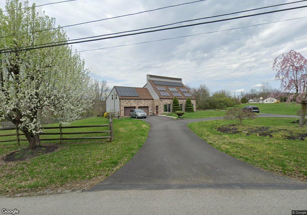
2511 Bean Rd Norristown, PA 19403
Estimated Value: $624,989 - $773,000
3
Beds
3
Baths
2,606
Sq Ft
$269/Sq Ft
Est. Value
About This Home
This home is located at 2511 Bean Rd, Norristown, PA 19403 and is currently estimated at $701,747, approximately $269 per square foot. 2511 Bean Rd is a home located in Montgomery County with nearby schools including Worcester Elementary School, Skyview Upper Elementary School, and Arcola Intermediate School.
Ownership History
Date
Name
Owned For
Owner Type
Purchase Details
Closed on
Mar 17, 2005
Sold by
Not Provided
Bought by
Not Provided
Current Estimated Value
Home Financials for this Owner
Home Financials are based on the most recent Mortgage that was taken out on this home.
Original Mortgage
$140,000
Outstanding Balance
$70,741
Interest Rate
5.56%
Mortgage Type
Purchase Money Mortgage
Estimated Equity
$631,006
Purchase Details
Closed on
Mar 9, 2005
Sold by
Not Provided
Bought by
Not Provided
Home Financials for this Owner
Home Financials are based on the most recent Mortgage that was taken out on this home.
Original Mortgage
$140,000
Outstanding Balance
$70,741
Interest Rate
5.56%
Mortgage Type
Purchase Money Mortgage
Estimated Equity
$631,006
Purchase Details
Closed on
Feb 18, 1998
Sold by
Samuel Robert and Samuel Sylvia
Bought by
Samuel Robert J and Samuel Sylvia T
Create a Home Valuation Report for This Property
The Home Valuation Report is an in-depth analysis detailing your home's value as well as a comparison with similar homes in the area
Home Values in the Area
Average Home Value in this Area
Purchase History
| Date | Buyer | Sale Price | Title Company |
|---|---|---|---|
| Not Provided | $355,000 | -- | |
| Not Provided | $355,000 | -- | |
| Samuel Robert J | -- | -- |
Source: Public Records
Mortgage History
| Date | Status | Borrower | Loan Amount |
|---|---|---|---|
| Open | Not Provided | $140,000 | |
| Closed | Not Provided | $140,000 |
Source: Public Records
Tax History Compared to Growth
Tax History
| Year | Tax Paid | Tax Assessment Tax Assessment Total Assessment is a certain percentage of the fair market value that is determined by local assessors to be the total taxable value of land and additions on the property. | Land | Improvement |
|---|---|---|---|---|
| 2025 | $8,556 | $225,880 | -- | -- |
| 2024 | $8,556 | $225,880 | -- | -- |
| 2023 | $8,206 | $225,880 | $0 | $0 |
| 2022 | $8,048 | $225,880 | $0 | $0 |
| 2021 | $7,889 | $225,880 | $0 | $0 |
| 2020 | $7,743 | $225,880 | $0 | $0 |
| 2019 | $7,667 | $225,880 | $0 | $0 |
| 2018 | $880 | $225,880 | $0 | $0 |
| 2017 | $7,372 | $225,880 | $0 | $0 |
| 2016 | $7,284 | $225,880 | $0 | $0 |
| 2015 | $7,025 | $225,880 | $0 | $0 |
| 2014 | $7,025 | $225,880 | $0 | $0 |
Source: Public Records
Map
Nearby Homes
- 1815 LOT 1 Yost Rd
- 116 Brindle Ct
- 107 Caspian Ln
- 1674 N Wales Rd
- 1734 Hallman Dr
- 2564 W Skippack Pike
- 1105 Whitpain Hills Unit 5
- 1698 Daws Rd
- 1411 Whitpain Hills
- 2624 Hawthorn Dr
- 1673 Sylvan Dr
- 15 Umbrell Dr
- 1600 Potshop Rd
- 2648 Hawthorn Dr
- 1783 Talbot Rd
- 121 Stony Way
- 2036 Bethel Rd
- 1510 Daws Rd
- 3117 Nottingham Rd
- 116 Norwood Ln
- 1703 N Wales Rd
- 1711 N Wales Rd
- 1715 N Wales Rd
- 000 N Wales Rd Unit 2 LOT
- 000 N Wales Rd
- 1408 N Wales Rd
- 1400 N Wales Rd
- 1416 N Wales Rd
- 1424 N Wales Rd
- 1719 N Wales Rd
- 1432 N Wales Rd
- 1440 N Wales Rd
- 1407 Mauck Rd
- 1401 Mauck Rd
- 1415 Mauck Rd
- 1651 N Wales Rd
- 1423 Mauck Rd
- 1448 N Wales Rd
- 1431 Mauck Rd
- 1439 Mauck Rd