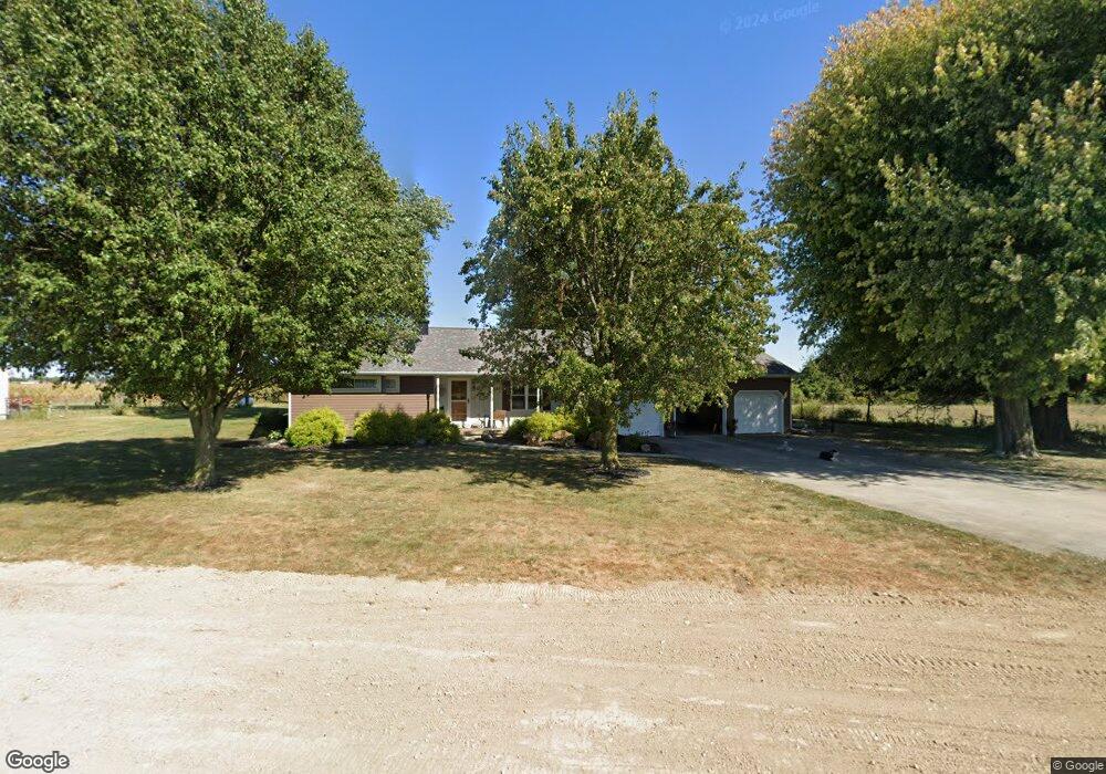
2511 Fair Rd Sidney, OH 45365
Estimated Value: $220,000 - $224,150
3
Beds
2
Baths
1,448
Sq Ft
$154/Sq Ft
Est. Value
About This Home
This home is located at 2511 Fair Rd, Sidney, OH 45365 and is currently estimated at $222,788, approximately $153 per square foot. 2511 Fair Rd is a home located in Shelby County with nearby schools including Sidney High School, Holy Angels Catholic School, and Christian Academy Schools.
Ownership History
Date
Name
Owned For
Owner Type
Purchase Details
Closed on
Feb 4, 2025
Sold by
Shelby County Land Reutilization Corpora
Bought by
Page Lynne M and Thuney Marcia L
Current Estimated Value
Purchase Details
Closed on
Dec 15, 1995
Sold by
Coffman Othel
Bought by
Page Lynne M
Home Financials for this Owner
Home Financials are based on the most recent Mortgage that was taken out on this home.
Original Mortgage
$66,100
Interest Rate
7.45%
Mortgage Type
New Conventional
Create a Home Valuation Report for This Property
The Home Valuation Report is an in-depth analysis detailing your home's value as well as a comparison with similar homes in the area
Home Values in the Area
Average Home Value in this Area
Purchase History
| Date | Buyer | Sale Price | Title Company |
|---|---|---|---|
| Page Lynne M | -- | None Listed On Document | |
| Page Lynne M | $73,500 | -- |
Source: Public Records
Mortgage History
| Date | Status | Borrower | Loan Amount |
|---|---|---|---|
| Previous Owner | Page Lynne M | $50,000 | |
| Previous Owner | Page Lynne M | $35,000 | |
| Previous Owner | Page Lynne M | $76,500 | |
| Previous Owner | Page Lynne M | $25,500 | |
| Previous Owner | Thuney Marcia L | $37,323 | |
| Previous Owner | Page Lynne M | $31,900 | |
| Previous Owner | Page Lynne M | $66,100 |
Source: Public Records
Tax History
| Year | Tax Paid | Tax Assessment Tax Assessment Total Assessment is a certain percentage of the fair market value that is determined by local assessors to be the total taxable value of land and additions on the property. | Land | Improvement |
|---|---|---|---|---|
| 2024 | $1,966 | $53,000 | $10,080 | $42,920 |
| 2023 | $1,944 | $53,000 | $10,080 | $42,920 |
| 2022 | $1,775 | $42,200 | $8,190 | $34,010 |
| 2021 | $1,791 | $42,200 | $8,190 | $34,010 |
| 2020 | $1,790 | $42,200 | $8,190 | $34,010 |
| 2019 | $1,513 | $36,150 | $6,800 | $29,350 |
| 2018 | $1,491 | $36,150 | $6,800 | $29,350 |
| 2017 | $1,327 | $31,960 | $6,800 | $25,160 |
| 2016 | $1,329 | $32,090 | $5,670 | $26,420 |
| 2015 | $1,285 | $32,090 | $5,670 | $26,420 |
| 2014 | $1,285 | $32,090 | $5,670 | $26,420 |
| 2013 | $1,242 | $28,540 | $5,670 | $22,870 |
Source: Public Records
Map
Nearby Homes
- 1780 Creekside Ct
- 1756 Creekside Ct
- 1788 Creekside Ct
- 1768 Creekside Ct
- 1774 Creekside Ct
- Lot 6737 Creekside Ct
- Lot 6744 Creekside Ct
- Lot 6742 Creekside Ct
- Lot 7511 Creekside Ct
- Lot 6740 Creekside Ct
- Lot 6739 Creekside Ct
- Lot 7510 Creekside Ct
- Lot 6743 Creekside Ct
- Lot 6741 Creekside Ct
- Lot 6738 Creekside Ct
- 2423 Cole Ct
- 2417 Cole Ct
- 0 Kuther Rd S Unit 1035067
- 1502 Cumberland Ave
- 00 Fair Rd
Your Personal Tour Guide
Ask me questions while you tour the home.