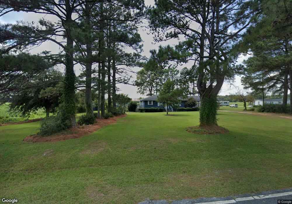
2511 William R King Rd Newton Grove, NC 28366
Estimated Value: $107,000 - $175,000
2
Beds
1
Bath
1,178
Sq Ft
$112/Sq Ft
Est. Value
About This Home
This home is located at 2511 William R King Rd, Newton Grove, NC 28366 and is currently estimated at $131,363, approximately $111 per square foot. 2511 William R King Rd is a home with nearby schools including Hobbton Elementary School, Hobbton Middle School, and Hobbton High School.
Ownership History
Date
Name
Owned For
Owner Type
Purchase Details
Closed on
Oct 12, 2020
Sold by
Macgiddens Allen Mac and Giddens Deborah
Bought by
Macgiddens Allen Mac and Giddens Deborah
Current Estimated Value
Purchase Details
Closed on
Aug 31, 2018
Sold by
Diddens-Jennings Doris
Bought by
Allen Macgiddens and Allen Deborah Giddens
Purchase Details
Closed on
Aug 22, 2018
Sold by
Warren Farming Co
Bought by
Allen Macgiddens and Allen Deborah Giddens
Purchase Details
Closed on
Aug 10, 2018
Sold by
Starling Luther D and Griffin Gregory T
Bought by
Warren Darming Co
Purchase Details
Closed on
Apr 1, 1993
Bought by
Macmacmacmacgiddens David Mac
Create a Home Valuation Report for This Property
The Home Valuation Report is an in-depth analysis detailing your home's value as well as a comparison with similar homes in the area
Home Values in the Area
Average Home Value in this Area
Purchase History
| Date | Buyer | Sale Price | Title Company |
|---|---|---|---|
| Macgiddens Allen Mac | -- | None Available | |
| Allen Macgiddens | -- | -- | |
| Allen Macgiddens | $50,500 | -- | |
| Warren Darming Co | $50,400 | -- | |
| Macmacmacmacgiddens David Mac | -- | -- |
Source: Public Records
Tax History Compared to Growth
Tax History
| Year | Tax Paid | Tax Assessment Tax Assessment Total Assessment is a certain percentage of the fair market value that is determined by local assessors to be the total taxable value of land and additions on the property. | Land | Improvement |
|---|---|---|---|---|
| 2025 | $674 | $88,695 | $10,631 | $78,064 |
| 2024 | $608 | $88,695 | $10,631 | $78,064 |
| 2023 | $511 | $56,778 | $9,244 | $47,534 |
| 2022 | $511 | $56,778 | $9,244 | $47,534 |
| 2021 | $511 | $56,778 | $9,244 | $47,534 |
| 2020 | $520 | $57,781 | $10,247 | $47,534 |
| 2019 | $1,040 | $57,781 | $0 | $0 |
| 2018 | $482 | $53,531 | $0 | $0 |
| 2017 | $540 | $60,698 | $0 | $0 |
| 2016 | $543 | $60,698 | $0 | $0 |
| 2015 | $543 | $60,698 | $0 | $0 |
| 2014 | $543 | $60,698 | $0 | $0 |
Source: Public Records
Map
Nearby Homes
- 13015 Hobbton Hwy
- 0 Suttontown Rd Unit 100516331
- 0 Suttontown Rd
- 0 Hobbton Hwy Unit 100510708
- 520 Fayetteville St
- 10455 U S 701 Hwy
- 0 Main St
- 762 Share Cake Rd
- 9501 Harper House Rd
- 9505 Harper House Rd
- 1676 Smithfield Hwy
- 410 E Barefoot Rd
- 904 Langston Rd
- 573 Langston Rd
- 00 Trail End Ln
- 00 Trail End Ln Unit LotWP001
- 10263 U S 701 Hwy
- 12525 N Carolina 50
- 3092 Harnett-Dunn Hwy
- 770 Simmons Rd
- 2360 William R King Rd
- 2653 William R King Rd
- 2670 William R King Rd
- 2321 William R King Rd
- 2719 William R King Rd
- 2300 William R King Rd
- 2270 William R King Rd
- 225 Rawhide Rd
- 320 Rawhide Rd
- 2141 William R King Rd
- 353 Rawhide Rd
- 381 Rawhide Rd
- 473 Rawhide Rd
- 3131 William R King Rd
- 3180 William R King Rd
- 639 Rawhide Rd
- 3260 William R King Rd
- 1709 Cedar Point Rd
- 0 Cedar Point Rd Unit 11254600
- 0 Cedar Point Rd Unit 11254597