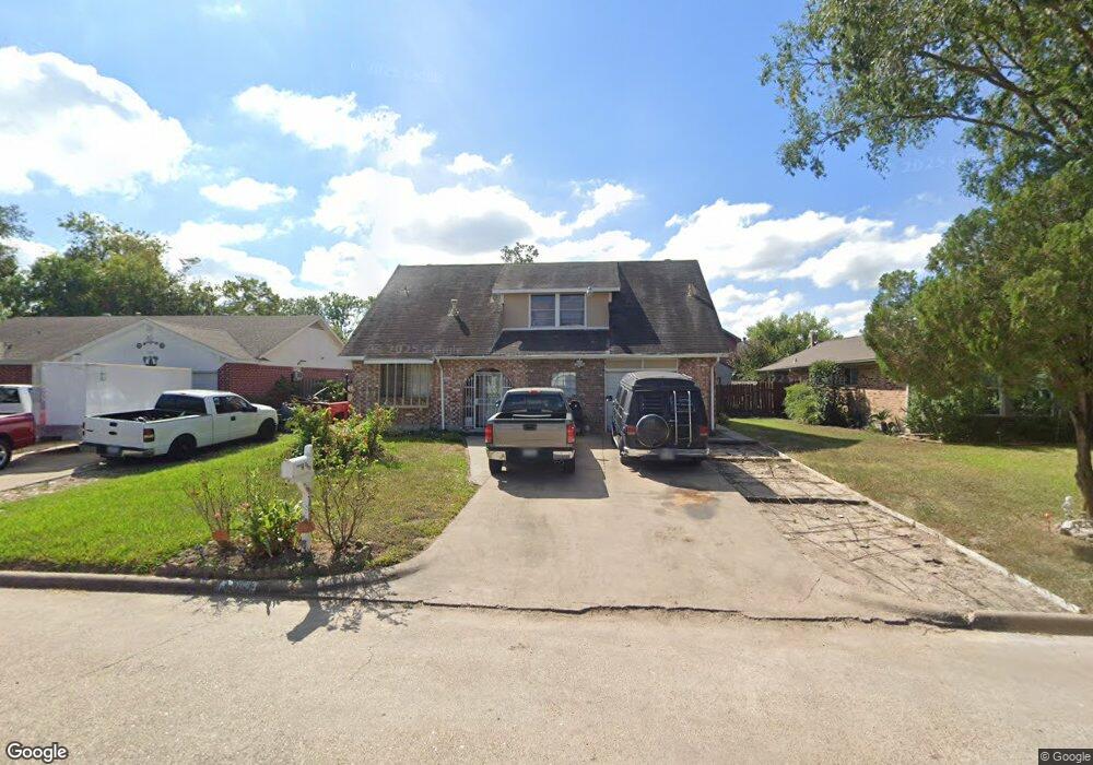
2511 Woodwild Dr Houston, TX 77038
North Houston NeighborhoodEstimated Value: $232,128 - $272,000
4
Beds
3
Baths
1,986
Sq Ft
$127/Sq Ft
Est. Value
About This Home
This home is located at 2511 Woodwild Dr, Houston, TX 77038 and is currently estimated at $251,282, approximately $126 per square foot. 2511 Woodwild Dr is a home located in Harris County with nearby schools including Gloria B. Sammons Elementary School, Stovall School, and Dr. Viola K. Garcia Middle School.
Ownership History
Date
Name
Owned For
Owner Type
Purchase Details
Closed on
Nov 26, 2014
Sold by
Johnson Jecaryous F
Bought by
Jackson Roosevelt
Current Estimated Value
Home Financials for this Owner
Home Financials are based on the most recent Mortgage that was taken out on this home.
Original Mortgage
$110,882
Outstanding Balance
$86,322
Interest Rate
4.37%
Mortgage Type
FHA
Estimated Equity
$164,960
Purchase Details
Closed on
Aug 26, 2014
Sold by
Evans Milton Mccoy
Bought by
Johnson Jecaryous F
Purchase Details
Closed on
Jun 8, 2009
Sold by
Evans Milton
Bought by
Evans Janice
Purchase Details
Closed on
May 12, 1998
Sold by
Evans Dolly Gale
Bought by
Evans Milton Mccoy and Evans Janice
Create a Home Valuation Report for This Property
The Home Valuation Report is an in-depth analysis detailing your home's value as well as a comparison with similar homes in the area
Home Values in the Area
Average Home Value in this Area
Purchase History
| Date | Buyer | Sale Price | Title Company |
|---|---|---|---|
| Jackson Roosevelt | -- | American Title Co | |
| Johnson Jecaryous F | -- | Stewart Title | |
| Evans Janice | -- | None Available | |
| Evans Milton Mccoy | -- | -- |
Source: Public Records
Mortgage History
| Date | Status | Borrower | Loan Amount |
|---|---|---|---|
| Open | Jackson Roosevelt | $110,882 |
Source: Public Records
Tax History Compared to Growth
Tax History
| Year | Tax Paid | Tax Assessment Tax Assessment Total Assessment is a certain percentage of the fair market value that is determined by local assessors to be the total taxable value of land and additions on the property. | Land | Improvement |
|---|---|---|---|---|
| 2025 | $2,198 | $208,223 | $35,910 | $172,313 |
| 2024 | $2,198 | $203,390 | $35,910 | $167,480 |
| 2023 | $2,198 | $203,390 | $35,910 | $167,480 |
| 2022 | $4,854 | $184,233 | $35,910 | $148,323 |
| 2021 | $4,572 | $160,409 | $21,546 | $138,863 |
| 2020 | $4,681 | $160,409 | $21,546 | $138,863 |
| 2019 | $4,414 | $140,837 | $21,546 | $119,291 |
| 2018 | $1,519 | $134,921 | $21,546 | $113,375 |
| 2017 | $3,659 | $134,921 | $21,546 | $113,375 |
| 2016 | $3,326 | $108,114 | $21,546 | $86,568 |
| 2015 | $1,038 | $111,137 | $21,546 | $89,591 |
| 2014 | $1,038 | $72,962 | $14,364 | $58,598 |
Source: Public Records
Map
Nearby Homes
- 2614 Lemonwood Ln
- 2719 Magnolia Hill Trail
- 2530 Woodtown Dr
- 2811 Oakland Brook St
- 2831 Oakland Brook St
- 2835 Oakland Brook St
- 2838 Packard Elm St
- 2203 Chalet Rd
- 2115 Havencrest Dr
- 12718 Sai Baba Dr
- 0 W Mt Houston Rd Unit 90464120
- 00 Fallbrook Dr
- 3127 Frick Rd
- 1327 Fallbrook Dr
- 12611 Landon Light Ln
- 13308 Ann Louise Rd
- 2919 Sunwood Dr
- 13803 Bearwood Rd
- Whitetail Plan at Forestwood
- Kitson Plan at Forestwood
- 2515 Woodwild Dr
- 2507 Woodwild Dr
- 2510 Woodsdale Blvd
- 2514 Woodsdale Blvd
- 2503 Woodwild Dr
- 2519 Woodwild Dr
- 2506 Woodsdale Blvd
- 2518 Woodsdale Blvd
- 2510 Woodwild Dr
- 2502 Woodsdale Blvd
- 2514 Woodwild Dr
- 2506 Woodwild Dr
- 2431 Woodwild Dr
- 2523 Woodwild Dr
- 2522 Woodsdale Blvd
- 2518 Woodwild Dr
- 2502 Woodwild Dr
- 2434 Woodsdale Blvd
- 2522 Woodwild Dr
- 2526 Woodsdale Blvd