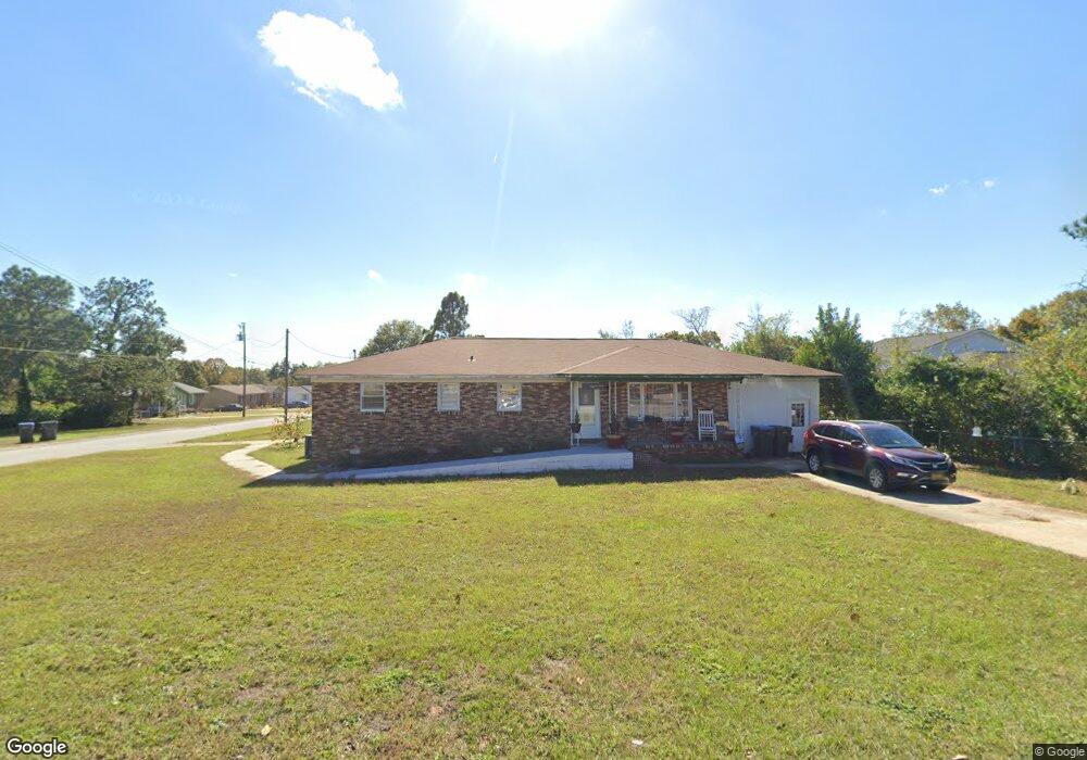
2512 Anthony Dejuan Pkwy Hephzibah, GA 30815
Jamestown NeighborhoodEstimated Value: $190,382 - $259,000
4
Beds
2
Baths
1,860
Sq Ft
$118/Sq Ft
Est. Value
About This Home
This home is located at 2512 Anthony Dejuan Pkwy, Hephzibah, GA 30815 and is currently estimated at $219,346, approximately $117 per square foot. 2512 Anthony Dejuan Pkwy is a home located in Richmond County with nearby schools including Diamond Lakes Elementary School, Pine Hill Middle School, and Johnson Magnet.
Ownership History
Date
Name
Owned For
Owner Type
Purchase Details
Closed on
Jul 16, 1999
Sold by
Tesch Irene Allen
Bought by
Stewart Robert P and Stewart Suzanne M
Current Estimated Value
Home Financials for this Owner
Home Financials are based on the most recent Mortgage that was taken out on this home.
Original Mortgage
$79,458
Outstanding Balance
$21,613
Interest Rate
7.43%
Mortgage Type
VA
Estimated Equity
$197,733
Purchase Details
Closed on
May 10, 1999
Sold by
Tesch Eugene L and Tesch Irene Allen
Bought by
Tesch Irene Allen
Create a Home Valuation Report for This Property
The Home Valuation Report is an in-depth analysis detailing your home's value as well as a comparison with similar homes in the area
Home Values in the Area
Average Home Value in this Area
Purchase History
| Date | Buyer | Sale Price | Title Company |
|---|---|---|---|
| Stewart Robert P | $77,900 | -- | |
| Tesch Irene Allen | -- | -- |
Source: Public Records
Mortgage History
| Date | Status | Borrower | Loan Amount |
|---|---|---|---|
| Open | Stewart Robert P | $79,458 |
Source: Public Records
Tax History Compared to Growth
Tax History
| Year | Tax Paid | Tax Assessment Tax Assessment Total Assessment is a certain percentage of the fair market value that is determined by local assessors to be the total taxable value of land and additions on the property. | Land | Improvement |
|---|---|---|---|---|
| 2025 | $1,802 | $51,436 | $4,480 | $46,956 |
| 2024 | $1,802 | $59,308 | $4,480 | $54,828 |
| 2023 | $1,905 | $52,108 | $4,480 | $47,628 |
| 2022 | $1,405 | $39,079 | $4,480 | $34,599 |
| 2021 | $1,191 | $28,644 | $4,467 | $24,177 |
| 2020 | $1,174 | $28,644 | $4,467 | $24,177 |
| 2019 | $1,697 | $42,845 | $4,467 | $38,378 |
| 2018 | $1,708 | $42,845 | $4,467 | $38,378 |
| 2017 | $1,700 | $42,845 | $4,467 | $38,378 |
| 2016 | $1,702 | $42,844 | $4,467 | $38,378 |
| 2015 | $1,713 | $42,844 | $4,467 | $38,378 |
| 2014 | $1,715 | $42,844 | $4,467 | $38,378 |
Source: Public Records
Map
Nearby Homes
- 4124 Country Ln
- 3366 Stockport Dr
- 2675 Ashton Dr
- 3371 Stockport Dr
- 3359 Stockport Dr
- 3351 Stockport Dr
- 3363 Stockport Dr
- 3367 Stockport Dr
- 0 Talbot Dr
- 3422 Firestone Dr
- 3434 Firestone Dr Unit 151
- 3424 Firestone Dr
- 3424 Firestone Dr Unit 155
- 3434 Firestone Dr
- 3422 Firestone Dr Unit 156
- Maywood 3 Plan at Laurel Park Townhomes
- 3440 Firestone Dr
- 3440 Firestone Dr Unit 148
- Stratford Plan at Laurel Park Townhomes
- 3428 Firestone Dr Unit 153
- 2514 Anthony Dejuan Pkwy
- 2510 Anthony Dejuan Pkwy
- 4123 S Allendale Ct
- 4122 S Allendale Ct
- 2511 Anthony Dejuan Pkwy
- 4114 Michael Place
- 4116 Michael Place
- 2513 Anthony Dejuan Pkwy
- 4118 Michael Place
- 2509 Anthony Dejuan Pkwy
- 4112 Michael Place
- 4124 S Allendale Ct
- 2508 1/2 Anthony Dejuan Pkwy
- 4120 Michael Place
- 4110 Michael Place
- 4117 N Allendale Ct
- 4125 S Allendale Ct
- 4123 S Sylvania Ct
- 4122 Michael Place
- 4126 S Allendale Ct