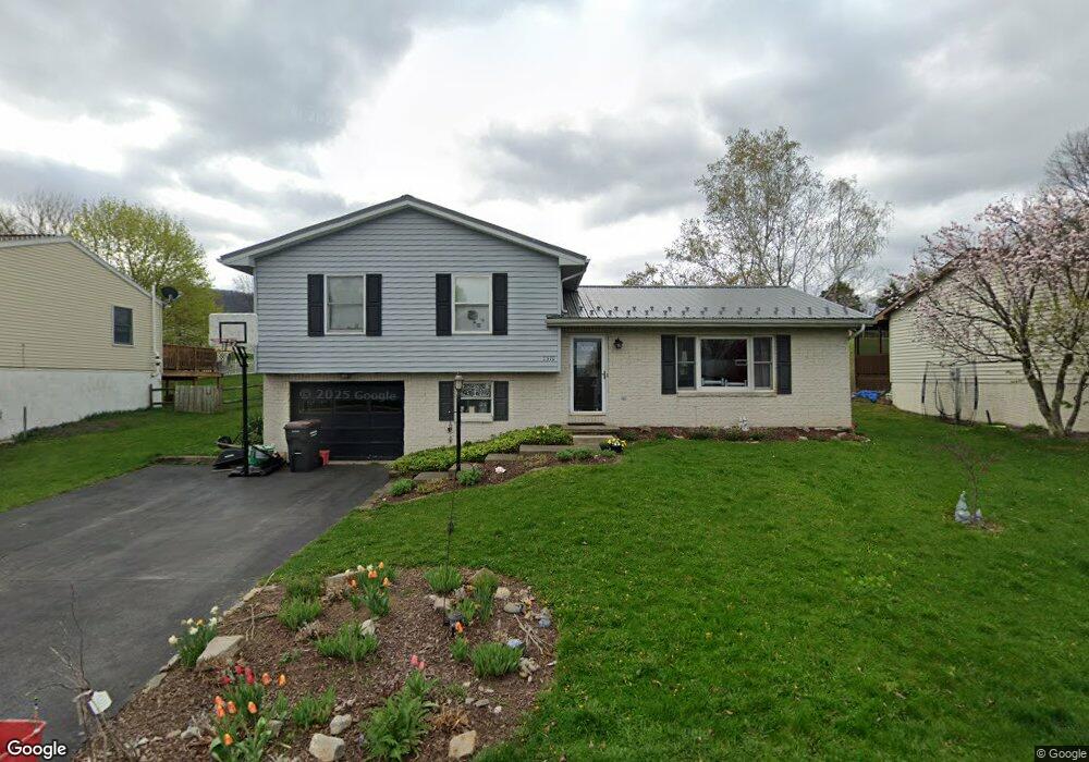
2512 Buchenhorst Rd State College, PA 16801
Estimated Value: $342,000 - $377,000
3
Beds
2
Baths
2,174
Sq Ft
$166/Sq Ft
Est. Value
About This Home
This home is located at 2512 Buchenhorst Rd, State College, PA 16801 and is currently estimated at $361,716, approximately $166 per square foot. 2512 Buchenhorst Rd is a home located in Centre County with nearby schools including Spring Creek Elementary, Mount Nittany Middle School, and State College Area High School.
Ownership History
Date
Name
Owned For
Owner Type
Purchase Details
Closed on
Aug 25, 2011
Sold by
Mahute Gary S and Mahute Jennifer B
Bought by
Smith Michael S and Smith Christine A
Current Estimated Value
Home Financials for this Owner
Home Financials are based on the most recent Mortgage that was taken out on this home.
Original Mortgage
$165,640
Outstanding Balance
$114,721
Interest Rate
4.5%
Mortgage Type
FHA
Estimated Equity
$246,995
Purchase Details
Closed on
Jun 25, 1998
Bought by
Mahute Gary S and Mahute Mahute
Create a Home Valuation Report for This Property
The Home Valuation Report is an in-depth analysis detailing your home's value as well as a comparison with similar homes in the area
Home Values in the Area
Average Home Value in this Area
Purchase History
| Date | Buyer | Sale Price | Title Company |
|---|---|---|---|
| Smith Michael S | $184,000 | None Available | |
| Mahute Gary S | $122,500 | -- |
Source: Public Records
Mortgage History
| Date | Status | Borrower | Loan Amount |
|---|---|---|---|
| Open | Smith Michael S | $165,640 |
Source: Public Records
Tax History Compared to Growth
Tax History
| Year | Tax Paid | Tax Assessment Tax Assessment Total Assessment is a certain percentage of the fair market value that is determined by local assessors to be the total taxable value of land and additions on the property. | Land | Improvement |
|---|---|---|---|---|
| 2025 | $3,665 | $56,500 | $14,375 | $42,125 |
| 2024 | $3,480 | $56,500 | $14,375 | $42,125 |
| 2023 | $3,480 | $56,500 | $14,375 | $42,125 |
| 2022 | $3,392 | $56,500 | $14,375 | $42,125 |
| 2021 | $3,392 | $56,500 | $14,375 | $42,125 |
| 2020 | $3,375 | $56,500 | $14,375 | $42,125 |
| 2019 | $2,800 | $56,500 | $14,375 | $42,125 |
| 2018 | $3,242 | $56,500 | $14,375 | $42,125 |
| 2017 | $3,204 | $56,500 | $14,375 | $42,125 |
| 2016 | -- | $56,500 | $14,375 | $42,125 |
| 2015 | -- | $56,500 | $14,375 | $42,125 |
| 2014 | -- | $56,500 | $14,375 | $42,125 |
Source: Public Records
Map
Nearby Homes
- 211 Farmhill Dr
- 217 Farmhill Dr
- 151 Sunhaven Lane Lot Unit 61
- 335 Gerald St
- 423 Farmhill Dr
- 429 Farmhill Dr
- ON 1st Ave
- 246 1st Ave
- 250 1st Ave
- 140 Pepperberry Ln
- 135 Fernleaf Ct
- 109 Buchanan Ave
- 624 Struble Rd
- 330 Trout Rd
- 124 Broad Oak Ln
- 122 Broad Oak Ln
- 118 Broad Oak Ln
- 127 Broad Oak Ln
- 116 Broad Oak Ln
- 418 Pike St
- 2510 Buchenhorst Rd
- 2514 Buchenhorst Rd
- 2646 Penbrook Ln
- 2642 Penbrook Ln
- 2508 Buchenhorst Rd
- 2650 Penbrook Ln
- 2516 Buchenhorst Rd
- 2654 Penbrook Ln
- 2491 Buchenhorst Rd
- 2638 Penbrook Ln
- 2487 Buchenhorst Rd
- 2493 Buchenhorst Rd
- 2506 Buchenhorst Rd
- 2485 Buchenhorst Rd
- 2658 Penbrook Ln
- 2634 Penbrook Ln
- 2497 Buchenhorst Rd
- 2483 Buchenhorst Rd
- 2649 Penbrook Ln
- 2653 Penbrook Ln