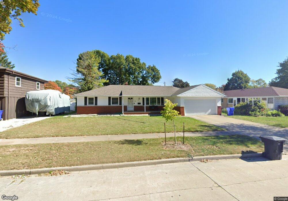
2512 Lillian Ct Appleton, WI 54911
Huntley Houses NeighborhoodEstimated Value: $296,000 - $316,000
3
Beds
1
Bath
1,592
Sq Ft
$193/Sq Ft
Est. Value
About This Home
This home is located at 2512 Lillian Ct, Appleton, WI 54911 and is currently estimated at $307,175, approximately $192 per square foot. 2512 Lillian Ct is a home located in Outagamie County with nearby schools including Huntley Elementary School, Appleton North High School, and Classical School.
Ownership History
Date
Name
Owned For
Owner Type
Purchase Details
Closed on
Jun 30, 2016
Bought by
Weir Daniel J
Current Estimated Value
Home Financials for this Owner
Home Financials are based on the most recent Mortgage that was taken out on this home.
Original Mortgage
$140,000
Outstanding Balance
$111,401
Interest Rate
3.48%
Estimated Equity
$195,774
Purchase Details
Closed on
Sep 23, 2010
Sold by
Romenesko Richard L and Romenesko Elizabeth A
Bought by
Romenesko Richard L and Romenesko Elizabeth A
Purchase Details
Closed on
Mar 29, 2006
Sold by
Kirchner Kenneth L
Bought by
Romenesko Richard L
Create a Home Valuation Report for This Property
The Home Valuation Report is an in-depth analysis detailing your home's value as well as a comparison with similar homes in the area
Home Values in the Area
Average Home Value in this Area
Purchase History
| Date | Buyer | Sale Price | Title Company |
|---|---|---|---|
| Weir Daniel J | -- | -- | |
| Romenesko Richard L | $137,300 | -- | |
| Romenesko Richard L | $137,500 | -- |
Source: Public Records
Mortgage History
| Date | Status | Borrower | Loan Amount |
|---|---|---|---|
| Open | Weir Daniel J | $140,000 | |
| Closed | Weir Daniel J | -- |
Source: Public Records
Tax History
| Year | Tax Paid | Tax Assessment Tax Assessment Total Assessment is a certain percentage of the fair market value that is determined by local assessors to be the total taxable value of land and additions on the property. | Land | Improvement |
|---|---|---|---|---|
| 2023 | $3,982 | $262,100 | $44,900 | $217,200 |
| 2022 | $3,598 | $176,300 | $37,300 | $139,000 |
| 2021 | $3,430 | $176,300 | $37,300 | $139,000 |
| 2020 | $3,423 | $176,300 | $37,300 | $139,000 |
| 2019 | $3,318 | $176,300 | $37,300 | $139,000 |
| 2018 | $3,158 | $147,100 | $33,800 | $113,300 |
| 2017 | $3,141 | $147,100 | $33,800 | $113,300 |
| 2016 | $2,868 | $137,300 | $33,800 | $103,500 |
| 2015 | $2,916 | $137,300 | $33,800 | $103,500 |
| 2014 | $2,890 | $137,300 | $33,800 | $103,500 |
| 2013 | $2,898 | $137,300 | $33,800 | $103,500 |
Source: Public Records
Map
Nearby Homes
- 841 E Windfield Place
- 1011 E Lindbergh St
- 701 E Longview Dr
- 921 E Windfield Place Unit A
- 920 E Marquette St
- 1009 E Northwood Dr
- 2412 N Morrison St
- 1437 E Glendale Ave
- 2940 N Oneida St
- 1815 N Ullman St
- 2916 N Rankin St
- 1801 N Racine St
- 433 E Parkway Blvd
- 507 E Roosevelt St
- 2308 N Appleton St
- 1833 N Charlotte St
- 3407 N Windward Ln
- 1430 N Graceland Ave
- 1809 N Charlotte St
- 1426 N Meade St
- 2512 N Lillian Ct
- 906 E Pershing St
- 2528 Lillian Ct
- 2528 N Lillian Ct
- 2513 N Viola St
- 2519 N Viola St
- 926 E Pershing St
- 2600 Lillian Ct
- 2521 Lillian Ct
- 2525 N Lillian Ct
- 2601 N Viola St
- 2525 Lillian Ct
- 907 E Pershing St
- 2612 Lillian Ct
- 2612 Lillian Ct
- 2606 Lillian Ct
- 2601 N Lillian Ct
- 2606 N Lillian Ct
- 2601 Lillian Ct
- 913 E Pershing St
Your Personal Tour Guide
Ask me questions while you tour the home.